Danville, Virginia — The American South (Mid-Atlantic)
Site of the Schoolfield Recreation Center

Photographed by C. Ryan Dodson, November 15, 2024
1. Site of the Schoolfield Recreation Center Marker
1915 - 2007
Topics. This historical marker is listed in this topic list: Parks & Recreational Areas. A significant historical year for this entry is 1915.
Location. 36° 34.227′ N, 79° 25.352′ W. Marker is in Danville, Virginia. It is at the intersection of West Main Street (Route 293) and Park Avenue, on the right when traveling north on West Main Street. Touch for map. Marker is at or near this postal address: 817 W Main St, Danville VA 24541, United States of America. Touch for directions.

Regionally, this marker is in Southside Virginia and specifically in Central Virginia. It is also in the American South and specifically in the Upper South. Globally, it is in North America, the Western Hemisphere, the Western World, and the Anglosphere. Historically, it finds itself in what was once the territory of the Mississippian Culture, one of the original Thirteen Colonies, one of the Confederate States of America, and the Antebellum South.
Other nearby markers. At least 8 other markers are within walking distance of this marker: Schoolfield Welfare Building (about 600
this page online
Regarding Site of the Schoolfield Recreation Center. The Schoolfield Recreation Center was demolished in 2007 and CVS now occupies the site.

Photographed by C. Ryan Dodson, November 15, 2024
2. Site of the Schoolfield Recreation Center Marker

Photographed by C. Ryan Dodson, November 15, 2024
3. Site of the Schoolfield Recreation Center Marker
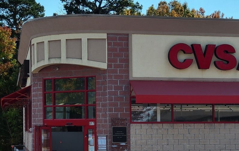
Photographed by C. Ryan Dodson, October 26, 2024
4. CVS Building currently located on the site

Photographed by C. Ryan Dodson, December 7, 2024
5. Schoolfield Recreation Center gallery
As a prominent local civic building for more than a century, portraits of the building are featured in the Golden Leaf Bistro
Credits. This page was last revised on December 11, 2024. It was originally submitted on December 5, 2024, by C. Ryan Dodson of Danville, Virginia. This page has been viewed 174 times since then and 16 times this year. Photos: 1, 2, 3, 4. submitted on December 5, 2024, by C. Ryan Dodson of Danville, Virginia. 5. submitted on December 8, 2024, by C. Ryan Dodson of Danville, Virginia. • Bernard Fisher was the editor who published this page.
