Brighton in Northumberland County, Ontario — Central Canada (North America)
Brighton District Pioneers and Farmers
Photographed by William Fischer, Jr., December 5, 2024
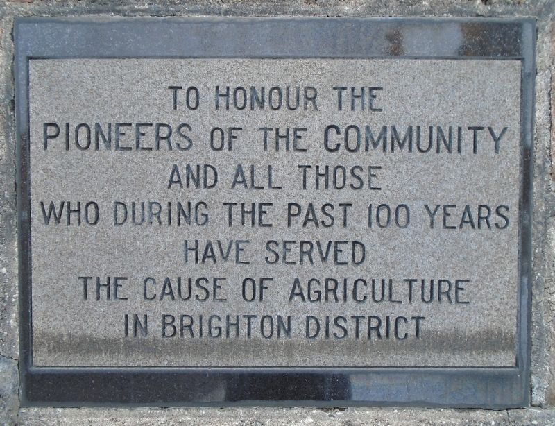
1. Brighton District Pioneers and Farmers Marker
Pioneers of the Community
and all those who
during the past 100 years
have served the cause of agriculture
in Brighton District
Erected 1957 by Ontario Department of Agriculture.
Topics. This historical marker is listed in these topic lists: Agriculture • Settlements & Settlers. A significant historical year for this entry is 1853.
Location. 44° 2.557′ N, 77° 43.9′ W. Marker is in Brighton, Ontario, in Northumberland County. It is at the intersection of Pinnacle Street South and Elizabeth Street (Provincial Highway 2), on the right when traveling south on Pinnacle Street South. Touch for map. Marker is at or near this postal address: 51 Elizabeth Street, Brighton ON K0K 1H0, Canada. Touch for directions.

Regionally, this marker is in the Kawarthas Northumberland Area and in Eastern Ontario. It is also in Central Canada. Globally, it is in North America, on the Great Lakes, in the Western Hemisphere, in the Western World, and in the Anglosphere. Historically, it finds itself in what was once a British colony, the Viceroyalty of New France, the Haudenosaunee (Iroquois) Confederacy,
this page online
Other nearby markers. At least 8 other markers are within 3 kilometers of this marker, measured as the crow flies: Brighton Agricultural Society (a few steps from this marker); Brighton Public School (about 150 meters away, measured in a direct line); Memorial Park: The Centre of Town (approx. 0.6 kilometers away); Memorial Park (approx. 0.6 kilometers away); Brighton Town Hall Bell (approx. 0.6 kilometers away); War Memorial Cenotaph (approx. 0.6 kilometers away); WWI Battle Honours (approx. 0.6 kilometers away); Van Sicklen Cemetery (approx. 2.8 kilometers away). Touch for a list and map of all markers in Brighton.
Photographed by William Fischer, Jr., December 5, 2024
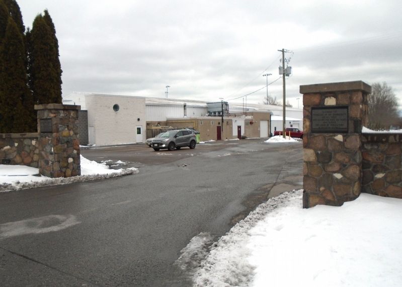
2. Brighton District Pioneers and Farmers Marker
Credits. This page was last revised on December 8, 2024. It was originally submitted on December 8, 2024, by William Fischer, Jr. of Reynoldsburg, Ohio. This page has been viewed 168 times since then and 24 times this year. Photos: 1, 2. submitted on December 8, 2024, by William Fischer, Jr. of Reynoldsburg, Ohio.
