Belleville in Hastings County, Ontario — Central Canada (North America)
The Belle of the Bay
⎯⎯⎯
Strolling Meyers Pier
Photographed by Cosmos Mariner, May 30, 2024
1. The Belle of the Bay / Strolling Meyers Pier Marker
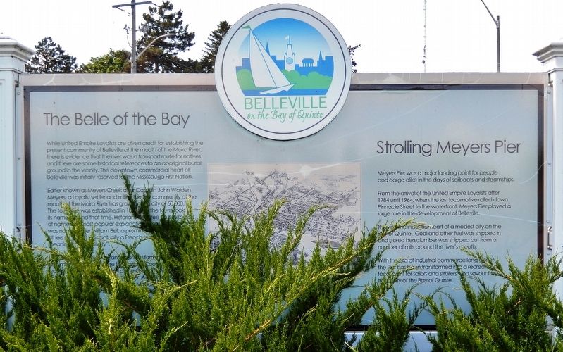
The Belle of the Bay
While United Empire Loyalists are given credit for establishing the present community of Belleville at the mouth of the Moira River, there is evidence that the river was a transport route for natives and there are some historical references to an aboriginal burial ground in the vicinity. The downtown commercial heart of Belleville was initially reserved for the Mississauga First Nation.
Earlier known as Meyers Creek after Captain John Walden Meyers, a Loyalist settler and miller, the tiny community at the mouth of the Moira River has grown into a city of 50,000. The town site was established in 1816 and the town took its name around that time. Historians disagree on the source of name: the most popular explanation is that the community was named after William Bell, a prominent citizen, while others suggest it was actually a French term, “Belleville” meaning “beautiful city”.
The town of Belleville was an important farming, lumbering and manufacturing centre for Hastings County. Its growth was influenced by the arrival of the Grand Trunk railway in 1856 and a gold rush a decade later. Among its more famous
this page online
Strolling Meyers Pier
Meyers Pier was a major landing point for people and cargo alike in the days of sailboats and steamships.
From the arrival of the United Empire Loyalists after 1784 until 1964, when the last locomotive rolled down Pinnacle Street to the waterfront, Meyers Pier played a large role in the development of Belleville.
This was the industrial heart of a modest city on the Bay of Quinte. Coal and other fuel was shipped in and stored here; lumber was shipped out from a number of mills around the river’s mouth.
With the era of industrial commerce long gone, the Pier has been transformed into a recreational focal point for sailors and strollers who savour the tranquility of the Bay of Quinte.
Topics. This historical marker is listed in these topic lists: Indigenous Peoples and Communities • Industry & Commerce • Railroads & Streetcars • Settlements & Settlers. A significant historical year for this entry is 1816.
Location. 44° 9.345′ N, 77° 22.679′ W. Marker is in Belleville, Ontario, in Hastings County. It is at the intersection
Photographed by Cosmos Mariner, May 30, 2024
2. The Belle of the Bay / Strolling Meyers Pier Marker
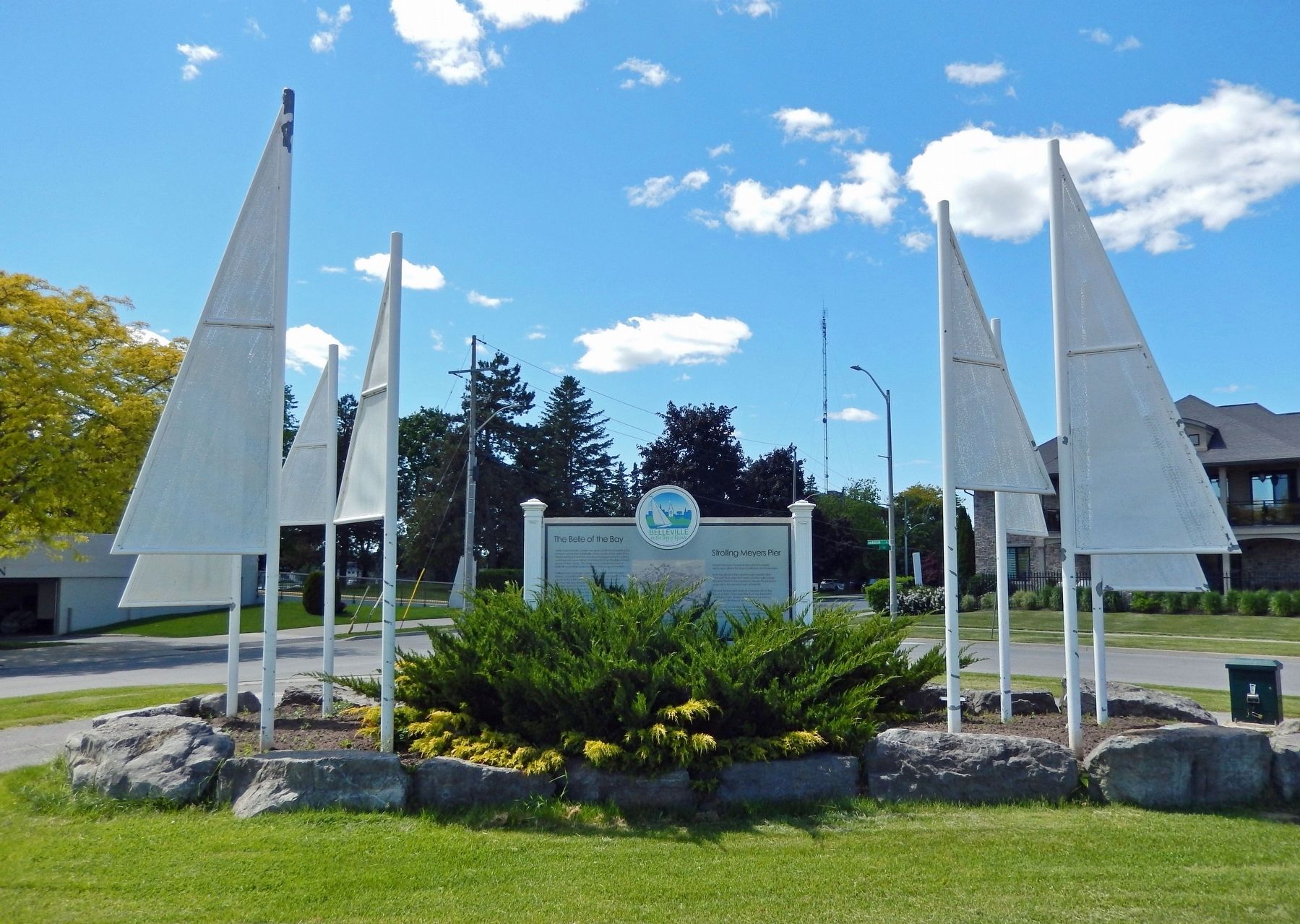
Looking northwest from Jane Forrester Park.

Regionally, this marker is in Eastern Ontario and specifically in Southeastern Ontario. It is also in Central Canada. Globally, it is in North America, on the Great Lakes, in the Western Hemisphere, in the Western World, and in the Anglosphere. Historically, it finds itself in what was once a British colony, the Viceroyalty of New France, the Haudenosaunee (Iroquois) Confederacy, and Rupert’s Land.
Other nearby markers. At least 8 other markers are within walking distance of this marker: Jane Forrester Park (within shouting distance of this marker); The Thurlow Purchase (about 120 meters away, measured in a direct line); Home of the Wharf Rats (about 180 meters away); Sir Mackenzie Bowell (approx. 0.3 kilometers away); Site of the Wharf Street Debating Club from 1921-2013 (approx. 0.3 kilometers away); Belleville (approx. half a kilometer away); Market Square (approx. 0.9 kilometers away); George Zegouras Market Square (approx. 0.9 kilometers away). Touch for a list and map of all markers in Belleville.
Also see . . . City of Belleville History.
Excerpt: The first large arrival of settlers came in 1789, when some fifty United Empire Loyalists arrived. The most notable was Captain John Walden Meyers who built a dam on the Moira River, erected a sawmill, gristmill and distillery and operated a trading post and brick kiln. The gristmill drew settlers from Napanee to Port Hope and the community soon became known as Meyers' Creek. He is credited with building the first brick house in Upper Canada in 1794.(Submitted on December 9, 2024, by Cosmos Mariner of Cape Canaveral, Florida.)A strong demand for timber in England in the 1800s made Belleville a bustling lumber town. Rich forests nearby were accessible by the Moira River and French Canadian loggers were a familiar sight. The logs were cut into timber at several local mills and taken down the St. Lawrence to Quebec. With export trade in lumber and flour, Belleville's harbour was alive with vessels of every description. Belleville was known as the most prosperous town in Upper Canada.
A visit in 1816 by Lieutenant-Governor Sir Francis Gore inspired the residents to change the name of their settlement to Belleville in honour his wife Lady Arabella.
Credits. This page was last revised on December 9, 2024. It was originally submitted on December 9, 2024, by Cosmos Mariner of Cape Canaveral, Florida. This page has been viewed 259 times since then and 79 times this year. Photos: 1, 2. submitted on December 9, 2024, by Cosmos Mariner of Cape Canaveral, Florida.
