Agua Dulce in Los Angeles County, California — The American West (Pacific Coastal)
The Asher Family
"Triple-A" Ranch
| — | Vasquez Rocks | — |
Photographed by Craig Baker, December 9, 2024
1. Asher Family marker
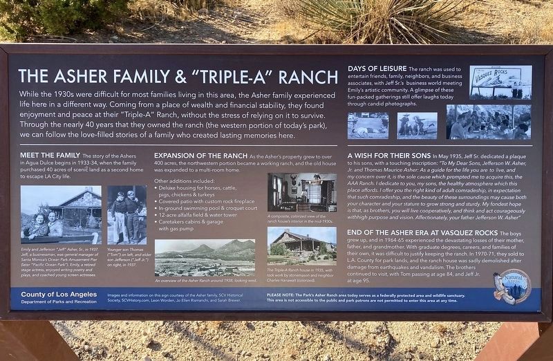
While the 1930s were difficult for most families living in this area, the Asher family experienced life here in a different way. Coming from a place of wealth and financial stability, they found enjoyment and peace at their "Triple-A" Ranch, without the stress of relying on it to survive. Through the nearly 40 years that they owned the ranch (the western portion of today's park), we can follow the love-filled stories of a family who created lasting memories here.
Meet the Family
The story of the Ashers in Agua Dulce begins in 1933-34, when the family purchased 40 acres of scenic land as a second home to escape LA City life.
Expansion of the Ranch
As the Asher's property grew to over 400 acres, the northwestern portion became a working ranch, and the old house was expanded to a multi-room home.
Other additions included:
• Deluxe housing for horses, cattle, pigs, chickens & turkeys.
• Covered patio with custom rock fireplace.
• In-ground swimming pool & croquet court.
• 12-acre alfalfa field & water tower.
• Caretakers cabins & garage with gas pump.
Days of Leisure
this page online
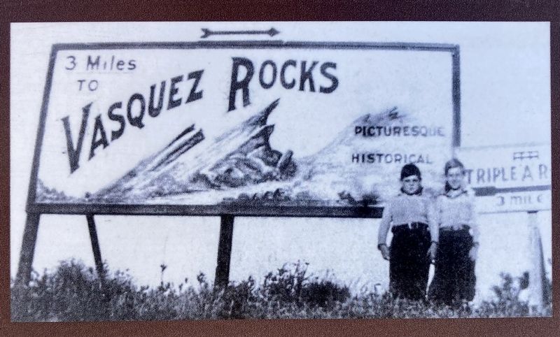
The ranch was used to entertain friends, family, neighbors, and business associates, with Jeff Sr.'s business world meeting Emily's artistic community. A glimpse of these fun-packed gatherings still offer laughs today through candid photographs.
A Wish for Their Sons
In May 1935, Jeff Sr. dedicated a plaque to his sons, with a touching inscription:
"To My Dear Sons, Jefferson W. Asher, Jr. and Thomas Maurice Asher: As a guide for the life you are to live, and my concern over it, is the sole cause which prompted me to acquire this, the AAA Ranch. I dedicate to you, my sons, the healthy atmosphere which this place affords. I offer you the right kind of adult comradeship, in expectation that such comradeship, and the beauty of these surroundings may cause both your character and your stature to grow strong and sturdy. My fondest hope is that, as brothers, you will live cooperatively, and think and act courageously withhigh purpose and vision.
Affectionately, your father,
Jefferson W. Asher"
End of an Era at Vasquez Rocks
The boys grew up, and in 1964-65 experienced the devastating
Photographed by Craig Baker, December 9, 2024
2. Marker Detail
PLEASE NOTE: The Park's Asher Ranch area today serves as a federally protected area and wildlife sanctuary. This area is not accessible to the public and park patrons are not permitted to enter this area at any time.
photo captions:
Emily and Jefferson "Jeff" Asher Sr, in 1937. Jeff, a businessman, was general manager of Santa Monica's Ocean Park Amusement Pier (later Pacific Ocean Park). Emily, a retired stage actress, enjoyed writing poetry and plays, and coached young screen actresses.
Younger son Thomas (Tom) on left, and elder son Jefferson (Jeff Jr) on right, in 1937.
An overview of the Asher Ranch around 1928 looking west.
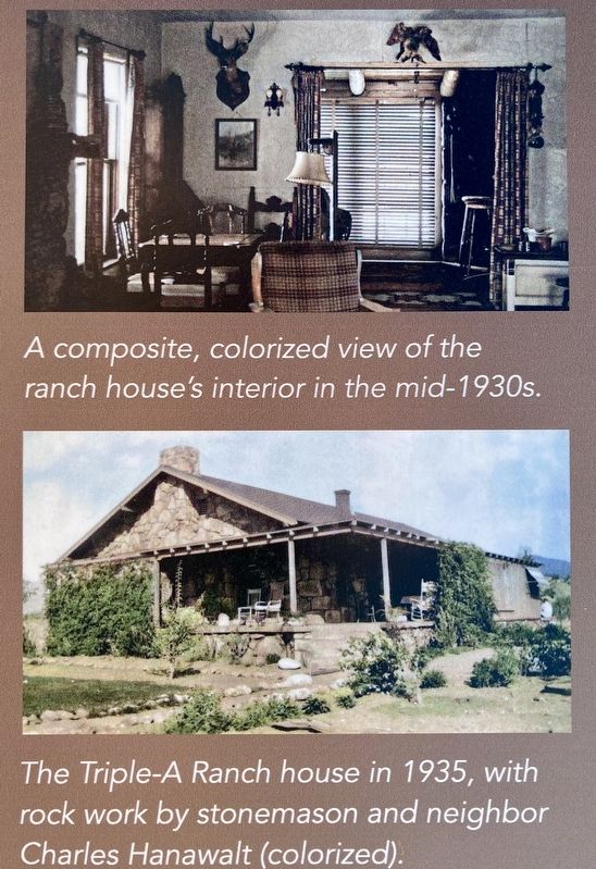
A composite, colorized view of the ranch house's interior in the mid-1930s.
The Triple A Ranch house in 1935, with rock work by stonemason and neighbor Charles Hanawalt (colorized).
Images and information on this sign courtesy of the Asher family, SCV Historical Society, SCVHistory.com, Leon Worden, Jo Ellen Rismanchi, and Sarah Brewer.
Erected 2024 by County of Los Angeles Department of Parks and Recreation.
Topics. This historical marker is listed in these topic lists: Parks & Recreational Areas • Settlements & Settlers. A significant historical month for this entry is May 1935.
Location. 34° 29.046′ N, 118° 18.539′ W. Marker is in Agua Dulce, California, in Los Angeles County. It can be reached from Escondido Canyon Road half a mile east of Agua
Photographed by Craig Baker, December 9, 2024
3. Marker Detail

Regionally, this marker is in Greater Los Angeles and in the Transverse Ranges. It is also on the American Pacific Coast. Globally, it is in North America, on the Ring of Fire, on the Pacific Rim, in the Western Hemisphere, in the Western World, and in the Anglosphere. Historically, it finds itself in what was once New Spain and also Mexico’s Alta California.
Other nearby markers. At least 11 other markers are within walking distance of this marker: The Krieg-Toney Family (about 600 feet away, measured in a direct line); Vasquez Rocks Becomes a Park (about 600 feet away); The Vasquez Rocks (approx. 0.2 miles away); The Castle of Vasquez Rocks (approx. 0.2 miles away); Land and Industry (approx. 0.4 miles away); The Mexican & Early American Eras (approx. 0.4 miles away); European Contact & the Spanish Era

Photographed by Craig Baker, December 9, 2024
4. Asher Family marker
Credits. This page was last revised on January 17, 2026. It was originally submitted on December 10, 2024, by Craig Baker of Sylmar, California. This page has been viewed 287 times since then and 54 times this year. Photos: 1, 2, 3, 4. submitted on December 10, 2024, by Craig Baker of Sylmar, California.
