
Fayetteville in Fayette County, West Virginia — The American South (Appalachia)
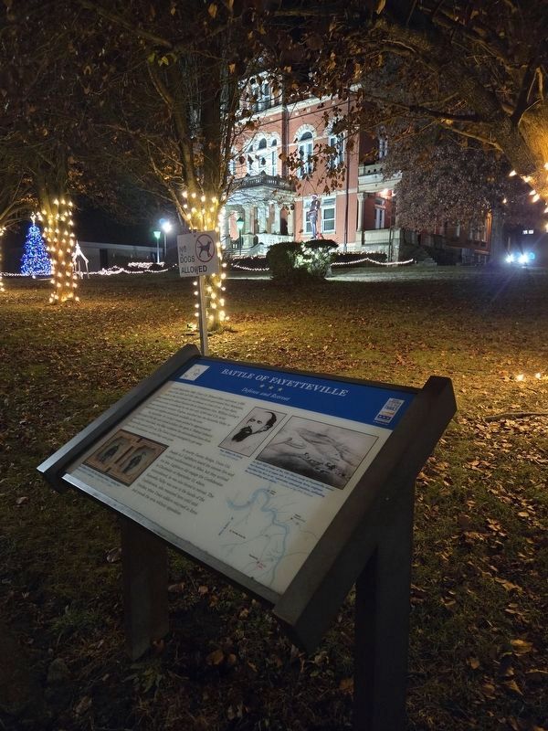
Battle of Fayetteville
Defense and Retreat
| — | West Virginia Civil War Trails | — |

Photographed by Mark Parker, December 10, 2024
1. Battle of Fayetteville Marker
In early September 1862, Union Col. Edward Siber and about 1,500 men of the 34th and 37th Ohio Infantries garrisoned Fort Scammon, built on the hill behind the courthouse in front of you. From there, Siber prepared to defend Fayetteville as Confederate Gen. William Loring's 5,000-man army, emboldened by the fact only 5,000 total US Army troops remained in western Virginia, marched into the Kanawha Valley to replenish salt supplies abundantly available in the area.
On September 10, Loring's troops pushed to approximately 300 yards of the fort and rained artillery fire upon it. Federal infantry and artillery fired back, but Siber withdrew his outnumbered force from Fayetteville around 1:00 AM. The Union troops managed to get away before the Confederates realized they were gone.
At nearby Gauley Bridge, Union Col. Joseph A.J. Lightburn heard the cannon fire and rushed reinforcements to Siber, but they arrived too late. Lightburn did engage the Confederates in Charleston on September 13, where, outnumbered, he was also forced to retreat. The Kanawha Valley was now in the hands of the Confederates, who remained here
this page online
(captions)
Soldiers of the 34th Ohio Volunteer Infantry wearing their unusual early issue uniforms. - Courtesy Library of Congress
Gen. William W. Loring Courtesy WVU Archives
An April 1863 image of the 12th Ohio's camp at Fayetteville shows Fort Scammon is at upper left. A Confederate Army engineer described the fort as an "admirable selected position, enfilading the surrounding open plains." - Courtesy of the WVU Archives
Erected by West Virginia Civil War Trails.
Topics and series. This historical marker is listed in these topic lists: Forts and Castles • War, US Civil. In addition, it is included in the West Virginia Civil War Trails series list. A significant historical date for this entry is September 10, 1862.
Location. 38° 3.178′ N, 81° 6.233′ W. Marker is in Fayetteville, West Virginia, in Fayette County. It is at the intersection of North Court Street (West Virginia Route 16) and East Maple Avenue, on the right when traveling north on North Court Street. The marker stands on the southeast corner of the Fayetteville County
Photographed by Mark Parker, December 10, 2024
2. Battle of Fayetteville Marker
Fayette county courthouse in background

Regionally, this marker is in the New River Gorge and in Greater Charleston Area. It is also in the American South, specifically in the Upper South, in Appalachia, and specifically in Southern Appalachia. Globally, it is in North America, the Western Hemisphere, the Western World, and the Anglosphere. Historically, it finds itself in what was once the territory of the Mississippian Culture.
Other nearby markers. At least 8 other markers are within walking distance of this marker: Marquis de Lafayette (a few steps from this marker); Fayetteville (a few steps from this marker); Abraham Vandal (within shouting distance of this marker); Fayette County Law Enforcement Officers' Memorial (within shouting distance of this marker); Morris Harvey House (about 500 feet away, measured in a direct line); American Legion Post 149 Veterans Memorial Torch (about 500 feet away); Fayette County Soldiers & Sailers Memorial Building (about 500 feet away); Land Of The Free (about 600 feet away). Touch for a list and map of all markers in Fayetteville.
Another marker is no longer nearby. Battle of Fayetteville (has been replaced with this marker).
Related marker. Click here for another marker that is related to this marker. Old CWT Marker At This Location also titled "Battle of Fayetteville".
Credits. This page was last revised on December 16, 2024. It was originally submitted on December 11, 2024, by Mark Parker of Hickory, North Carolina. This page has been viewed 373 times since then and 64 times this year. Last updated on December 11, 2024, by Mark Parker of Hickory, North Carolina. Photos: 1, 2. submitted on December 11, 2024, by Mark Parker of Hickory, North Carolina. • Devry Becker Jones was the editor who published this page.
Editor’s want-list for this marker. Clear, daylight photos of the marker and its context. • Can you help?
