Kempsville Gardens in Virginia Beach, Virginia — The American South (Mid-Atlantic)
Kempsville in the 19th Century
Photographed by Brandon D Cross
1. Kempsville in the 19th Century Marker
Government
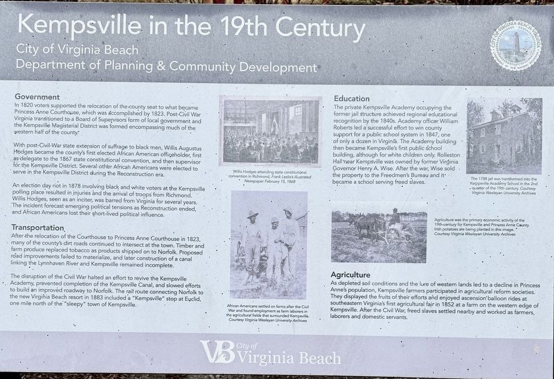
In 1820 voters supported the relocation of the county seat to what became Princess Anne Courthouse, which was accomplished by 1823. Post-Civil War Virginia transitioned to a Board of Supervisors form of local government and the Kempsville Magisterial District was formed encompassing much of the western half of the county.
With post-Civil-War state extension of suffrage to black men, Willis Augustus Hodges became the county's first elected African American officeholder, first as delegate to the 1867 state constitutional convention, and then supervisor for the Kempsville District. Several other African Americans were elected to serve in the Kempsville District during the Reconstruction era.
An election day riot in 1878 involving black and white voters at the Kempsville polling place resulted in injuries and the arrival of troops from Richmond. Willis Hodges, seen as an inciter, was barred from Virginia for several years. The incident forecast emerging political tensions as Reconstruction ended, and African Americans lost their short-lived political influence.
Transportation
After the relocation of
this page online
The disruption of the Civil War halted an effort to revive the Kempsville Academy, prevented completion of the Kempsville Canal, and slowed efforts to build an improved roadway to Norfolk. The rail route connecting Norfolk to the new Virginia Beach resort in 1883 included a "Kempsville" stop at Euclid, one mile north of the "sleepy" town of Kempsville.
Education
The private Kempsville Academy occupying the former jail structure achieved regional educational recognition by the 1840s. Academy officer William Roberts led a successful effort to win county support for a public school system in 1847, one of only a dozen in Virginia. The Academy building then became Kempsville's first public school building, although for white children only. Rolleston Hall near Kempsville was owned by former Virginia
Photographed by Brandon D Cross
2. Kempsville in the 19th Century Marker
Agriculture
As depleted soil conditions and the lure of western lands led to a decline in Princess Anne's population, Kempsville farmers participated in agricultural reform societies. They displayed the fruits of their efforts and enjoyed ascension balloon rides at southeastern Virginia's first agricultural fair in 1852 at a farm on the western edge of Kempsville. After the Civil War, freed slaves settled nearby and worked as farmers, laborers and domestic servants.
(captions)
Willis Hodges attending state constitutional convention in Richmond, Frank Leslie's Illustrated Newspaper February 15, 1868
African Americans settled on farms after the Civil War and found employment as farm laborers in the agricultural fields that surrounded Kempsville. Courtesy Virginia Wesleyan University Archives
Agriculture was the primary economic activity of the 19th-century for Kempsville and Princess Anne County. Irish potatoes are being planted in this image. Courtesy Virginia Wesleyan University Archives
Erected by City of Virginia Beach, Department of Planning & Community Development.
Topics. This historical marker is listed in these topic lists: African Americans • Agriculture • Education • Settlements & Settlers. A significant historical year for this entry is 1823.
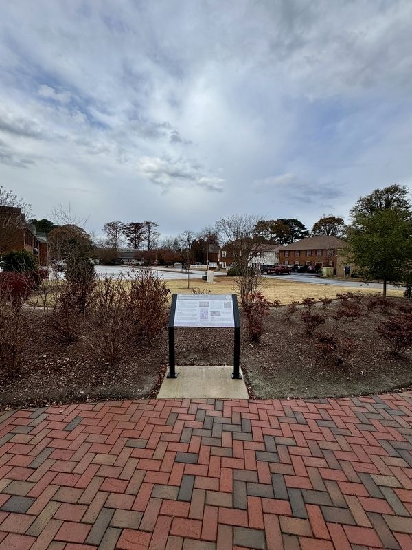
Location. 36° 49.739′ N, 76° 9.631′ W. Marker is in Virginia Beach, Virginia. It is in Kempsville Gardens. It is at the intersection of South Witchduck Road and Office Square Lane, on the right when traveling south on South Witchduck Road. Touch for map. Marker is at or near this postal address: 405 South Witchduck Road, Virginia Beach VA 23462, United States of America. Touch for directions.

Regionally, this marker is in Hampton Roads, specifically in Coastal Virginia, and in the Hampton Roads Metropolitan Area. It is also in the American South, specifically in the Upper South, in the Tidewater, and on the Eastern Seaboard. Globally, it is in the North Atlantic Region, North America, the Western Hemisphere, the Western World, and the Anglosphere. Historically, it finds itself in what was once the territory of the Mississippian Culture, one of the original Thirteen Colonies, one of the Confederate States of America, and the Antebellum South.
Other nearby markers. At least 8 other markers are within walking distance of this marker: Kempsville in the 20th Century (here, next to this marker); Kempes Landing (a few steps from this marker); Declaration of Independence Victory Dance (about 600 feet away, measured in a direct line); The Skirmish Of Kempsville (about 700 feet away); Princess Anne County Courthouse (about 800 feet away); Willis Augustus Hodges (1815~1890) (approx. 0.2 miles away); Skirmish at Kemp’s Landing (approx. 0.2 miles away); Kempsville (approx. 0.2 miles away). Touch for a list and map of all markers in Virginia Beach.
Also see . . .
1. Willis Augustus Hodges (1815 - 1890). (Submitted on December 11, 2024, by Brandon D Cross of Flagler Beach, Florida.)
2. Princess Anne County. (Submitted on December 11, 2024, by Brandon D Cross of Flagler Beach, Florida.)
Credits. This page was last revised on June 20, 2025. It was originally submitted on December 11, 2024, by Brandon D Cross of Flagler Beach, Florida. This page has been viewed 392 times since then and 53 times this year. Photos: 1, 2. submitted on December 11, 2024, by Brandon D Cross of Flagler Beach, Florida. • Bernard Fisher was the editor who published this page.
