
Statesville in Iredell County, North Carolina — The American South (South Atlantic)
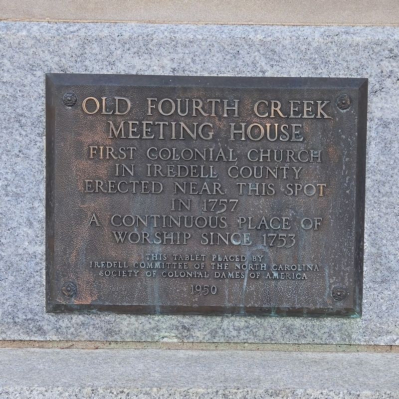
Old Fourth Creek Meeting House
Photographed by Mark Parker, December 14, 2024
1. Old Fourth Creek Meeting House Marker
Erected 1950 by Iredell Committee of the North Carolina Society of Colonial Dames of America.
Topics. This historical marker is listed in these topic lists: Colonial Era • Religion & Religious Structures • Settlements & Settlers. A significant historical year for this entry is 1753.
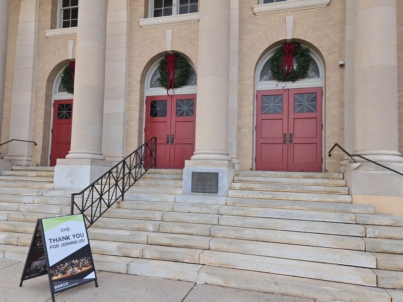
Location. 35° 47.101′ N, 80° 53.439′ W. Marker is in Statesville, North Carolina, in Iredell County. It is at the intersection of North Meeting Street and West End Avenue (North Carolina Route 90), on the right when traveling south on North Meeting Street. The plaque is mounted on the base of the center column of the First Presbyterian Church entrance. Touch for map. Marker is at or near this postal address: 125 N Meeting St, Statesville NC 28677, United States of America. Touch for directions.

Regionally, this marker is in North Carolina’s Piedmont. It is also in the American South and specifically in the Upper South. Globally, it is in North America, the Western Hemisphere, the Western World, and the
this page online
Other nearby markers. At least 8 other markers are within walking distance of this marker: Fourth Creek Meeting House (within shouting distance of this marker); Site of North Carolina's First Public Power Community (about 300 feet away, measured in a direct line); Old Fourth Creek Burying Ground (about 300 feet away); Original Town Limits of Statesville (about 300 feet away); James Hall (about 300 feet away); Dr. R.V. Cowan (about 300 feet away); Lowenstein & Co. (about 400 feet away); T. Ross Alexander Company (about 600 feet away). Touch for a list and map of all markers in Statesville.
Another marker is no longer nearby. Fourth Creek Meeting House (was within shouting distance of this marker but has been replaced with another marker now near it).
Photographed by Mark Parker, December 14, 2024
2. Old Fourth Creek Meeting House Marker at the base of the column near the top of the steps

Photographed by Mark Parker, December 14, 2024
3. Full view of First Presbyterian Church, former site of Fourth Creek Meeting House
Credits. This page was last revised on December 16, 2024. It was originally submitted on December 14, 2024, by Mark Parker of Hickory, North Carolina. This page has been viewed 172 times since then and 20 times this year. Photos: 1, 2, 3. submitted on December 14, 2024, by Mark Parker of Hickory, North Carolina. • Bernard Fisher was the editor who published this page.
