Carrizo Plain National Monument in San Luis Obispo County, California — The American West (Pacific Coastal)
Wallace Creek Interpretive Trail
Along the San Andreas Fault
Photographed by Craig Baker, April 23, 2022
1. Wallace Creek Marker
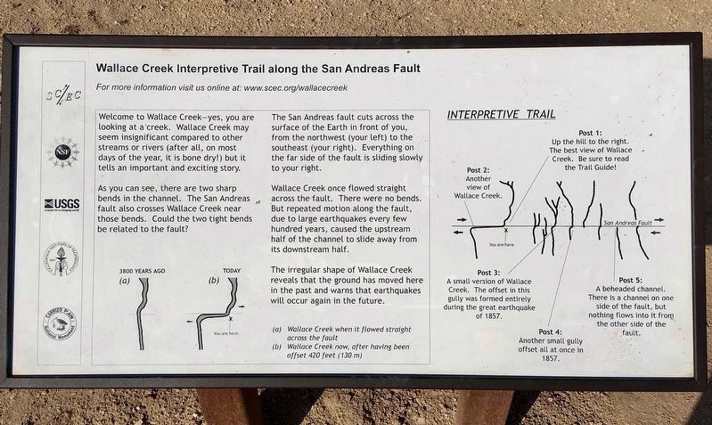
Welcome to Wallace Creek. Yes, you are looking at a creek. Wallace Creek may seem insignificant compared to other streams or rivers, after all, on most days of the year, it is bone dry. But it tells an important and exciting story.
As you can see, there are two sharp bends in the channel. The San Andreas fault also crosses Wallace Creek near those bends. Could the two tight bends be related to the fault?
The San Andreas fault cuts across the surface of the Earth in front of you, from the northwest (your left) to the southeast (your right). Everything on the far side of the fault is sliding slowly to your right.
Wallace Creek once flowed straight across the fault. There were no bends. But repeated motion along the fault, due to large earthquakes every few hundred years, caused the upstream half of the channel to slide away from its downstream half.
The irregular shape of Wallace Creek reveals that the ground has moved here in the past, and warns that earthquakes will occur again in the future.
For more information visit us online at: www.scec.ord/wallacecreek
Erected by Carrizo Plain National
this page online
Topics. This historical marker is listed in this topic list: Natural Features.
Location. 35° 16.265′ N, 119° 49.628′ W. Marker is in Carrizo Plain National Monument, California, in San Luis Obispo County. It can be reached from Elkhorn Road 4½ miles south of California Route 58. Touch for map. Marker is in this post office area: Santa Margarita CA 93453, United States of America. Touch for directions.

Regionally, this marker is on the Central Coast and specifically on the Coast Ranges. It is also on the American Pacific Coast. Globally, it is in North America, on the Ring of Fire, in the Pacific Rim, in the Western Hemisphere, in the Western World, and in the Anglosphere. Historically, it finds itself in what was once New Spain and also Mexico’s Alta California.
Other nearby markers. At least 8 other markers are within 12 miles of this marker, measured as the crow flies: Goodwin Ranch (approx. 4.7 miles away); Soda Lake (approx. 4.8 miles away); a different marker also named Soda Lake (approx. 5.1 miles away); a different marker also named Soda Lake (approx.
Photographed by Craig Baker, April 23, 2022
2. Wallace Creek Marker
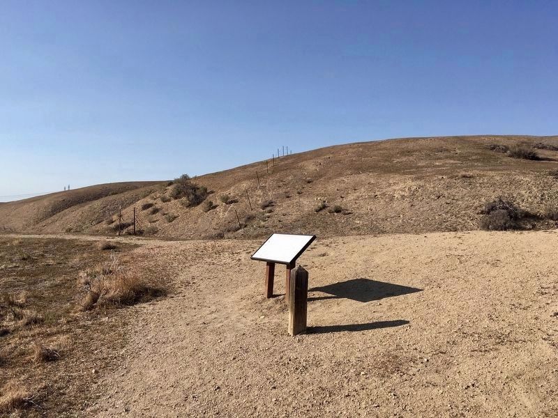
More about this marker. Elkhorn Road is a dirt road and could be closed after a rain storm. The marker is a short hike from the parking lot.
Also see . . . Trail Guide to Wallace Creek. (Submitted on July 8, 2018.)

Photographed by Craig Baker, April 23, 2022
3. Wallace Creek Offset and Marker
The marker is at lower left.
Photographed by Craig Baker, April 23, 2022
4. Interpretive Sign at Trailhead
Click on any photo to see it full size.
Photographed by Craig Baker, April 23, 2022
5. Interpretive Sign at Trailhead
Credits. This page was last revised on December 17, 2024. It was originally submitted on July 8, 2018, by Craig Baker of Sylmar, California. This page has been viewed 1,134 times since then and 100 times this year. Last updated on December 14, 2024, by Adam Margolis of Mission Viejo, California. Photos: 1, 2, 3, 4, 5. submitted on December 17, 2024, by Craig Baker of Sylmar, California. • Devry Becker Jones was the editor who published this page.
