Watsontown in Northumberland County, Pennsylvania — The American Northeast (Mid-Atlantic)
The Robert E. Brown Memorial Park
Dedicated: October 9, 2010
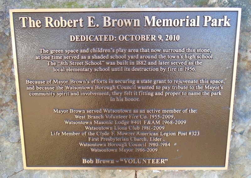
Photographed by William Fischer, Jr., December 14, 2024
1. The Robert E. Brown Memorial Park Marker
stone, at one time served as a shaded school yard around the town's
high school. The "8th Street School" was built in 1882 and later
served as the local elementary school until its destruction
by fire in 1956.
Because of Mayor Brown's efforts in securing a state grant to rejuvenate this space, and because the Watsontown Borough Council wanted to pay tribute to the Mayor's community spirit and involvement, they felt it fitting and proper to name the park in his honor.
Mayor Brown served Watsontown as an active member of the:
West Branch Volunteer Fire Co. 1955-2009,
Watsontown Masonic Lodge #401 F&AM 1968-2009
Watsontown Lions Club 1981-2009
Life Member of the Clyde F. Mowrer American Legion Post #323
First Presbyterian Church, Elder
Watsontown Borough Council 1980-1984
Watsontown Mayor 1986-2009
Bob Brown - "VOLUNTEER"
Topics. This historical marker is listed in these topic lists: Charity & Public Work • Parks & Recreational Areas. A significant historical year for this entry is 1882.
Location. 41° 5.23′ N, 76° 52.061′ W. Marker is in Watsontown,
this page online

Regionally, this marker is in Pennsylvania’s Anthracite Coal Region and in the Susquehanna Valley. It is also in the American Northeast, in the Mid-Atlantic, in Appalachia, and specifically in Northern Appalachia. Globally, it is in North America, the Western Hemisphere, the Western World, and the Anglosphere. Historically, it finds itself in what was once the Haudenosaunee (Iroquois) Confederacy and also one of the original Thirteen Colonies.
Other nearby markers. At least 8 other markers are within 4 miles of this marker, measured as the crow flies: War Memorial (approx. ¼ mile away); Town Clock Bell (approx. 0.3 miles away); Widow Catherine Smith (approx. 0.9 miles away); Dewart (approx. 1.6 miles away); Warrior Run Church (approx. 3.2 miles away); Col. Matthew Smith (approx. 3.3 miles away); Fort Freeland (approx. 3.3 miles

Photographed by William Fischer, Jr., December 14, 2024
2. The Robert E. Brown Memorial Park and Marker
Credits. This page was last revised on December 15, 2024. It was originally submitted on December 15, 2024, by William Fischer, Jr. of Reynoldsburg, Ohio. This page has been viewed 243 times since then and 39 times this year. Photos: 1, 2. submitted on December 15, 2024, by William Fischer, Jr. of Reynoldsburg, Ohio.
