Buffalo Township near Washington in Washington County, Pennsylvania — The American Northeast (Mid-Atlantic)
Washington
Photographed by J. J. Prats, August 27, 2006
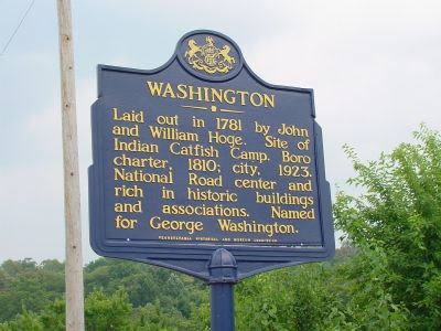
1. Washington Marker
Laid out in 1781 by John and William Hoge. Site of Indian Catfish Camp. Boro charter, 1810; city, 1823. National Road center and rich in historic buildings and associations. Named for George Washington.
Erected 1947 by the Pennsylvania Historical and Museum Commission.
Topics and series. This historical marker is listed in these topic lists: Political Subdivisions • Roads & Vehicles. In addition, it is included in the Pennsylvania Historical and Museum Commission (PHMC), and the The Historic National Road series lists. A significant historical year for this entry is 1781.
Location. Marker is missing. It was located near 40° 8.999′ N, 80° 19.682′ W. Marker was near Washington, Pennsylvania, in Washington County. It was in Buffalo Township. It was at the intersection of U.S. 40 and Coffeys Crossing Road, on the right when traveling east on U.S. 40. This marker is on the western approach to the city. Touch for map. Marker was at or near this postal address: 3610 Coffeys Crossing Rd, Washington PA 15301, United States of America. Touch for directions.

Regionally, this marker was in Greater Pittsburgh. It was also
this page online
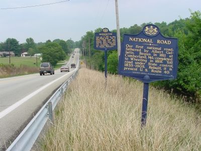
Other nearby markers. At least 8 other markers are within 3 miles of this location, measured as the crow flies: National Road (here, next to this marker); Wolff’s Fort (approx. 0.3 miles away); Revolutionary War Soldiers (approx. 0.8 miles away); a different marker also named Revolutionary War Soldiers (approx. 1.3 miles away); “S” Bridge (approx. 1.3 miles away); William Holmes McGuffey (approx. 1.8 miles away); Falconi Field (approx. 2.3 miles away); Wild Things Frontier League All Stars (approx. 2.4 miles away). Touch for a list and map of all markers in Washington.
Regarding Washington. Washington was built on the site of an Indian village known as Catfish’s Camp, named for the Delaware Chief Catfish.
Also see . . . Washington PA. Wikipedia entry (Submitted on July 12, 2022, by Larry Gertner of New York, New York.)
Photographed by J. J. Prats, August 27, 2006
2. National Road and Washington Markers on U.S. 40
Photographed by Mark Parker, December 10, 2024
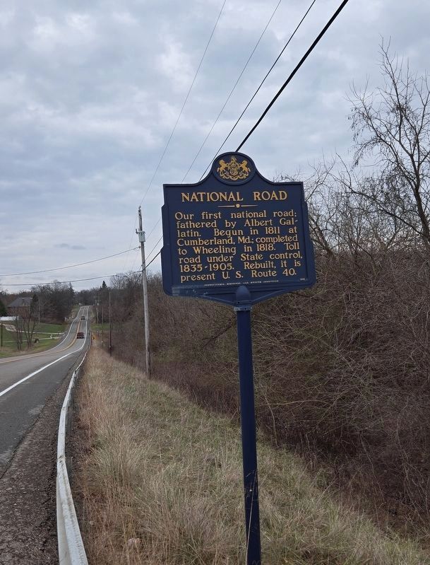
3. Washington Marker missing
Previously located next to National Road marker, now no longer there.
Credits. This page was last revised on February 1, 2025. It was originally submitted on January 15, 2007, by J. J. Prats of Powell, Ohio. This page has been viewed 2,032 times since then and 54 times this year. Last updated on December 16, 2024, by Mark Parker of Hickory, North Carolina. Photos: 1, 2. submitted on January 15, 2007, by J. J. Prats of Powell, Ohio. 3. submitted on December 16, 2024, by Mark Parker of Hickory, North Carolina. • J. Makali Bruton was the editor who published this page.
