Altstadt in Koblenz, Rhineland-Palatinate, Germany — Central Europe
The Good Old Times
End of the 19th century
⎯⎯⎯ Die gute alte Zeit
Ende des 19. Jahrhunderts
Photographed by Steve Stoessel, December 16, 2024
1. The Good Old Times Marker
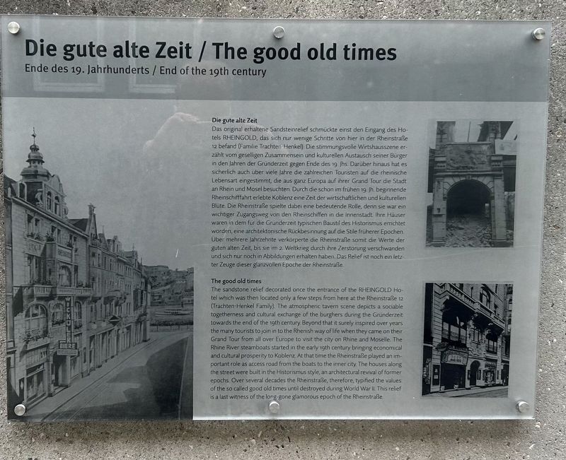
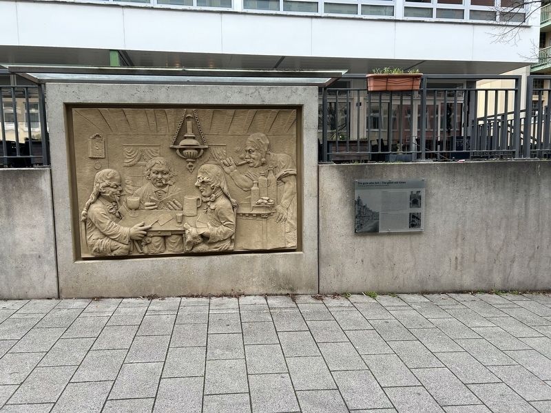
Inscription. The sandstone relief decorated once the entrance of the Rheingold Hotel which was then located only a few steps from here at the Rheinstraße 12 (Trachten-Henkel Family). The atmospheric tavern scene depicts a sociable togetherness and cultural exchange of the burghers during the Gründerzeit towards the end of the 1gth century. Beyond that it surely inspired over years the many tourists to join in to the Rhenish way of life when they came on their Grand Tour from all over Europe to visit the city on Rhine and Moselle. The Rhine River steamboats started in the early i9th century bringing economical and cultural prosperity to Koblenz At that time the Rheinstraße played an important role as access road from the boats to the inner city. The houses along the street were built in the Historismus style, an architectural revival of former epochs. Over several decades the Rheinstraße, therefore, typified the values of the so called good old times until destroyed during World War II. This relief is a last witness of the long-gone glamorous epoch of the Rheinstraße.
Das original erhaltene Sandsteinrelief schmückte
Click or scan to see this page online
einst den Eingang des Hotels Rheingold, das sich nur wenige Schritte von hier in der Rheinstraße 12 befand (Familie Trachten-Henkel). Die stimmungsvolle Wirtshausszene erzählt vom geselligen Zusammensein und kulturellen Austausch seiner Burger in den Jahren der Gründerzeit gegen Ende des 19 Jhs. Darüber hinaus hat es sicherlich auch über viele Jahre die zahlreichen Touristen auf die rheinische Lebensart eingestimmt, die aus ganz Europa auf ihrer Grand Tour die Stadt an Rhein und Mosel besuchten. Durch die schon im frühen 19. Jh. beginnende Rheinschifffahrt erlebte Koblenz eine Zeit der wirtschaftlichen und kulturellen Blute. Die Rheinstraße spielte dabei eine bedeutende Rolle, denn sie war ein wichtiger Zugangsweg von den Rheinschiffen in die Innenstadt Ihre Hauser waren in dem für die Gründerzeit typischen Baustil des Historismus errichtet worden, eine architektonische Rückbesinnung auf die Stile früherer Epochen Uber mehrere Jahrzehnte verkorperte die Rheinstraße somit die Werte der guten alten Zeit, bis sie im 2. Weltkrieg durch ihre Zerstörung verschwanden und sich nur noch in Abbildungen erhalten haben Das Relief ist noch ein letzter
Location. 50° 21.589′ N, 7° 36.212′ E. Marker is in Koblenz, Rheinland-Pfalz (Rhineland-Palatinate). It is in Altstadt. It is on Rheinstraße east of Karmeliterstrasse, on the right when traveling west. Touch for map. Marker is at or near this postal address: Rheinstraße 4, Koblenz RP 56068, Germany. Touch for directions.
Regionally, this marker is in the German Rhineland, in the Upper Middle Rhine Valley, and specifically in the Moselle Valley. Globally, it is in Europe, the European Union, Atlantic Europe, Central Europe, the Schengen Area, Western Europe, and the Western World. Historically, it finds itself in what was once the Roman Empire, the Holy Roman Empire, and the former West Germany.
Credits. This page was last revised on February 26, 2025. It was originally submitted on December 17, 2024, by Steve Stoessel of Niskayuna, New York. This page has been viewed 154 times since then and 25 times this year. Photos:1, 2. submitted on December 17, 2024, by Steve Stoessel of Niskayuna, New York.