Louisville in Jefferson County, Kentucky — The American South (East South Central)
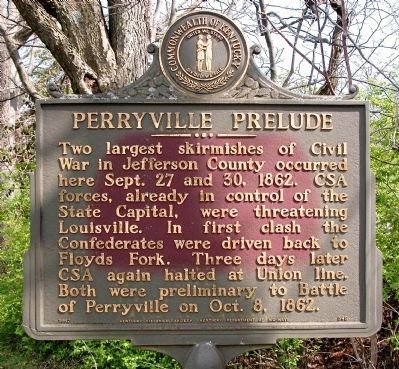
Perryville Prelude
Erected 1962 by The Kentucky Historical Society & the Kentucky Department of Highways. (Marker Number 548.)
Topics and series. This historical marker is listed in this topic list: War, US Civil. In addition, it is included in the Kentucky Historical Society series list. A significant historical month for this entry is September 1941.
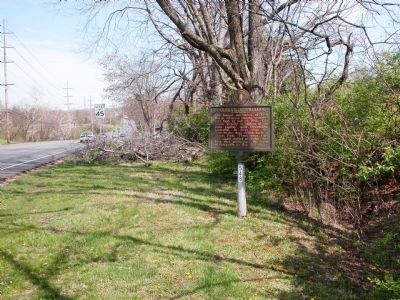
Location. 38° 14.678′ N, 85° 33.349′ W. Marker is in Louisville, Kentucky, in Jefferson County. Marker is on Shelbyville Road (U.S. 60) 0.2 miles east of Moser Road, on the right when traveling east. Marker is on the South side of the road, about 12 feet off the edge of the pavement. Touch for map. Marker is in this post office area: Louisville KY 40223, United States of America. Touch for directions.
Other nearby markers. At least 8 other markers are within walking distance of this marker. Jefferson Marders Building (approx. 0.7 miles away); Griffytown (approx. ¾ mile away); The Benjamin Head House (approx. 0.8 miles away); Middletown's First Gas Station (approx. 0.8 miles away); Arterburn House (approx. 0.8 miles away); Bank of Middletown (approx. 0.9 miles away); Milestone / Old Public Well (approx. 0.9 miles away); Middletown Methodist Church (approx. 0.9 miles away).
Credits. This page was last revised on June 16, 2016. It was originally submitted on January 9, 2010, by Karl Stelly of Gettysburg, Pennsylvania. This page has been viewed 1,913 times since then and 47 times this year. Photos: 1, 2. submitted on January 9, 2010, by Karl Stelly of Gettysburg, Pennsylvania. • Craig Swain was the editor who published this page.

