
Surry in Surry County, Virginia — The American South (Mid-Atlantic)
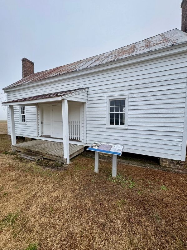
The Slave & Tenant House
Bacon’s Castle, circa 1665

Photographed by Brandon D Cross
1. The Slave & Tenant House Marker
Once slavery was abolished in 1865, the former slave quarters were converted to houses for tenant farmers. Many, including this one, remained in use through the mid-20th century. The house was wired for electricity and a small kitchen was added to the back of the building. Although three or four families would have lived here prior to the Civil War, the interior was modified to accommodate one or two families after the war. The kitchen was removed in the 1990's, returning the building closer to its antebellum appearance.
(captions)
In the 1844 survey map of Bacon’s Castle, shown to the left, the likely location of the slave quarter has been circled in red. The structure had yet to be expanded to its current size. The proximity of this slave quarter to the “big house” suggests that its enslaved residents would perform more domestic duties rather than agricultural roles.
The original 1829 section is diagrammed in white with the possible location of the entrance door, stair and porch indicated. It is most likely that two new entrances were constructed in1849, creating the three door facade.
Erected by The
this page online
Topics. This historical marker is listed in these topic lists: African Americans • Agriculture. A significant historical year for this entry is 1829.
Location. 37° 6.566′ N, 76° 43.322′ W. Marker is in Surry, Virginia, in Surry County. It can be reached from Bacons Castle Trail half a mile east of Colonial Trail East (U.S. 10), on the left when traveling east. The marker is located on the grounds of Bacon's Castle. Touch for map. Marker is at or near this postal address: 465 Bacons Castle Trail, Surry VA 23883, United States of America. Touch for directions.

Regionally, this marker is in Coastal Virginia and in the Hampton Roads Metropolitan Area. It is also in the American South, specifically in the Upper South, in the Tidewater, and on the Eastern Seaboard. Globally, it is in the North Atlantic Region, North America, the Western Hemisphere, the Western World, and the Anglosphere. Historically, it finds itself in what was once the territory of the Mississippian Culture, one of the original Thirteen Colonies, one of the Confederate States of America, and the
Photographed by Brandon D Cross
2. The Slave & Tenant House Marker
Other nearby markers. At least 8 other markers are within 2 miles of this marker, measured as the crow flies: The Smokehouse (a few steps from this marker); 1701 Barn (within shouting distance of this marker); Hog Island (approx. half a mile away); Bacon’s Castle (approx. half a mile away); Lower Surry Church (approx. ¾ mile away); A Final Resting Place for Six Unknown Colonists (approx. 0.8 miles away); Lawne’s Creek Church (approx. 1.2 miles away); Quiyoughcohannock Indians (approx. 1.3 miles away). Touch for a list and map of all markers in Surry.
Also see . . .
1. Restoration of slave quarter and smokehouse at Bacon’s Castle. (Submitted on December 18, 2024, by Brandon D Cross of Flagler Beach, Florida.)
2. Bacon’s Castle. (Submitted on December 18, 2024, by Brandon D Cross of Flagler Beach, Florida.)

Photographed by Brandon D Cross
3. Bacon’s Castle

Photographed by Brandon D Cross
4. Bacon’s Castle Entrance Sign
Credits. This page was last revised on July 10, 2026. It was originally submitted on December 18, 2024, by Brandon D Cross of Flagler Beach, Florida. This page has been viewed 263 times since then and 29 times this year. Photos: 1, 2, 3, 4. submitted on December 18, 2024, by Brandon D Cross of Flagler Beach, Florida. • Andrew Ruppenstein was the editor who published this page.
