Castalian Springs in Sumner County, Tennessee — The American South (East South Central)
Bledsoe's Fort Historical Park
Site of Bledsoe's Fort, 1783-1806
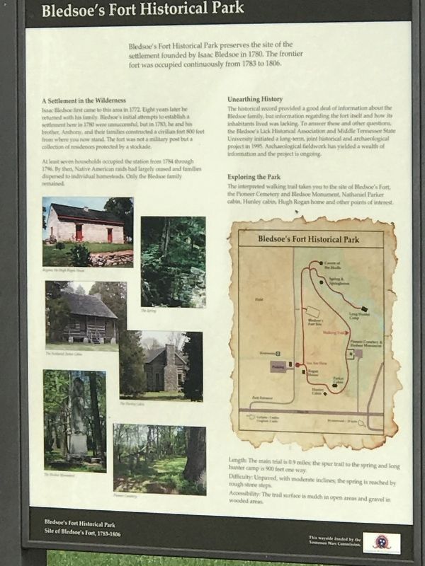
Photographed by Duane and Tracy Marsteller, May 10, 2020
1. Bledsoe's Fort Historical Park Marker
Bledsoe's Fort Historical Park preserves the site of the settlement founded by Isaac Bledsoe in 1780. The frontier fort was occupied continuously from 1783 to 1806.
A Settlement in the Wilderness
Isaac Bledsoe first came to this area in 1772 Eight years later he returned with his family. Bledsoe's initial attempts to establish a settlement here in 1780 were unsuccessful, but in 1783, he and his brother, Anthony, and their families constructed a civilian fort 800 feet from where you row stand. The fort was not a military post but a collection of residences protected by a stockade.
At least seven households occupied the station from 1784 through 1796. By then, Native American raids had largely ceased and families dispersed to individual homesteads. Only the Bledsoe family remained.
Unearthing History
The historical record provided a good deal of information about the Bledsoe family, but information regarding the fort itself and how its inhabitants lived was lacking. To answer these and other questions, the Bledsoe's Lick Historical Association and Middle Tennessee State University initiated a long-term, joint
this page online
Exploring the Park
The interpreted walking trail takes you to the site of Bledsoe's Fort, the Pioneer Cemetery and Bledsoe Monument, Nathaniel Parker cabin, Hunley cabin, Hugh Rogan home and other points of interest.
Length: The main trial is 0.9 miles; the spur trail to the spring and long hunter camp is 900 feet one way.
Difficulty: Unpaved, with moderate inclines; the spring is reached by rough stone steps.
Accessibility: The trail surface is mulch in open areas and gravel in wooded areas.
Erected by Our Tennessee Wars Commission.
Topics. This historical marker is listed in these topic lists: Anthropology & Archaeology • Exploration • Settlements & Settlers. A significant historical year for this entry is 1780.
Location. 36° 23.898′ N, 86° 19.266′ W. Marker is in Castalian Springs, Tennessee, in Sumner County. It can be reached from Hartsville Pike (State Highway 25) 0.1 miles west of Rock Springs Road, on the right when traveling west. Marker is located at the end of
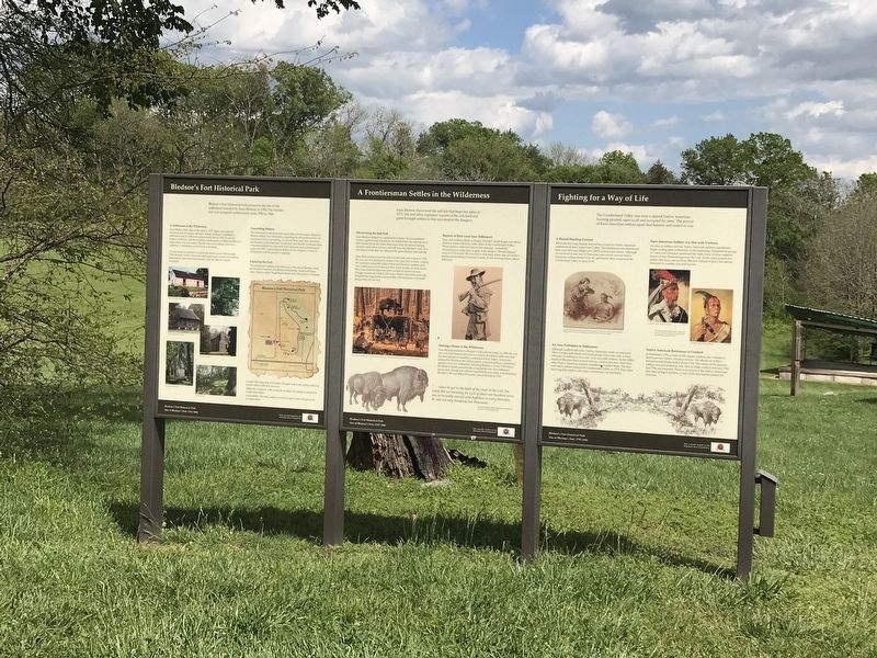
Photographed by Duane and Tracy Marsteller, May 10, 2020
2. Bledsoe's Fort Historical Park Marker

Regionally, this marker is in Middle Tennessee and in Greater Nashville. It is also in the American South and specifically in the Upper South. Globally, it is in North America, the Western Hemisphere, the Western World, and the Anglosphere. Historically, it finds itself in what was once the territory of the Mississippian Culture, one of the Confederate States of America, and the Antebellum South.
Other nearby markers. At least 8 other markers are within walking distance of this marker: A Frontiersman Settles in the Wilderness (here, next to this marker); Fighting for a Way of Life (here, next to this marker); Rogana (a few steps from this marker); Bill "Hoss" Allen (a few steps from this marker); Hugh Rogan (a few steps from this marker); A Traditional Irish Farmhouse (within shouting distance of this marker); Hugh Rogan, Irish Immigrant (within shouting distance of this marker); An Early Catholic Community (within shouting distance of this marker). Touch for a list and map of all markers in Castalian Springs.
Related markers. Click here for a list of markers that are related to this marker.
Credits. This page was last revised on December 24, 2024. It was originally submitted on May 13, 2020, by Duane and Tracy Marsteller of Murfreesboro, Tennessee. This page has been viewed 916 times since then and 78 times this year. Last updated on December 21, 2024, by Darren Jefferson Clay of Duluth, Georgia. Photos: 1, 2. submitted on May 13, 2020, by Duane and Tracy Marsteller of Murfreesboro, Tennessee. • James Hulse was the editor who published this page.
