Oakwood in Montgomery County, Ohio — The American Midwest (Great Lakes)
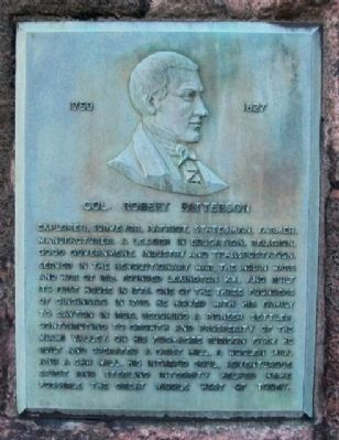
Col. Robert Patterson
1753 - 1827
Explorer, surveyor, patriot, statesman, farmer, manufacturer, a leader in education, religion, good government, industry and transportation. Served in the Revolutionary War, the Indian Wars and War of 1812. Founded Lexington, Ky., and built its first house in 1776. One of the three founders of Cincinnati in 1788. He moved with his family to Dayton in 1804, becoming a pioneer settler, contributing to growth and prosperity of the Miami Valley. On his 700-acre rubicon farm he built and operated a grist mill, a woolen mill and a saw mill. His intrepid soul, adventurous spirit and sterling integrity helped make possible the great Middle West of today.
Topics. This historical marker is listed in these topic lists: Agriculture • Settlements & Settlers • War of 1812 • War, US Revolutionary • Wars, US Indian. A significant historical year for this entry is 1812.
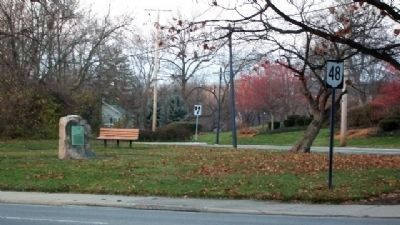
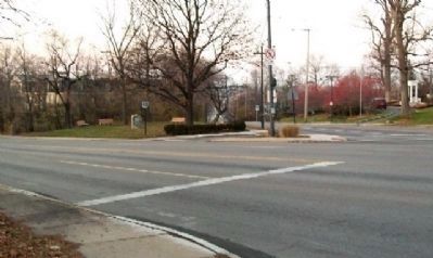
Location. 39° 43.7′ N, 84° 10.747′ W. Marker is in Oakwood, Ohio, in Montgomery County. Marker is at the intersection of Far Hills Avenue (Ohio Route 48) and Oakwood Avenue, on the right when traveling north on Far Hills Avenue. Marker is about 150 feet NNW of the intersection of Far Hills Avenue, Oakwood Avenue, and Thruston Boulevard. Touch for map. Marker is in this post office area: Dayton OH 45409, United States of America. Touch for directions.
Other nearby markers. At least 8 other markers are within one mile of this marker, measured as the crow flies. The Patterson Homestead (approx. half a mile away); Patterson Homestead 1804 (approx. half a mile away); Erma Bombeck (approx. 0.8 miles away); St. Mary’s Hall (approx. 0.8 miles away); The 93rd Regiment (approx. 0.9 miles away); Deeds Carillon (approx. one mile away); Woodland Cemetery and Arboretum (approx. one mile away); Carillon Brewing Company (approx. one mile away).
Also see . . . Robert Patterson. Ohio History Central website entry (Submitted on January 11, 2010, by William Fischer, Jr. of Scranton, Pennsylvania.)
Credits. This page was last revised on March 29, 2023. It was originally submitted on January 11, 2010, by William Fischer, Jr. of Scranton, Pennsylvania. This page has been viewed 1,142 times since then and 15 times this year. Photos: 1, 2, 3. submitted on January 11, 2010, by William Fischer, Jr. of Scranton, Pennsylvania.


