Near Nemo in Somervell County, Texas — The American South (West South Central)
George's Creek Cemetery
Photographed by James Hulse, December 22, 2024
1. George's Creek Cemetery Marker
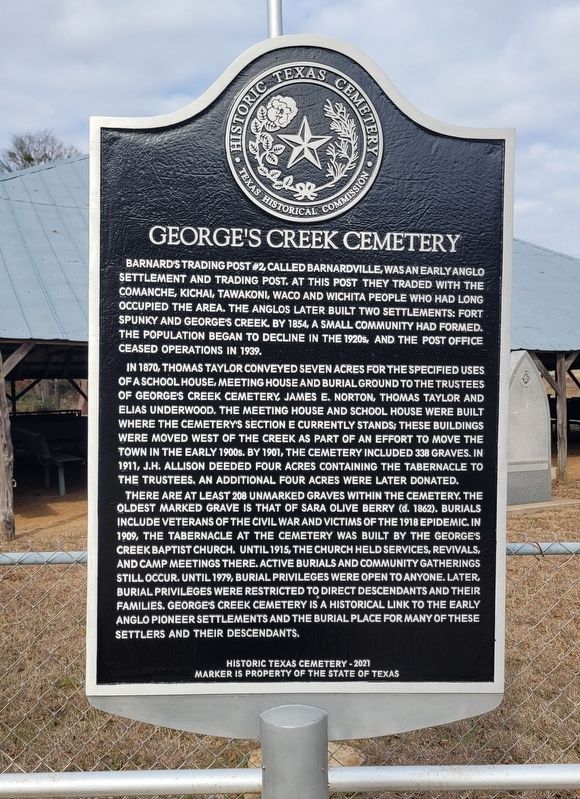
In 1870, Thomas Taylor conveyed seven acres for the specified uses of a school house, meeting house and burial ground to the trustees of George's Creek Cemetery, James E. Norton, Thomas Taylor and Elias Underwood. The meeting house and school house were built where the cemetery's Section E currently stands; these buildings were moved west of the creek as part of an effort to move the town in the early 1900s. By 1901, the cemetery included 338 graves. In 1911, J.H. Allison deeded four acres containing the tabernacle to the trustees. An additional four acres were later donated.
There are at least 208 unmarked graves within the cemetery. The oldest marked grave is that of Sara Olive Berry (d. 1862). Burials
this page online
Erected 2021 by Texas Historical Commission. (Marker Number 23509.)
Topics. This historical marker is listed in this topic list: Cemeteries & Burial Sites. A significant historical year for this entry is 1854.
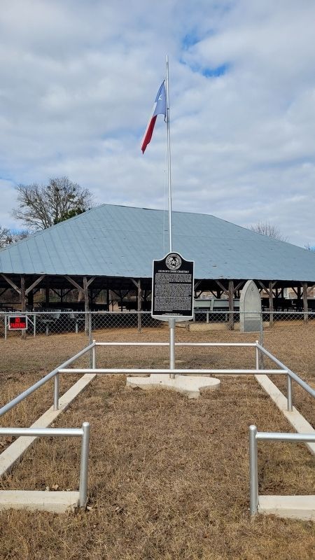
Location. 32° 17.681′ N, 97° 38.123′ W. Marker is near Nemo, Texas, in Somervell County. It is on County Road 308 south of Farm to Market Road 2174. The marker is located at the front of the cemetery. Touch for map. Marker is in this post office area: Cleburne TX 76033, United States of America. Touch for directions.

Regionally,
Photographed by James Hulse, December 22, 2024
2. George's Creek Cemetery Marker
Other nearby markers. At least 8 other markers are within 8 miles of this marker, measured as the crow flies: A different marker also named Georges Creek Cemetery (here, next to this marker); George's Creek Baptist Church (approx. ¼ mile away); Barnard's Trading Post No. 2 (approx. 1.3 miles away); Squaw Creek Indian Fight, 1864 (approx. 5.9 miles away); Dry Cleaners Building (approx. 8 miles away); Telephone Switchboard (approx. 8 miles away); Lanham Mill Schoolhouse (approx. 8 miles away); Wheeler-Epps-McMahon Cabin (approx. 8 miles away). Touch for a list and map of all markers in Nemo.
Photographed by James Hulse, December 22, 2024
3. George's Creek Cemetery Marker
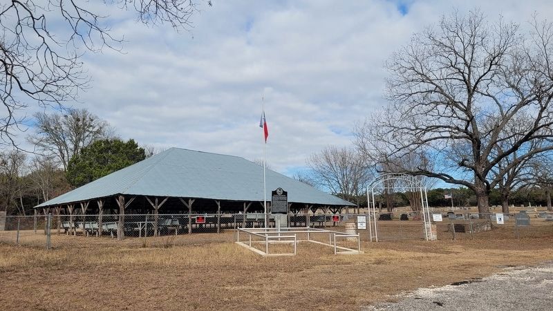
The view of the cemetery, tabernacle and marker from the entrance to the cemetery.
Credits. This page was last revised on December 25, 2024. It was originally submitted on December 23, 2024, by James Hulse of Medina, Texas. This page has been viewed 371 times since then and 118 times this year. Photos: 1, 2, 3. submitted on December 25, 2024, by James Hulse of Medina, Texas.
