Near Nemo in Somervell County, Texas — The American South (West South Central)
Georges Creek Cemetery
Est. 1850
Photographed by James Hulse, December 22, 2024
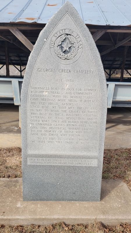
1. Georges Creek Cemetery Marker
Since 1892 we have met the 1st Sat. in May to work the graves of those who rest in these hallowed grounds. Veterans of Texas Revolution and other wars since are buried here, some in unmarked graves known only to God. This historical marker erected to the memory of those who have gone and those who follow.
To us this is sacred ground we hope you will treat it as such.
Our cemetery has been in four counties, Navarro, Johnson, Hood, and Somervell.
Erected 1970 by State of Texas.
Topics. This historical marker is listed in this topic list: Cemeteries & Burial Sites. A significant historical year for this entry is 1909.
Location. 32° 17.685′ N, 97° 38.121′ W. Marker is near Nemo, Texas, in Somervell County. It is on County Road 308 south of Farm to Market Road 2174. The marker is located at the front of the tabernacle. Touch for map. Marker is in this post office area: Cleburne TX 76033, United States of America. Touch for directions.

Regionally, this marker is in the Prairies & Lakes Region. Globally, it is in North America, a Gulf of Mexico state, the Western Hemisphere, the Western World, and the Anglosphere. Historically, it finds itself in what was once New Spain, the Republic of Texas, and one of the Confederate States of America.
Other nearby markers. At least 8 other markers are within 8 miles of this marker, measured as the crow flies: A different marker also named George's Creek Cemetery (here, next to this marker); George's Creek Baptist Church (approx. ¼ mile away); Barnard's Trading Post No. 2 (approx. 1.3 miles away); Squaw Creek Indian Fight, 1864 (approx. 5.9 miles away); Dry Cleaners Building (approx. 8 miles away);
this page online

Photographed by James Hulse, December 22, 2024
2. Georges Creek Cemetery Marker
The view of the tabernacle and marker from the entrance to the cemetery.

Photographed by James Hulse, December 22, 2024
3. Georges Creek Cemetery Marker
The view inside the tabernacle.
Credits. This page was last revised on December 25, 2024. It was originally submitted on December 23, 2024, by James Hulse of Medina, Texas. This page has been viewed 205 times since then and 25 times this year. Photos: 1, 2, 3. submitted on December 25, 2024, by James Hulse of Medina, Texas.
