Harrisonburg, Virginia — The American South (Mid-Atlantic)
End of the Campaign
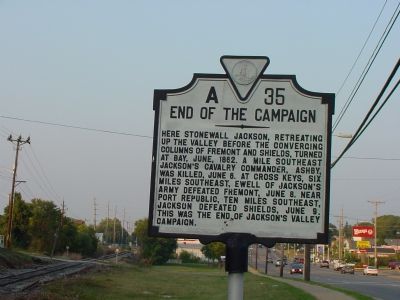
Photographed by J. J. Prats, September 25, 2007
1. End of the Campaign Marker
Erected 1941 by Virginia Conservation Commission. (Marker Number A-35.)
Topics and series. This historical marker is listed in this topic list: War, US Civil. In addition, it is included in the Virginia Department of Historic Resources (DHR) series list. A significant historical month for this entry is June 1862.
Location. This marker has been replaced by another marker nearby. It was located near 38° 25.754′ N, 78° 53.128′ W. Marker was in Harrisonburg, Virginia. It was on South Main Street (U.S. 11) south of Monument Avenue, on the right when traveling south. It is at the railroad crossing. Touch for map. Marker was in this post office area: Harrisonburg VA 22801, United States of America. Touch for directions.

Regionally,
this page online
Other nearby markers. At least 8 other markers are within walking distance of this location: End of the Shenandoah Valley Campaign (here, next to this marker); Where Ashby Fell (approx. half a mile away); General Turner Ashby of Fauquier (approx. half a mile away); James Madison University (approx. half a mile away); The George Earman House (approx. 0.7 miles away); Beta Gamma Sigma (approx. 0.8 miles away); James Madison (approx. 0.8 miles away); a different marker also named James Madison University (approx. 0.9 miles away). Touch for a list and map of all markers in Harrisonburg.
Regarding End of the Campaign. The military officers named on this marker were Confederate Gen. Thomas J. “Stonewall”
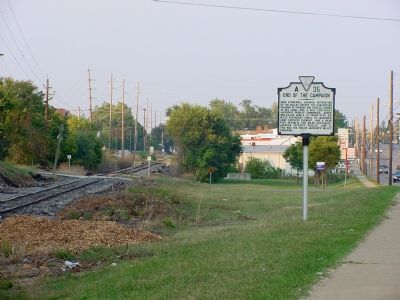
Photographed by J. J. Prats, September 25, 2007
2. End of the Campaign Marker
Related marker. Click here for another marker that is related to this marker. New Reaplacement Marker At This Location titled "End of the Shenandoah Valley Campaign."
Credits. This page was last revised on December 26, 2024. It was originally submitted on October 8, 2007, by J. J. Prats of Powell, Ohio. This page has been viewed 2,423 times since then and 41 times this year. Last updated on December 24, 2024, by Mark Parker of Hickory, North Carolina. Photos: 1, 2. submitted on October 8, 2007, by J. J. Prats of Powell, Ohio. • Bernard Fisher was the editor who published this page.
