
Near Melissa in Collin County, Texas — The American South (West South Central)
Brinlee Cemetery
Photographed by James Hulse, December 27, 2024
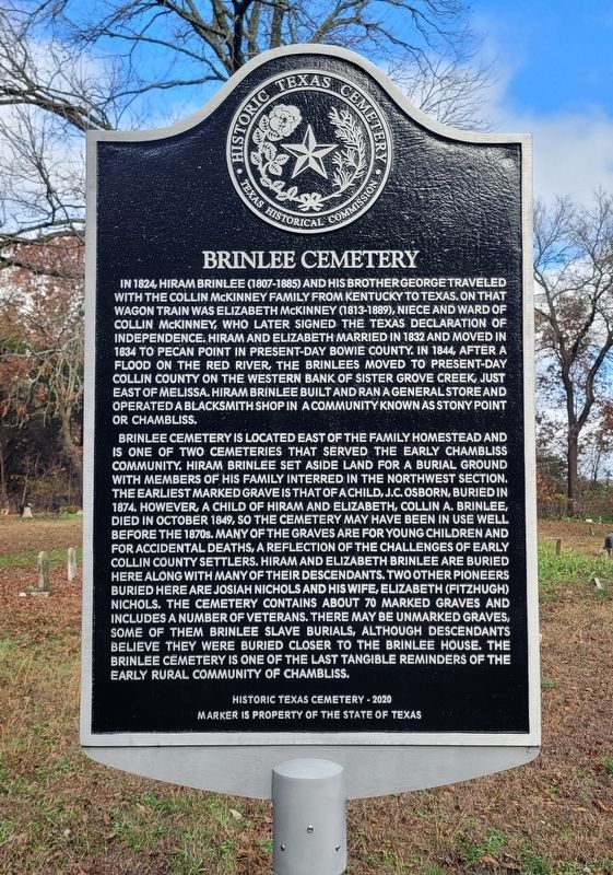
1. Brinlee Cemetery Marker
In 1824, Hiram Brinlee (1807-1885) and his brother George traveled with the Collin McKinney family from Kentucky to Texas. On that wagon train was Elizabeth McKinney (1813-1889), niece and ward of Collin McKinney, who later signed the Texas Declaration of Independence. Hiram and Elizabeth married in 1832 and moved in 1834 to Pecan Point in present-day Bowie County. In 1844, after a flood on the Red River, the Brinlees moved to present-day Collin County on the western bank of Sister Grove Creek, just east of Melissa. Hiram Brinlee built and ran a general store and operated a blacksmith shop in a community known as Stony Point or Chambliss.
Brinlee Cemetery is located east of the family homestead and is one of two cemeteries that served the early Chambliss community. Hiram Brinlee set aside land for a burial ground with members of his family interred in the northwest section. The earliest marked grave is that of a child, J.C. Osborn, buried in 1874. However, a child of Hiram and Elizabeth, Collin A. Brinlee, died in October 1849, so the cemetery may have been in use well before the 1870s. Many of the graves are for young
this page online
Erected 2020 by Texas Historical Commission. (Marker Number 22846.)
Topics. This historical marker is listed in these topic lists: Cemeteries & Burial Sites • Settlements & Settlers. A significant historical month for this entry is October 1849.
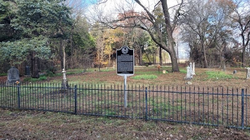
Location. 33° 18.237′ N, 96° 30.51′ W. Marker is near Melissa, Texas, in Collin County. It is on County Road 473 half a mile west of County Road 472, on the right when traveling west. The marker is located at the front of the cemetery. Touch for map. Marker is in this post
Photographed by James Hulse, December 27, 2024
2. Brinlee Cemetery Marker

Regionally, this marker is in the Prairies & Lakes Region and in the Dallas-Fort Worth Metropolitan Area. Globally, it is in North America, a Gulf of Mexico state, the Western Hemisphere, the Western World, and the Anglosphere. Historically, it finds itself in what was once New Spain, the Republic of Texas, one of the Confederate States of America, and the Antebellum South.
Other nearby markers. At least 8 other markers are within 4 miles of this marker, measured as the crow flies: Stony Point Church and Cemetery (approx. 1.1 miles away); Stiff Chapel Cemetery (approx. 3.2 miles away); Highland Cemetery (approx. 3.6 miles away); Corner Post of Uncle Charlie Wysong's Blacksmith Shop (approx. 3.6 miles away); First Baptist Church of Melissa (approx. 3.7 miles away); Public Education in Anna (approx. 3.7 miles away); Scott-Barker House (approx. 3.8 miles away); First Christian Church of Anna (approx. 3.8 miles away). Touch for a list and map of all markers in Melissa.
Photographed by James Hulse, December 27, 2024
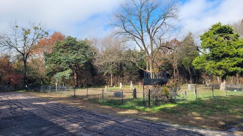
3. The view of the Brinlee Cemetery and Marker from the road
Credits. This page was last revised on July 21, 2025. It was originally submitted on December 28, 2024, by James Hulse of Medina, Texas. This page has been viewed 461 times since then and 75 times this year. Photos: 1, 2, 3. submitted on December 28, 2024, by James Hulse of Medina, Texas.
