Irving in Dallas County, Texas — The American South (West South Central)
Irving's First 'Water Tower'
Photographed by Morgan Petermann, December 20, 2024
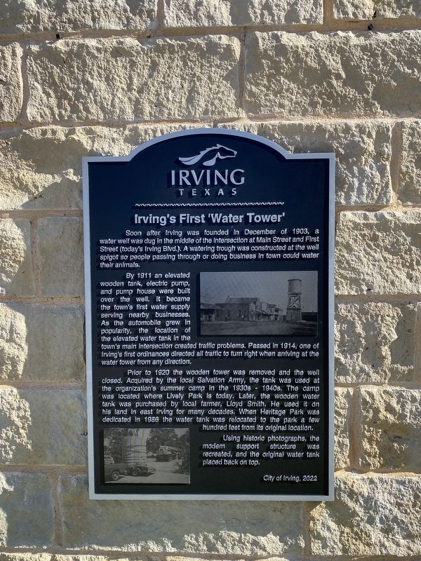
1. Irving's First 'Water Tower' Marker
By 1911 an elevated wooden tank, electric pump, and pump house were built over the well. It became the town's first water supply serving nearby businesses. As the automobile grew in popularity, the location of the elevated water tank in the town's main intersection created traffic problems. Passed in 1914, one of Irving's first ordinances directed all traffic to turn right when arriving at the water tower from any direction.
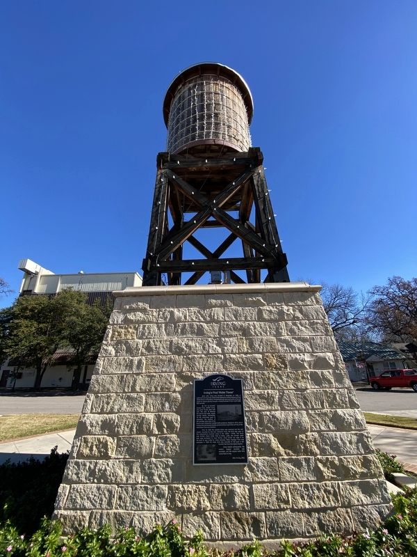
Prior to 1920 the wooden tower was removed and the well closed. Acquired by the local Salvation Army, the tank was used at the organization's summer camp in the 1930s - 1940s. The camp was located where Lively Park is today. Later, the wooden water tank was purchased by local farmer, Lloyd Smith. He used it on his land in east Irving for many decades. When Heritage Park was dedicated in 1986 the water
this page online
Using historic photographs, the modern support structure was recreated, and the original water tank placed back on top.
Erected 2022 by City of Irving.
Topics. This historical marker is listed in this topic list: Man-Made Features.
Location. 32° 48.738′ N, 96° 56.787′ W. Marker is in Irving, Texas, in Dallas County. It is at the intersection of South Main Street and West 2nd Street on South Main Street. Touch for map. Marker is at or near this postal address: 217 S Main St, Irving TX 75060, United States of America. Touch for directions.

Regionally, this marker is in the Prairies & Lakes Region and in the Dallas-Fort Worth Metropolitan Area. Globally, it is in North America, a Gulf of Mexico state, the Western Hemisphere, the Western World, and the Anglosphere. Historically, it finds itself in what was once New Spain, the Republic of Texas, one of the Confederate States of America, and the Antebellum South.
Other nearby markers. At least 8 other markers are within walking distance
Photographed by Morgan Petermann, December 20, 2024
2. Irving's First 'Water Tower' Marker
Credits. This page was last revised on December 31, 2024. It was originally submitted on December 30, 2024, by Morgan Petermann of Hurst, Texas. This page has been viewed 527 times since then and 120 times this year. Photos: 1, 2. submitted on December 30, 2024, by Morgan Petermann of Hurst, Texas. • James Hulse was the editor who published this page.
