Macon in Macon County, Missouri — The American Midwest (Upper Plains)
Macon
Photographed by Delbert Botes, July 4, 2024
1. Macon Marker
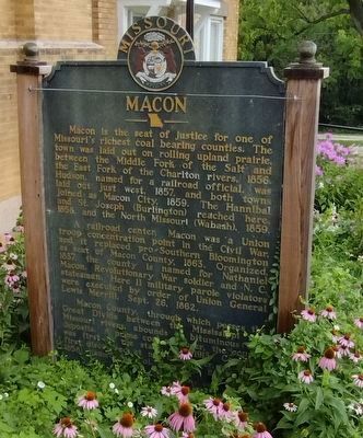
Macon is the seat of justice for one of Missouri's richest coal bearing counties. The town was laid out on rolling upland prairie, between the Middle Fork of the Salt and the East Fork of the Chariton rivers, 1856. Hudson, named for a railroad official, was laid out just west, 1857, and both towns joined as Macon City, 1859. The Hannibal and St. Joseph (Burlington) reached here, 1858, and the North Missouri (Wabash), 1859.
A railroad center, Macon was a Union troop concentration point in the Civil War, and it replaced pro-Southern Bloomington as seat of Macon County, 1863. Organized, 1837, the county is named for Nathaniel Macon, Revolutionary War soldier and N.C. statesman. Here 11 military parole violators were executed by order of Union General Lewis Merrill, Sept. 26, 1862.
Macon County, through which passes the Great Divide between the Mississippi and Missouri rivers, abounds in bituminous coal deposits. A prime coal producer, the county was first in the state, 1891-1913. Coal was first discovered at nearby Bevier, laid out, 1858, named for Col. Robert S. Bevier.
Reverse
this page online
Early schools established in Macon were Johnson College (Methodist), 1866; St. James Academy and St. Agnes Hall (Episcopal), 1875 and 1884; outstanding Blees Military Academy, 1899; and south at College Mound, noted McGee (Presbyterian) College, 1853. Blees Academy was sold, 1914, and is now the Still-Hildreth Osteopathic Sanatorium.
Macon owes much of its development to Col. F.W.V. Blees (1860-1906), Prussian-born educator, businessman, and philanthropist; and to Theodore Gary (1854-1952), utilities magnate, first chairman Mo. State Highway Commission, and town benefactor.
Erected 1955 by State Historical Society of Missouri and State Highway

Photographed by Cosmos Mariner, September 9, 2017
2. Macon Marker Reverse
Topics and series. This historical marker is listed in these topic lists: Indigenous Peoples and Communities • Industry & Commerce • Railroads & Streetcars • Settlements & Settlers. In addition, it is included in the Missouri, The State Historical Society of series list. A significant historical date for this entry is September 26, 1862.
Location. 39° 43.258′ N, 92° 28.032′ W. Marker is in Macon, Missouri, in Macon County. It can be reached from South Missouri Street (U.S. 63) west of County Park Drive (Lake View Drive), on the left when traveling north. Marker is located outside the Macon County Historical Society. Touch for map. Marker is at or near this postal address: 1402 South Missouri Street, Macon MO 63552, United States of America. Touch for directions.

Regionally, this marker is in North Missouri. It is also in the American Midwest, in the Lewis & Clark Corridor, and in the Corn Belt. Globally, it is in North America, the Western Hemisphere, the Western World, and the Anglosphere. Historically, it finds itself in what was once the territory of the Mississippian Culture, the Louisiana Purchase, and the

Photographed by Cosmos Mariner, September 9, 2017
3. Macon Marker Reverse
Other nearby markers. At least 8 other markers are within 6 miles of this marker, measured as the crow flies: Macon Sesquicentennial Time Capsule (approx. 1.3 miles away); Macon County World War II Memorial (approx. 1½ miles away); 3rd Courthouse in Macon County (approx. 1½ miles away); Macon County World War Memorial (approx. 1½ miles away); Macon Kiwanis U.S. Bi-Centennial Time Capsule (approx. 1½ miles away); Korean and Vietnam Wars Memorial (approx. 1½ miles away); Freedom Will Never Be Free (approx. 1½ miles away); Bevier & Southern Locomotive No. 112 (approx. 5½ miles away). Touch for a list and map of all markers in Macon.

Photographed by Delbert Botes, July 4, 2024
4. Macon Marker Reverse
Photographed by Delbert Botes, July 4, 2024
5. Macon Marker
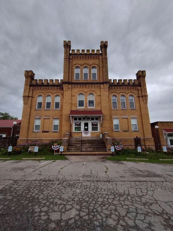
Macon Marker is located outside the Macon Historical Society.
Credits. This page was last revised on February 2, 2025. It was originally submitted on September 14, 2020, by Cosmos Mariner of Cape Canaveral, Florida. This page has been viewed 1,042 times since then and 107 times this year. Last updated on December 31, 2024, by Delbert Botes of Columbia, Missouri. Photos: 1. submitted on December 31, 2024, by Delbert Botes of Columbia, Missouri. 2. submitted on September 14, 2020, by Cosmos Mariner of Cape Canaveral, Florida. 3. submitted on September 15, 2020, by Cosmos Mariner of Cape Canaveral, Florida. 4, 5. submitted on December 31, 2024, by Delbert Botes of Columbia, Missouri. • J. Makali Bruton was the editor who published this page.
Editor’s want-list for this marker. photo of side 1 • Can you help?
