Newkirk in Kay County, Oklahoma — The American South (West South Central)
Cherokee Outlet... or Cherokee Strip?
Photographed by Cosmos Mariner, September 9, 2024
1. Cherokee Outlet... or Cherokee Strip? Marker
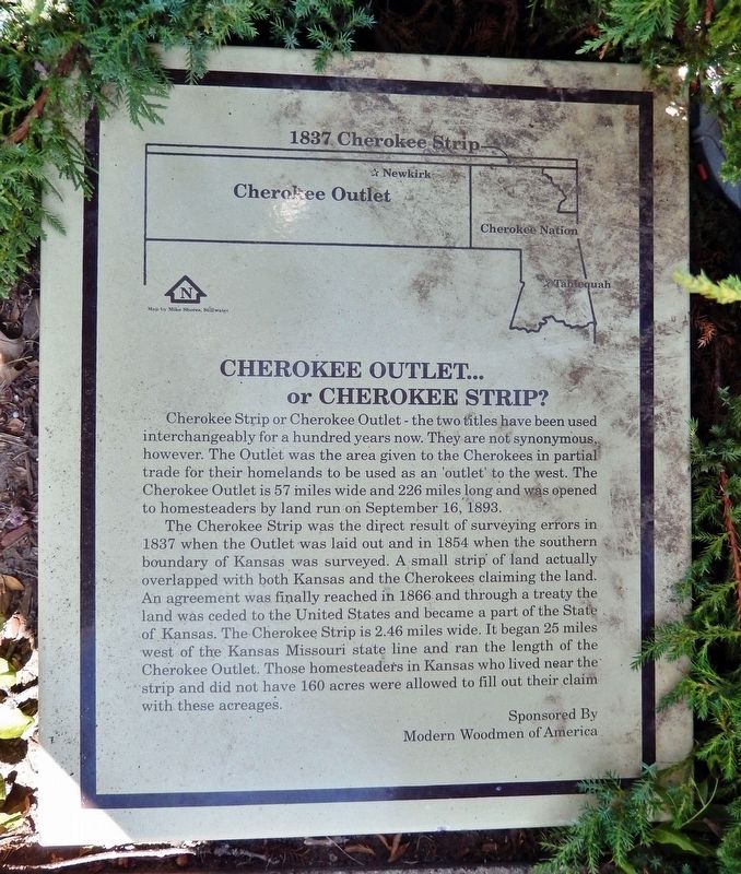
Cherokee Strip or Cherokee Outlet — the two titles have been used interchangeably for a hundred years now. They are not synonymous, however. The Outlet was the area given to the Cherokees in partial trade for their homelands to be used as an 'outlet' to the west. The Cherokee Outlet is 57 miles wide and 226 miles long and was opened to homesteaders by land run on September 16, 1893.
The Cherokee Strip was the direct result of surveying errors in 1837 when the Outlet was laid out and in 1854 when the southern boundary of Kansas was surveyed. A small strip of land actually overlapped with both Kansas and the Cherokees claiming the land. An agreement was finally reached in 1866 and through a treaty the land was ceded to the United States and became a part of the State of Kansas. The Cherokee Strip is 2.46 miles wide. It began 25 miles west of the Kansas Missouri state line and ran the length of the Cherokee Outlet. Those homesteaders in Kansas who lived near the strip and did not have 160 acres were allowed to fill out their claim with these acreages.
Erected by Modern Woodmen of America.
Topics. This historical
this page online
Location. 36° 52.94′ N, 97° 3.25′ W. Marker is in Newkirk, Oklahoma, in Kay County. It is on West 7th Street just west of South Main Street (U.S. 77), on the left when traveling west. The marker is mounted at ground level beside the sidewalk. Touch for map. Marker is at or near this postal address: 107 West 7th Street, Newkirk OK 74647, United States of America. Touch for directions.

Regionally, this marker is in the American South, specifically on the prairies, and on the Southern Plains. Globally, it is in North America, the Western Hemisphere, the Western World, and the Anglosphere. Historically, it finds itself in what was once the territory of the Mississippian Culture, the Louisiana Purchase, and Cherokee Outlet.
Other nearby markers. At least 8 other markers are within walking distance of this marker: Red Rose Garden Club (a few steps from this marker); City Hall & Opera House (a few steps from this marker); First National Bank (within shouting distance of this marker);
Photographed by Cosmos Mariner, September 9, 2024
2. Cherokee Outlet... or Cherokee Strip? Marker
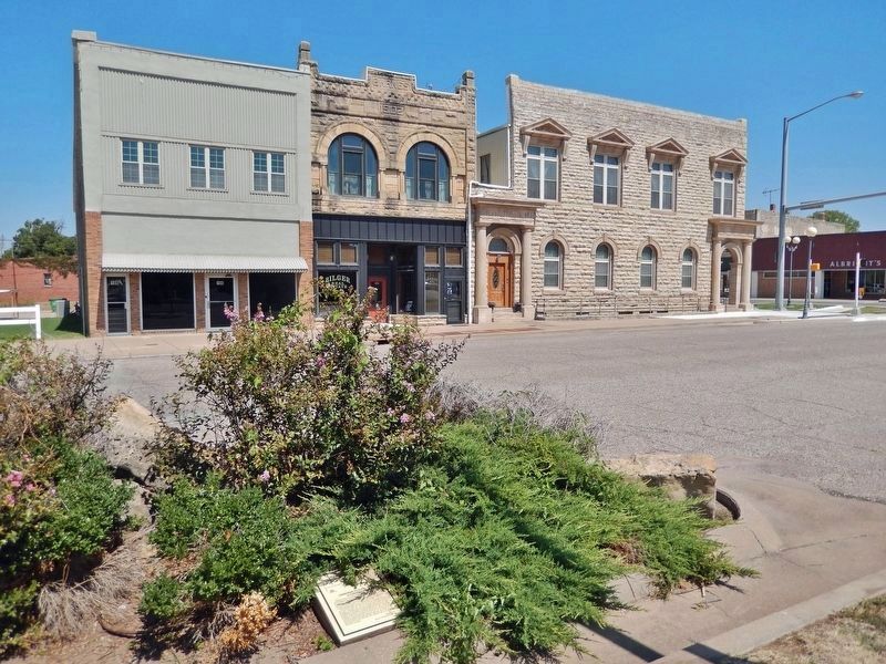
Looking northeast across West 7th Street; the marker is located within a concrete curbside planter box and may sometimes be obscured by vegetation.
More about this marker. The marker is located within a concrete curbside planter box and may sometimes be obscured by vegetation.
Also see . . . Cherokee Outlet (Wikipedia).
Excerpt: In 1836, the Treaty of New Echota between the Cherokees and the United States obligated the Cherokees to move west of the Mississippi River to lands assigned them in Indian Territory (later Oklahoma). Their new lands included a 7.0-million-acre reservation and "a perpetual outlet west...as far west as the sovereignty of the United States" extended. The parcel of land extending west from the Cherokee reservation became known as the Cherokee Outlet.(Submitted on December 31, 2024, by Cosmos Mariner of Cape Canaveral, Florida.)In 1889, Congress authorized the Cherokee Commission to persuade the Cherokee to cede their complete title to the Cherokee Outlet. After a great
amount of pressure, and confirmed by a treaty Congress approved March 17, 1893, the Cherokee agreed to turn title over to the United States government. On September 16, 1893, the eastern end of the Cherokee Outlet was settled in the Cherokee Strip land run, the largest land run in the United States and possibly the largest event of its kind in history.
Credits. This page was last revised on December 31, 2024. It was originally submitted on December 31, 2024, by Cosmos Mariner of Cape Canaveral, Florida. This page has been viewed 440 times since then and 61 times this year. Photos: 1, 2. submitted on December 31, 2024, by Cosmos Mariner of Cape Canaveral, Florida.
