Blowing Rock in Watauga County, North Carolina — The American South (South Atlantic)
Stoneman's Raid
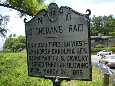
Photographed by Stanley and Terrie Howard, June 28, 2009
1. Stoneman's Raid Marker
Erected 1940 by Department of Conservation and Development. (Marker Number N-10.)
Topics and series. This historical marker is listed in this topic list: War, US Civil. In addition, it is included in the North Carolina Division of Archives and History series list. A significant historical date for this entry is March 28, 1865.
Location. This marker has been replaced by another marker nearby. It was located near 36° 7.24′ N, 81° 40.046′ W. Marker was in Blowing Rock, North Carolina, in Watauga County. It was on U.S. 321 south of Norwood Circle, on the right when traveling south. Touch for map. Marker was in this post office area: Blowing Rock NC 28605, United States of America. Touch for directions.

Regionally, this marker was in North Carolina’s and he Mountains in the High Country. It was also in the American South, specifically in the Upper South, in Appalachia, and specifically in Southern Appalachia. Globally, it was in North America, the Western Hemisphere, the Western World, and the Anglosphere.
this page online
Other nearby markers. At least 8 other markers are within walking distance of this location: Green Park-Norwood Golf Course (approx. 0.2 miles away); Emily Prudden (approx. ¼ mile away); The Blowing Rock (approx. 0.3 miles away); Green Park Hotel (approx. 0.4 miles away); Green Park Inn (approx. 0.4 miles away); Church of the Epiphany (approx. half a mile away); Maymont (approx. 0.6 miles away); Sunset Manor (approx. 0.6 miles away). Touch for a list and map of all markers in Blowing Rock.
More about this marker. This original N-10 marker was erected in Blowing Rock in 1940 to mark the 75th anniversary of Stoneman's Raid. This 1940 marker was removed by the state highway department during highway construction. A replacement marker cast in 2012 was erroneously erected 38 miles east of here in Roaring River, NC. Though the raiders did pass through both locations, the N-10 marker was recently relocated
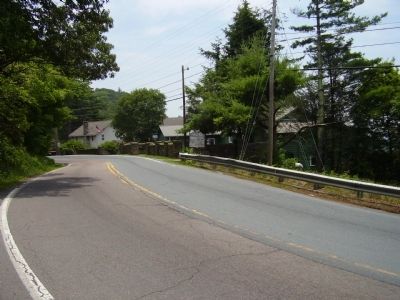
Photographed by Stanley and Terrie Howard, June 28, 2009
2. Stoneman's Raid Marker
Related markers. Click here for a list of markers that are related to this marker. Misplaced Replacement Marker & Relocated Marker Nearby also titled "Stoneman's Raid".
Also see . . . Marker finally finds its way home. The Stoneman Gazette (11/16/2015) (Submitted on August 29, 2016, by Michael C. Wilcox of Winston-Salem, North Carolina.)
Credits. This page was last revised on January 2, 2025. It was originally submitted on June 29, 2009, by Stanley and Terrie Howard of Greer, South Carolina. This page has been viewed 1,291 times since then and 21 times this year. Last updated on January 1, 2025, by Mark Parker of Hickory, North Carolina. Photos: 1, 2. submitted on June 29, 2009, by Stanley and Terrie Howard of Greer, South Carolina. • Bernard Fisher was the editor who published this page.
