Eatonton in Putnam County, Georgia — The American South (South Atlantic)
In Commemoration of The Old Union Church

Photographed by Mark Parker, December 27, 2024
1. In Commemoration of The Old Union Church Marker
Here in 1831 assembled the first state internal improvement convention composed of seventy-five representative citizens of thirty counties. Their resolutions, adopted almost immediately, resulted in the construction of railroads in which Georgia in 1836, led the world with 200 miles.
in 1864-65 this building was used as a hospital for wounded soldiers after the battles around Atlanta.
When all the organizations either withdrew or erected separate buildings, this historic structure was reluctantly removed in 1896.
Topics. This historical marker is listed in these topic lists: Railroads & Streetcars • Religion & Religious Structures • Settlements & Settlers • War, US Civil. A significant historical date for this entry is June 24, 1819.
Location. 33° 19.762′ N, 83° 23.578′ W. Marker is in Eatonton, Georgia, in Putnam County. It is on West Church Street
this page online

Regionally, this marker is in the Antebellum Trail and in the Piedmont. It is also in the American South and specifically in the Deep South. Globally, it is in North America, the Western Hemisphere, the Western World, and the Anglosphere. Historically, it finds itself in what was once the territory of the Mississippian Culture, one of the original Thirteen Colonies, one of the Confederate States of America, and the Antebellum South.
Other nearby markers. At least 8 other markers are within walking distance of this marker: The Shackleford-Adams-Folds-Marshall House (a few steps from this marker); Eatonton Presbyterian Church (about 300 feet away, measured in a direct line); Eatonton Male and Female Academy (about 300 feet away); Methodist Educational Building (about 500 feet away); First Methodist Church (about 600 feet away); Site of John C. Mason's Dwelling House (approx. 0.2 miles away); The Bronson House (approx.
Photographed by Mark Parker, December 27, 2024
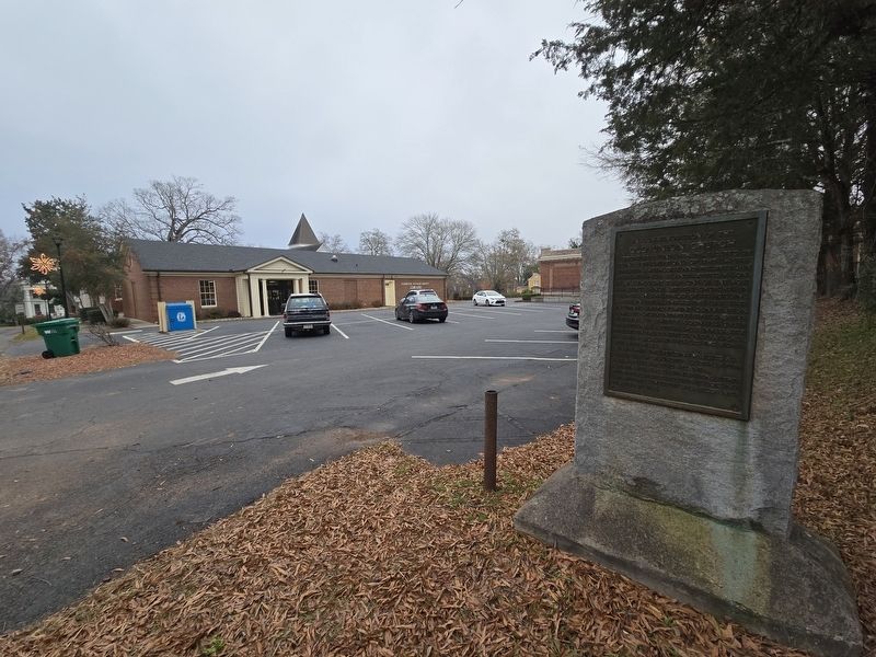
2. In Commemoration of The Old Union Church Marker
Across the parking lot is Eatonton-Putnam County Public Library. This was the site of the Old Union Church, mentioned in the marker.

Photographed by Mark Parker, December 27, 2024
3. In Commemoration of The Old Union Church Marker
Looking west along West Church Street. The Union Church cemetery is within the adjacent fence.
Credits. This page was last revised on January 4, 2025. It was originally submitted on January 3, 2025, by Mark Parker of Hickory, North Carolina. This page has been viewed 179 times since then and 27 times this year. Photos: 1, 2, 3. submitted on January 3, 2025, by Mark Parker of Hickory, North Carolina. • Bernard Fisher was the editor who published this page.
