Buckeye Furnace in Jackson County, Ohio — The American Midwest (Great Lakes)
Hanging Rock Region
Photographed by William Fischer, Jr., August 15, 2009
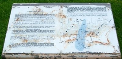
1. Hanging Rock Region Marker
Charcoal iron production in Ohio was centered in the Hanging Rock Region, a geographic area extending from Hocking County to the Ohio River and including portions of northern Kentucky. The region encompassed an 1800 square mile area that was rich in deposits of iron ore and limestone and was covered by a forest that supplied the raw material for charcoal. Union Furnace, built in 1826, was the first to be located in the Hanging Rock Region. By 1856, sixty-five furnaces were located in this region, and the Ohio furnaces alone produced 105,000 tons of pig iron that year.
Stimulated by a need for munitions during the Civil War, the demand for iron produced by the Hanging Rock charcoal furnaces increased. After the Civil War, however, the furnaces fell on hard times. By the beginning of the 20th century the once prosperous industry had all but disappeared.
The decline of the Hanging Rock charcoal furnaces was a result of several changes that swept across the American iron industry during the second half of the 19th century.
this page online
Photographed by William Fischer, Jr., August 15, 2009
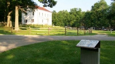
2. Hanging Rock Region Marker
The former company store (now a museum) is in background.
When Jefferson Furnace at Oak Hill closed on December 29, 1916, the last of Ohio's charcoal furnaces went out of operation. Furnaces decayed, equipment was scrapped and communities disbanded, leaving only the bleak stone furnace stacks as a reminder of these once thriving businesses.
Erected by the Ohio Historical Society.
Topics and series. This historical marker is listed in these topic lists: Industry & Commerce • Landmarks • Man-Made Features • Natural Resources • Settlements & Settlers. In addition, it is included in the Appalachian Iron Furnaces series list. A significant historical month for this entry is December 1892.
Location. This marker has been replaced by another marker nearby. It was located near 39° 3.297′ N, 82° 27.526′ W. Marker was in Buckeye Furnace, Ohio, in Jackson County. It was at the intersection of Buckeye Park Road (Local
Photographed by William Fischer, Jr., August 15, 2009
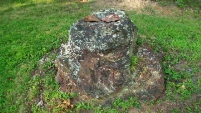
3. Iron Ore Outcropping at Buckeye Furnace Historical Site

Regionally, this marker was in Southern Ohio Hill Country. It was also in the American Midwest, in Appalachia, and specifically in Northern Appalachia. Globally, it was in North America, the Western Hemisphere, the Western World, and the Anglosphere. Historically, it found itself in what was once the Haudenosaunee (Iroquois) Confederacy, the territory of the Mississippian Culture, and the Northwest Territory.
Other nearby markers. At least 8 other markers are within walking distance of this location: A different marker also named Hanging Rock Region (here, next to this marker); Civil War (here, next to this marker); Buckeye Furnace (1851 - 1894) (within shouting distance of this marker); Buckeye Furnace Covered Bridge (within shouting distance of this marker); Scales (within shouting distance of this marker); Furnace Communities (within shouting distance of this marker); Casting (about 600 feet away, measured in a direct line); Bridge Loft/Charging House (about 700 feet away). Touch for a list and map of all markers in Buckeye Furnace.
Other markers no longer nearby. Buckeye Furnace (was within shouting distance of this marker but has been confirmed missing); a different marker also named Scales (was within shouting distance of this marker but has been replaced with another marker now near it).
Related marker. Click here for another marker that is related to this marker. This marker has been replaced by the linked marker.
Also see . . . Hanging Rock, Ohio Birthplace of the Iron Region. Village website entry (Submitted on February 25, 2022, by Larry Gertner of New York, New York.)
Credits. This page was last revised on February 25, 2022. It was originally submitted on January 14, 2010, by William Fischer, Jr. of Reynoldsburg, Ohio. This page has been viewed 1,706 times since then and 34 times this year. Photos: 1, 2, 3. submitted on January 14, 2010, by William Fischer, Jr. of Reynoldsburg, Ohio.
