Hot Springs in Garland County, Arkansas — The American South (West South Central)
Hot Springs National Park Rotary Club Centennial Mural
Photographed by Cosmos Mariner, September 13, 2024
1. Hot Springs National Park Rotary Club Centennial Mural Marker
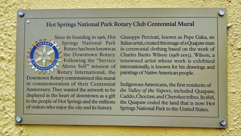
Since its founding in 1916, Hot Springs National Park Rotary has been known as the Downtown Rotary. Following the “Service Above Self” mission of Rotary International, the Downtown Rotary commissioned this mural in commemoration of their Centennial Anniversary. They wanted the artwork to be displayed in the heart of downtown as a gift to the people of Hot Springs and the millions of visitors who enjoy the city and its history.
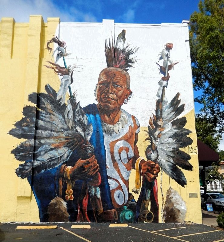
Giuseppe Percivati, known as Pepe Gaka, an Italian artist, created this image of a Quapaw man in ceremonial clothing based on the work of Charles Banks Wilson (1918-2013). Wilson, a renowned artist whose work is exhibited internationally, is known for his drawings and paintings of Native American people.
Indigenous Americans, the first residents of the Valley of the Vapors, included Quapaw, Caddo, Choctaw, and Cherokee tribes. In 1818, the Quapaw ceded the land that is now Hot Springs National Park to the United States.
Erected by Hot Springs National Park Rotary Club.
Topics and series. This historical marker is listed in these topic lists: Arts, Letters, Music • Charity & Public Work
this page online
Location. 34° 30.775′ N, 93° 3.251′ W. Marker is in Hot Springs, Arkansas, in Garland County. It is on Central Avenue (State Highway 7) 0.1 miles south of Mountain Street, on the right when traveling south. The mural spans the south facade of the building at this address. The marker is mounted at eye-level near the right/east edge of the mural (the southeast corner of the building) facing south. Touch for map. Marker is at or near this postal address: 424 Central Avenue, Hot Springs National Park AR 71901, United States of America. Touch for directions.

Regionally, this marker is in the Ouachita Mountains. It is also in the American South and specifically in the Upper South. Globally, it is in North America, the Western Hemisphere, the Western World, and the Anglosphere. Historically, it finds itself in what was once the territory of the Mississippian Culture, the Louisiana Purchase, one of the Confederate States of America,
Photographed by Cosmos Mariner, September 15, 2024
2. Hot Springs National Park Rotary Club Centennial Mural
The marker is mounted near the bottom right side of the mural.
Other nearby markers. At least 8 other markers are within walking distance of this marker: Hot Springs Flood of 1923 (a few steps from this marker); Horse Racing in Hot Springs (within shouting distance of this marker); Ozark Bathhouse (within shouting distance of this marker); The Flynn-Doran Battle (within shouting distance of this marker); Hot Springs' Major Fires (within shouting distance of this marker); Bathhouse Row (within shouting distance of this marker); Quapaw Bathhouse (within shouting distance of this marker); “We Bathe the World” (within shouting distance of this marker). Touch for a list and map of all markers in Hot Springs.
Also see . . . Quapaw Treaty of 1818 (stateoftheunionhistory.com).
Excerpt: William Clark of the famed Lewis and Clark expedition, now the governor of the Missouri territory was tasked with handling the affair. According to author Larry G. Johnson in his book Tar Creek, Clark used "extravagant entertainment and many gifts" to entice the Quapaw into signing a treaty on August 24, 1818. Johnson explained that "as important as the gifts and annuity were, the Quapaws believed they had finally received the recognition and status they deserved and had become a valuable ally of the United States". So, the tribe of the Quapaw Indians in exchange for full protection under the United States ceded 30 million acres of land on the north and south banks of the Arkansas river and along the east bank of the Mississippi river for $4,000 and $1,000 in annuities. This included all lands in Oklahoma and Arkansas except for a small section in the southwest corner of the Red River.(Submitted on January 9, 2025, by Cosmos Mariner of Cape Canaveral, Florida.)President Monroe in his 1818 State of the Union called the treaty one that was "obtained on conditions very satisfactory to the Indians." The Quapaw lands were just one of the treaties that removed the claims of Native Americans to very extensive lands in the territory purchased by the United States from France. The tribes were promised protection and continued hunting rights. That is until, it infringed on white settlers who were soon to come.
Credits. This page was last revised on January 9, 2025. It was originally submitted on January 8, 2025, by Cosmos Mariner of Cape Canaveral, Florida. This page has been viewed 128 times since then and 19 times this year. Photos: 1, 2. submitted on January 8, 2025, by Cosmos Mariner of Cape Canaveral, Florida.
