
Historische Binnenstad in Dordrecht, South Holland, Netherlands — Northwestern Europe
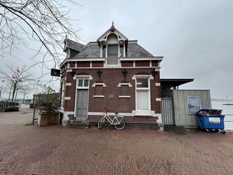
Veerhuis
Photographed by Steve Stoessel, December 14, 2024
1. Veerhuis Marker
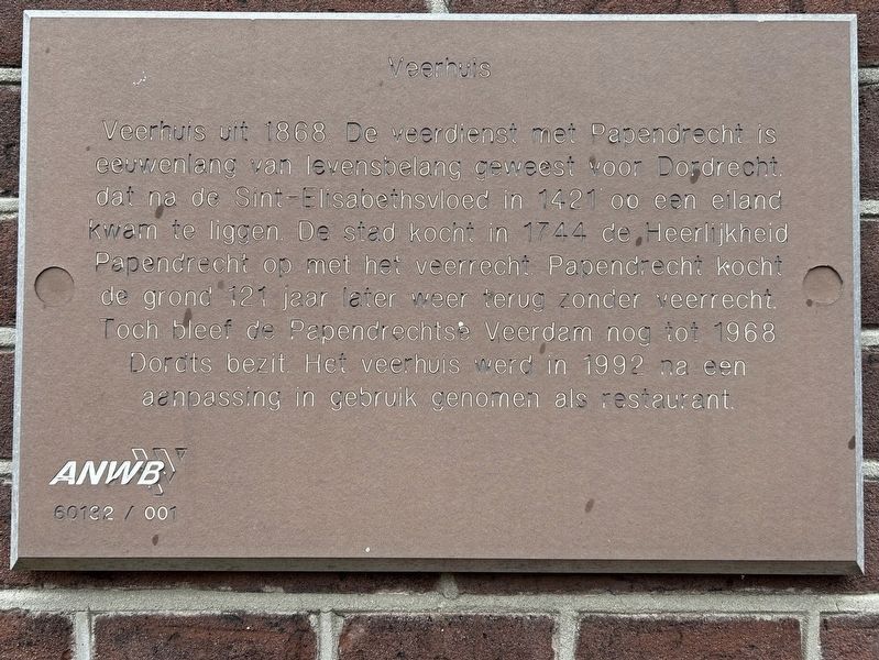
Veerhuis uit 1868 De veerdienst met Papendrecht is eeuwenlang van levensbelang geweest voor Dordrecht. dat na de Sint-Elisabethsvloed in 1421 oo een eiland kwam te liggen. De stad kocht in 1744 de Heerlijkheid Papendrecht op met het veerrecht Papendrecht kocht de grond 121 jaar later weer terug zonder veerrecht. Toch bleef de Papendrechtse Veerdam nog tot 1968 Dordts bezit. Het veerhuis werd in 1992 na een aanpassing in gebruik genomen als restaurant.
Ferry house from 1868 The ferry service with Papendrecht has been of vital importance to Dordrecht for centuries. After the St. Elizabeth's flood in 1421, Papendrecht came to lie on an island. The city bought the Lordship of Papendrecht in 1744 with the ferry right. Papendrecht bought the land back 121 years later without the ferry right. The Papendrecht ferry remained in Dordrecht's possession until 1968. The ferry house was put into use as a restaurant in 1992 after an adjustment.
Erected by anwb.
Topics. This historical marker is listed in this topic list: Waterways & Vessels. A significant historical year for this entry is 1868.
Location. 51° 49.129′ N, 4° 40.532′ E.
this page online

Regionally, it is in Europe, the European Union, Atlantic Europe, the Benelux Low Countries, the Schengen Area, Western Europe, and the Western World. Historically, it finds itself in what was once the Roman Empire and specifically also the Holy Roman Empire.
Other nearby markers. At least 8 other markers are within walking distance of this marker: Hoe dichter bij Dordt....hoe gewiekster het wordt (within shouting distance of this marker); Schuttevaerkade (approx. 0.2 kilometers away); Groothoofdspoort (approx. 0.4 kilometers away); De Kyck over den Dyck (approx. 0.4 kilometers away); Doelesteijn (approx. half a kilometer away); Gerechtsgebouw (approx. half a kilometer away); Damiatebrug (approx. half a kilometer away); Varend Erfgoed / Floating Heritage (approx. 0.6 kilometers away). Touch for a list and map of all
Photographed by Steve Stoessel, December 14, 2024
2. Veerhuis Marker
Also see . . . St. Elizabeth's Flood (1421) (Wikipedia). (Submitted on January 15, 2025, by Steve Stoessel of Niskayuna, New York.)
Credits. This page was last revised on January 15, 2025. It was originally submitted on January 14, 2025, by Steve Stoessel of Niskayuna, New York. This page has been viewed 81 times since then and 9 times this year. Photos: 1, 2. submitted on January 14, 2025, by Steve Stoessel of Niskayuna, New York.
