
Elmhurst in DuPage County, Illinois — The American Midwest (Great Lakes)
Elmhurst and Salt Creek: History at a Glance

Photographed by Sean P. Flynn, January 15, 2025
1. Elmhurst and Salt Creek: History at a Glance Marker
"In 1842 Gerry Bates arrived from Ohio and staked claim to a treeless tract of land in what became the center of Elmhurst, the land along Salt Creek already having been occupied."
"Elmhurst," Margaret Franson Pruter in DuPage Roots, Richard A. Thompson, ed.
Since Elmhurst's founding, increasing population, development and industry meant roads and buildings replaced open land. Engineers modified Salt Creek, changing its natural channel and flood plain. As Elmhurst grew along the creek, flooding became a significant threat to homes and businesses.
Elmhurst built extensive municipal sewers to move waste and stormwater to treatment facilities along Salt Creek.
• 1834 Elisha Fish settles in York Township
• 1843 Gerry Bates builds Hill Cottage Tavern, a travelers inn
• 1860 Population reaches 200
• 1890 Population is 1,050
• 1893 First municipal sewer installed, discharges directly into Salt Creek
• 1910 First municipal sewage treatment plant built, population 2360
• 1930 Population grows to 14,055
• 1960s & 1970s Salt Creek extensively modified and straightened
• 1968 Dedicated storm sewer built, separating
this page online
• 1987 9.5" of rain in 24 hours cause massive flooding throughout Chicagoland
• 1989 DuPage County Stormwater Management Plan enacted
• 1992 Elmhurst levee system built, DuPage county purchases Elmhurst Quarry
• 1993 Elmhurst Quarry Flood Control facility opens
• 2000 Population is 42,762
• 2008 Storms swell Salt Creek but floodwaters divert into the Elmhurst Quarry
In heavy rains Salt Creek threatens to overflow its banks. Fortunately recent flood control measures, including reservoirs and levees, keep Salt Creek contained.
Flood Prevention: Reservoirs
DuPage County built several reservoirs throughout the Salt Creek basin, mostly north of Elmhurst. Opened in 1993, the Elmhurst Quarry Flood Control Facility, a former limestone quarry, diverts creek water into a reservoir. It holds nearly 2,705,560,000 gallons and is one of the largest non-Federal flood-control reservoirs in the United States.
Flood Prevention: Levees
Since 1992, a series of levees has protected southwest Elmhurst from Salt Creek flooding. This system extends from St. Charles Road south to Butterfield Road and, when combined with

Photographed by Sean P. Flynn, January 15, 2025
2. Elmhurst and Salt Creek: History at a Glance Marker
Salt Creek runs right to left just behind the marker. Beyond that is Elmhurst's wastewater treatment plant, one of the aspects of the city's water management that is discussed on this marker.
[Caption beneath photo in upper right:]
In the early 1900s, Salt Creek was a great place to swim. Today, it's surrounded by developed land.
Erected by City of Elmhurst.
Topics. This historical marker is listed in these topic lists: Settlements & Settlers • Waterways & Vessels. A significant historical year for this entry is 1834.
Location. 41° 52.871′ N, 87° 57.496′ W. Marker is in Elmhurst, Illinois, in DuPage County. It is on Rex Boulevard near Crescent Avenue. The marker is on the southern edge of Sleepy Hollow Park, alongside a trail that overlooks Salt Creek. Touch for map. Marker is at or near this postal address: 610 South Rex Boulevard, Elmhurst IL 60126, United States of America. Touch for directions.

Regionally, this marker is in Greater Chicago. It is also in the American Midwest and on the Great Lakes. Globally, it is in North America, the Western Hemisphere, the Western World, and the Anglosphere. Historically, it finds itself in what was once the territory of the Mississippian Culture and also the Northwest Territory.
Other nearby markers. At
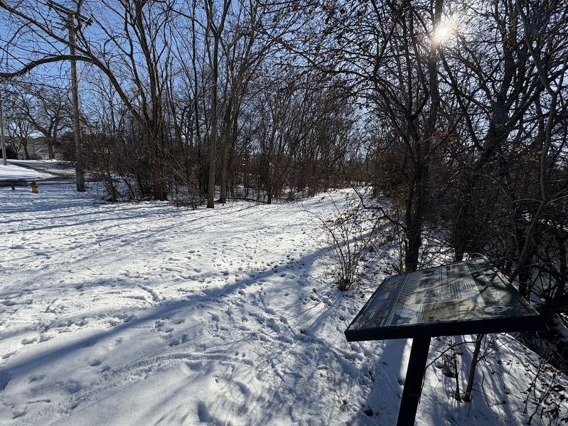
Photographed by Sean P. Flynn, January 15, 2025
3. Elmhurst and Salt Creek: History at a Glance Marker
Salt Creek runs on the right side in this south-facing photo.
More about this marker. The Elmhurst Water Reclamation Facility, one of the elements of Elmhurst's water management that is discussed on this marker, is visible just across Salt Creek from this marker.
Also see . . .
1. Elmhurst Park District: Sleepy Hollow Park.

Photographed by Sean P. Flynn, January 15, 2025
4. Sleepy Hollow Park
The Elmhurst and Salt Creek marker is in the background on the left.
Excerpt: "The land is owned by the City of Elmhurst and is leased to the Park District. A contest was held to name the park in March 1975, and a fourth grade student at Visitation School submitted the winning name."(Submitted on January 15, 2025, by Sean P. Flynn of Oak Park, Illinois.)
2. Encyclopedia of Chicago: Elmhurst, IL.
Excerpt: "York Township's early residents came mainly from New York or Europe to live along Salt Creek; Germans, such as Frederick Graue, settled in the north near the Elmhurst-Addison boundary, and those of predominantly English ancestry resided in the south near today's Butterfield Road. The village remained bilingual for decades."(Submitted on January 15, 2025, by Sean P. Flynn of Oak Park, Illinois.)
3. Elmhurst Wastewater Treatment Facility virtual tour. (Submitted on January 15, 2025, by Sean P. Flynn of Oak Park, Illinois.)
Credits. This page was last revised on September 18, 2025. It was originally submitted on January 15, 2025, by Sean P. Flynn of Oak Park, Illinois. This page has been viewed 56,067 times since then and 120 times this year. Photos: 1, 2, 3, 4. submitted on January 15, 2025, by Sean P. Flynn of Oak Park, Illinois.
