Waynesville in Warren County, Ohio — The American Midwest (Great Lakes)
John Evans House
Photographed by William Fischer, Jr., December 6, 2009
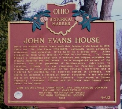
1. John Evans House Marker
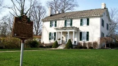
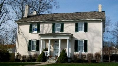
David and Rachel Burnet Evans built this Federal style house in 1836. Their son, Dr. John Evans (1814-1897), nationally known physician, statesman, and educator, lived here as a young man. After graduating from Lynn Medical College in Cincinnati, Dr. Evans became a prominent physician in Indiana and helped establish the Indiana Hospital for the Insane. He is recognized as one of the founders and first president of Northwestern University in Evanston, Illinois. He was appointed by President Abraham Lincoln as the first governor of the Colorado Territory and is credited for developing the railroad system in Colorado. His desire to institute a system of higher education in the territory led to the founding of Colorado Seminary, later known as Denver University. Evanston, Illinois and Mt. Evans near Denver were named in his honor.
Erected 2002 by Ohio Bicentennial Commission, The Longaberger Company, Village of Waynesville Historic Preservation Board, and The Ohio Historical Society. (Marker Number 4-83.)
Topics and series. This historical marker is listed in these topic lists: Charity & Public Work • Education
this page online
Location. 39° 31.931′ N, 84° 5.079′ W. Marker is in Waynesville, Ohio, in Warren County. It is on Main Street, on the left when traveling north. Marker is on Main Street between Chapman and Mill Streets. Touch for map. Marker is at or near this postal address: 129 North Main Street, Waynesville OH 45068, United States of America. Touch for directions.

Regionally, this marker is in Greater Cincinnati and in the Miami Valley. It is also in the American Midwest and in the Corn Belt. Globally, it is in North America, the Western Hemisphere, the Western World, and the Anglosphere. Historically, it finds itself in what was once the Haudenosaunee (Iroquois) Confederacy, the territory of the Mississippian Culture, and the Northwest Territory.
Other nearby markers. At least 8 other markers are within 5 miles of this marker, measured as the crow flies: The Lockup (about 300 feet away, measured in a direct line); Mary's Ghost (approx.
Photographed by William Fischer, Jr., December 6, 2009
2. John Evans House and Marker
Also see . . . John Evans. Colorado State Archives (Submitted on January 15, 2010, by William Fischer, Jr. of Reynoldsburg, Ohio.)
Photographed by William Fischer, Jr., December 6, 2009
3. John Evans House
Credits. This page was last revised on October 14, 2023. It was originally submitted on January 15, 2010, by William Fischer, Jr. of Reynoldsburg, Ohio. This page has been viewed 2,777 times since then and 138 times this year. Photos: 1, 2, 3. submitted on January 15, 2010, by William Fischer, Jr. of Reynoldsburg, Ohio.
