Historisch centrum in Antwerpen, Flanders, Belgium — Northwestern Europe
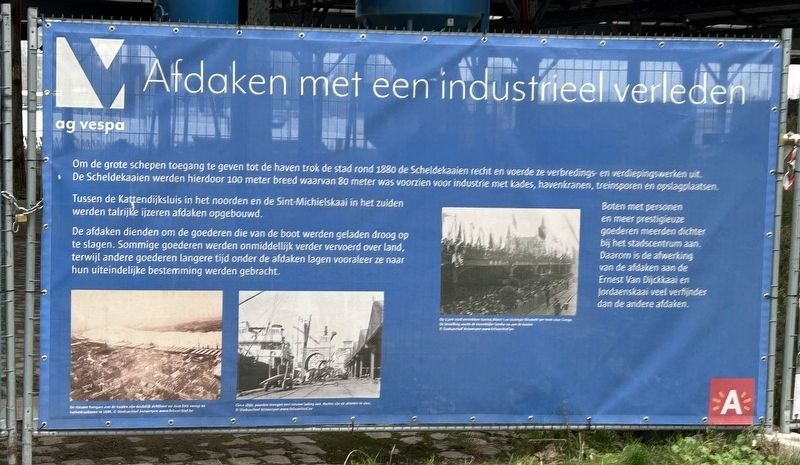
Afdaken met een industrieel verle den
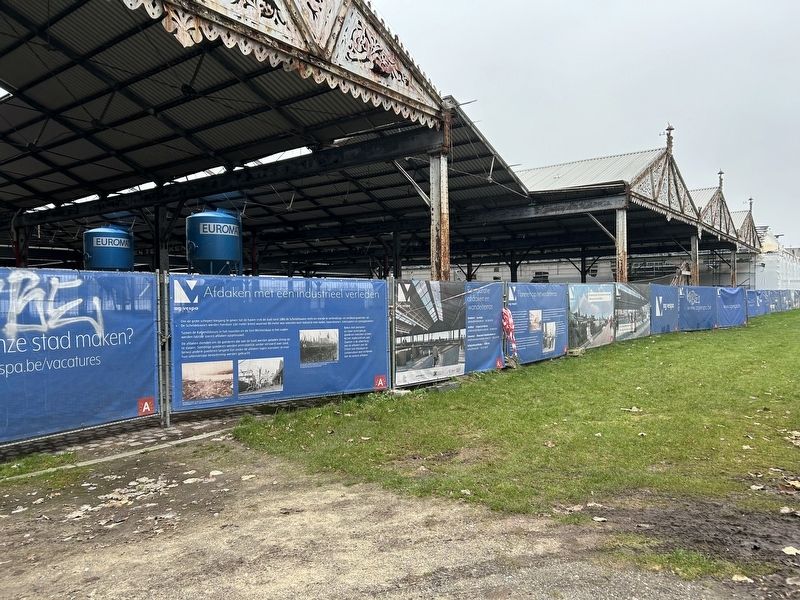
Canopies with an industrial past
Photographed by Steve Stoessel, December 13, 2024
1. Afdaken met een industrieel verle den Marker
Om de grote schepen toegang te geven tot de haven trok de stad rond 1880 de Scheldekesien recht en veesde ze verbredings en verdiepingswerken uit. De Scheldekaaien werden hierdoor 100 meter breed waarvan 20 meter was voorzien woor industrie met kedes, kavenkranen, treinsporen en uplegplaatsen
Tussen de Kattendijksluis in het noorden en de Sint-Michielskaai in het zuiden werden talrijke ijzeren afdaken opgebouwd.
De afdaken dienden om de goederen die van de boot werden geladen droog op te slagen. Sommige goederen werden onmiddellifk verder vervoerd over land, terwijl andere goederen langere tijd onder de afdaken lagen vooraleer ze naar hun uiteindelifke bestemming werden gebracht.
Boten met personen en mees prestigieuze goederen meesden dictiter bij het stadscentrum zan. Daarom is de afwerking vean de aldeken zen de Ernest Van Difckszai en Jordzenskani vsel verffinder dan de andere afdaken.
In order to give large ships access to the harbour, the city straightened the Scheldt quays around 1880 and carried out widening and deepening works. This made the Scheldt quays 100 metres wide, of which 20 metres was
this page online
Numerous iron shelters were built between the Kattendijk lock in the north and the Sint-Michielskaai in the south.
The shelters served to store the goods that were unloaded from the boat dry. Some goods were immediately transported further over land, while other goods were stored under the shelters for a longer period of time before being taken to their final destination.
Boats with people and mostly prestigious goods often stopped near the city centre. That is why the finishing of the alcoves is more subtle than the other canopies.
Topics. This historical marker is listed in this topic list: Waterways & Vessels. A significant historical year for this entry is 1880.
Location. 51° 13.385′ N, 4° 23.883′ E. Marker is in Antwerpen, Vlaanderen (Flanders). It is in Historisch centrum. It is on Jordaenskaai north of Steenplein, on the right when traveling south. Touch for map. Marker is in this post office area: Antwerpen, Vlaanderen 2000, Belgium. Touch for directions.

Regionally, it is in Europe, the European Union, Atlantic Europe, the Benelux Low

Photographed by Steve Stoessel, December 13, 2024
2. Afdaken met een industrieel verle den Marker
Other nearby markers. At least 8 other markers are within walking distance of this marker: Het Steen (about 90 meters away, measured in a direct line); Semini (about 90 meters away); “Onze Woning” (about 90 meters away); Vleeshuis / Das Fleischhaus / La Halle des Bouchers / Butchers’ Hall (about 120 meters away); De Legende van Lange Wapper (about 120 meters away); Willem Ogier (about 150 meters away); Ruihuis (about 210 meters away); Ernest van Dyck (approx. 0.3 kilometers away). Touch for a list and map of all markers in Antwerpen.
Also see . . .
1. Bierwerf. (Submitted on January 19, 2025, by Steve Stoessel of Niskayuna, New York.)
2. Canopies 18A-19B. (Submitted on January 19, 2025, by Steve Stoessel of Niskayuna, New York.)
3. Restoration of Hangars. (Submitted on January 19, 2025, by Steve Stoessel of Niskayuna, New York.)
Photographed by Steve Stoessel, December 13, 2024
3. Afdaken met een industrieel verle den Marker
Credits. This page was last revised on January 22, 2025. It was originally submitted on January 19, 2025, by Steve Stoessel of Niskayuna, New York. This page has been viewed 96 times since then and 15 times this year. Photos: 1, 2, 3. submitted on January 19, 2025, by Steve Stoessel of Niskayuna, New York.
