Near Little Falls in Herkimer County, New York — The American Northeast (Mid-Atlantic)
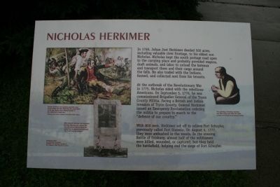
Nicholas Herkimer
Photographed by Dale K. Benington, June 12, 2012
1. Nicholas Herkimer Marker
At the outbreak of the Revolutionary War in 1775, Nicholas sided with the rebellious Americans. On September 5, 1776, he was commissioned Brigadier General of the Tryon County Militia. Facing a British and Indian invasion of Tryon County, General Herkimer issued an Emergency Proclamation ordering the militia to prepare to march to the "defence of our country."
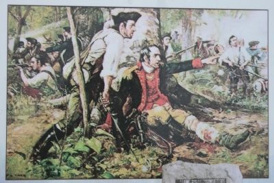
With 800 men, Herkimer set off to relieve Fort Schuyler, previously called Fort Stanwix. On August 6, 1777, they were ambushed in the woods. In the ensuing Battle of Oriskany, almost half of the militiamen were killed, wounded, or captured, but they held the battlefield, helping end the siege of Fort Schuyler.
Topics. This historical marker is listed in these topic lists: Indigenous Peoples and Communities
this page online
Location. 43° 1.644′ N, 74° 49.023′ W. Marker is near Little Falls, New York, in Herkimer County. It can be reached from New York State Route 169 east of General Herkimer Road. This historic marker is located in the Herkimer Home State Park, at the eastern edge of the parking lot, where the footpath that leads to the park visitor center and the Herkimer Homestead begins. Touch for map. Marker is at or near this postal address: 200 State Route 169, Little Falls NY 13365, United States of America. Touch for directions.

Regionally, this marker is in Upstate New York and in the Mohawk Valley. It is also in the American Northeast and in the Mid-Atlantic. Globally, it is in North America, the Great North Woods, the Western Hemisphere, the Western World, and the Anglosphere. Historically, it finds itself in what was once the Haudenosaunee (Iroquois) Confederacy, New Netherland, and one of the original Thirteen Colonies.
Other nearby markers. At least 8 other markers are within walking distance of this marker: In Memory of the Men (a few steps from this
Photographed by Dale K. Benington, June 12, 2012
2. Nicholas Herkimer Marker
A close-up view of the picture of the wounded General Herkimer at the Battle of Oriskany that is displayed on the historical marker.
Also see . . .
1. Herkimer Home State Historic Site. This is a link to information provided by Wikipedia, the free encyclopedia. (Submitted on June 15, 2013, by Dale K. Benington of Toledo, Ohio.)
2. Herkimer Home. This is a link to information provided by the "Revolutionary Day" website. (Submitted on June 15, 2013, by Dale K. Benington of Toledo, Ohio.)
Photographed by Dale K. Benington, June 12, 2012
3. Nicholas Herkimer Marker
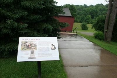
View of the historical marker along the walkway leading to the park's visitor center.
Photographed by Dale K. Benington, June 12, 2012
4. Nicholas Herkimer Marker
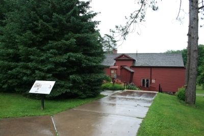
A more distant view of the historical marker along the walkway leading to the park's visitor center.
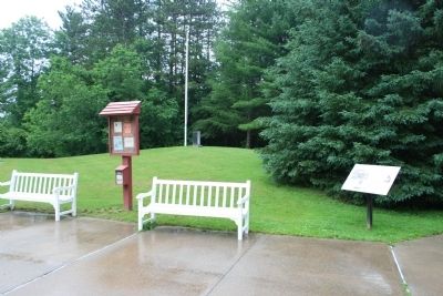
Photographed by Dale K. Benington, June 12, 2012
5. Nicholas Herkimer Marker
View of the historical marker in the right foreground and in the center background, the park's flagpole and a General Herkimer, 40 Mile March, Monument.
Credits. This page was last revised on September 4, 2025. It was originally submitted on June 15, 2013, by Dale K. Benington of Toledo, Ohio. This page has been viewed 803 times since then and 51 times this year. Last updated on January 22, 2025, by Carl Gordon Moore Jr. of North East, Maryland. Photos: 1, 2, 3, 4, 5. submitted on June 15, 2013, by Dale K. Benington of Toledo, Ohio. • Michael Herrick was the editor who published this page.
