Flemington in Polk County, Missouri — The American Midwest (Upper Plains)
Yoast Station
1858
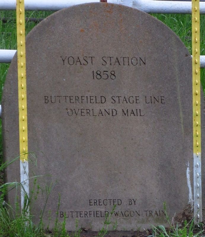
Photographed by Brent Hugh, May 3, 2019
1. Yoast Station 1858 Marker
Erected by Butterfield Wagon Train.
Topics and series. This historical marker is listed in these topic lists: Communications • Roads & Vehicles. In addition, it is included in the Butterfield Overland Mail series list. A significant historical year for this entry is 1858.
Location. 37° 49.417′ N, 93° 25.834′ W. Marker is in Flemington, Missouri, in Polk County. It is at the intersection of State Highway 83 and County Road 340, on the right when traveling south on State Highway 83. The marker stands in the grass along a white fence with wagon wheels on the northwest corner of the crossroads. Though the marker is just a few feet from the road, often the grass grows tall enough to obscure the marker and you may need to look sharp or tramp through the weeds a bit to spot it. Touch for map. Marker is at or near this postal address: 27012 MO-83, Flemington MO 65650, United States of America. Touch for directions.

Regionally, this marker is in South-Central Missouri and in Greater Springfield. It is also in the American Ozarks, in the Lewis & Clark Corridor, and in the Corn Belt.
this page online
Other nearby markers. At least 7 other markers are within 13 miles of this marker, measured as the crow flies: Butterfield Overland Mail in Missouri 1858-1861 (approx. 2 miles away); Veterans Memorial (approx. 7.6 miles away); John Whitaker (approx. 7.7 miles away); Weaubleau Christian Institute and College (approx. 7.7 miles away); Hickory County War Memorial (approx. 10.2 miles away); Hickory County (approx. 10.3 miles away); Butterfield Overland Mail Route - 1858-1861 (approx. 13 miles away).
More about this marker. This is similar to the series of stone markers erected in the 1920s by the Drywood Threshers Association of Sheldon, Missouri, to commemorate the Butterfield Stage Overland Mail route. However, this marker was erected by Butterfield Wagon Train, a local group that has been active in preserving the trail, its history, and historic artifacts.
Additional keywords. National
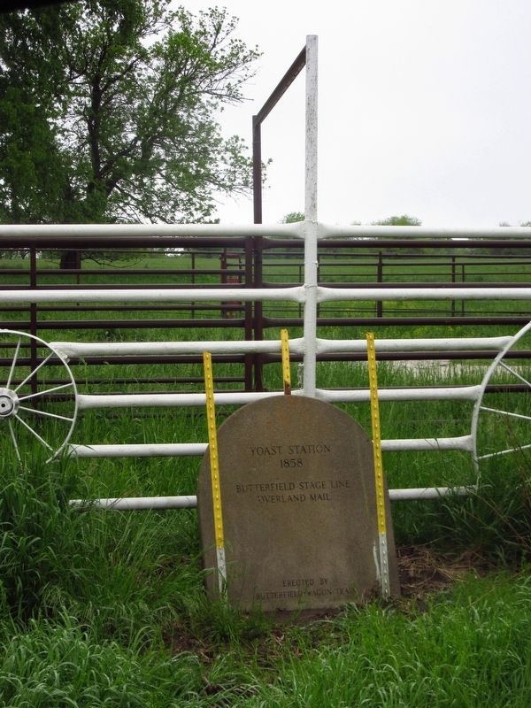
Photographed by Brent Hugh, May 3, 2019
2. Yoast Station 1858 Marker
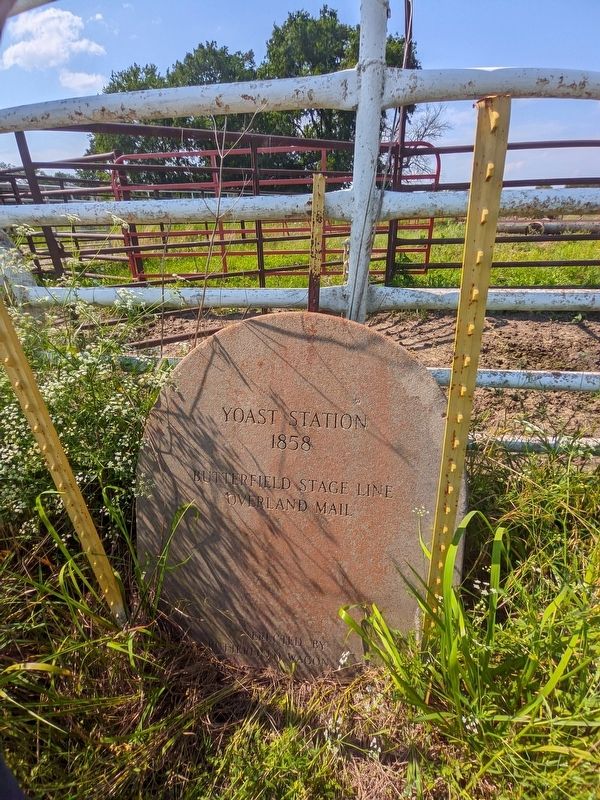
Photographed by Brent Hugh, June 16, 2024
3. Yoast Station 1858 Marker
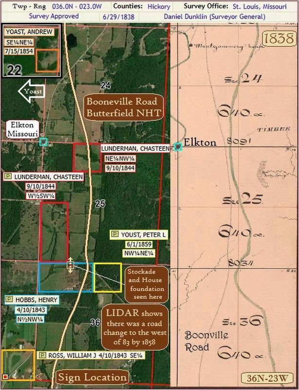
Photographed by Gregory William Wadley, August 2, 2026
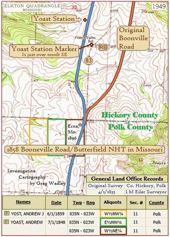
4. Area of the Old Boonville Road at Elkton with land ownership
Photographed by Gregory William Wadley, August 1, 2026
5. Location of Yoast Station
Credits. This page was last revised on August 3, 2026. It was originally submitted on January 24, 2025, by Brent Hugh of Raytown, Missouri. This page has been viewed 267 times since then and 78 times this year. Photos: 1, 2, 3. submitted on January 24, 2025, by Brent Hugh of Raytown, Missouri. 4, 5. submitted on August 2, 2026, by Gregory William Wadley of Fremont Hills, Missouri. • Devry Becker Jones was the editor who published this page.
