Verdun in Meuse, Alsace, Lorraine, Champagne-Ardenne, France — Western Europe
Porte Saint-Paul
XIXe siècle
Photographed by Steve Stoessel, November 18, 2024
1. Porte Saint-Paul Marker

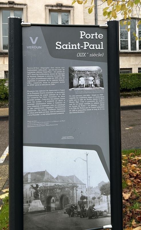
Aujourd'hui dégagée des murs qui l'entouraient, cette porte - qui tire son nom de l'ancienne abbaye Saint-Paul - fut percée en 1877 dans les fortifications datant de l'époque de Vauban. Destinée à rattacher le centre-ville à la gare nouvellement créée en 1870, elle fut implantée à proximité de la caserne Jeanne-d'Arc, construite dans la première moitié du XVIII siècle et détruite en 1939.
Plusieurs fois menacé de destruction à l'issue de la Première Guerre mondiale, ce monument emblématique du passé militaire de la ville fut conservé en l'état. Constitué de deux grandes arches - l'une pour les entrées, l'autre pour les sorties -, il présente un décor à bossage relativement sobre à l'intérieur et plus complexe à l'extérieur, avec un crénelage et des mâchicoulis rappelant l'architecture médiévale. On notera d'ailleurs l'existence de deux pont-levis en bois, dont le mécanisme « à la Poncelet » a été intégralement préservé.
Du côté extérieur, une stèle - érigée en 1929 - rappelle les nombreux sièges et destructions subis par la ville de Verdun depuis le Haut Moyen Âge. C'est à proximité de celle-ci que fut un temps installée la célèbre statue en bronze de Rodin « La Défense », offerte à la Ville de Verdun par le Comité hollandais en 1920 et aujourd'hui située le long de la rue des Frères-Boulhaut.
Threatened with destruction several times after the First World War, this emblematic monument of the city's military past was
this page online
On the outside, a stele - erected in 1929 - recalls the many sieges and destructions suffered by the city of Verdun since the Early Middle Ages. It was near this that Rodin's famous bronze statue "La Défense" was once installed, donated to the City of Verdun by the Dutch Committee in 1920 and today located along the Rue des Frères-Boulhaut.
[Photo Captions]
La Porte Saint-Paul encore incluse dans les murailles
Bibliothèque du Grand Verdun, Album Photos 15 (No. 4),
The Porte Saint-Paul still included in the walls.
Bibliothèque du Grand Verdun, Photo Album 15 (No. 4),
Photo en bas :
La Porte Saint-Paul at le monument « La Défense » de Rodin durant la Seconde Guerre mondiale
Bibliothèque du Grand Verdun, Album Photos 4 (No. 6)
Photo below:
The Porte Saint-Paul and the monument "La Defense" by Rodin during the Second World War
Bibliothèque du Grand Verdun, Photo Album 4 (No. 6)
Erected by Ville
Photographed by Steve Stoessel, November 18, 2024
2. Porte Saint-Paul Marker
Topics. This historical marker is listed in these topic lists: Forts and Castles • Roads & Vehicles • Settlements & Settlers. A significant historical year for this entry is 1877.
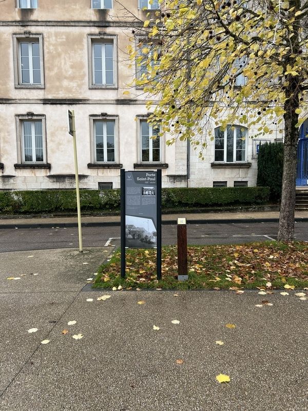
Location. 49° 9.834′ N, 5° 23.074′ E. Marker is in Verdun, Grand Est (Alsace, Lorraine, Champagne-Ardenne), in Meuse. It is on Place Saint-Paul south of Place Vauban when traveling south. Touch for map. Marker is at or near this postal address: 5 Pl Saint-Paul, Verdun, Grand Est 55100, France. Touch for directions.

Regionally, it is in the North Atlantic Region, Europe, the European Union, Atlantic Europe, the Schengen Area, Western Europe, a coastal Mediterranean country, and the Western World. Historically, it finds itself in what was once a French colony, the Roman Empire, and specifically the Holy Roman Empire.
Other nearby markers. At least 8 other markers are within walking distance of this marker: Verdun (within shouting distance of this marker); Victor Schleiter (about 90 meters away, measured in a direct line); Ancienne abbaye Saint-Paul (about 120 meters away); « Honneur et Reconnaissance aux Femmes des Territoires » (about 120 meters away); The Defense (about 150 meters away); Chapel Saint Nicolas/Chapelle Saint-Nicolas (about 180 meters away); St. Nicolas Chapel / Chapelle Saint-Nicholas (about 180 meters away); Le 166eme Régiment d'Infanterie (approx. 0.3 kilometers away). Touch for a list and map of all markers in Verdun.
Credits. This page was last revised on February 3, 2025. It was originally submitted on January 25, 2025, by Steve Stoessel of Niskayuna, New York. This page has been viewed 134 times since then and 14 times this year. Photos: 1, 2. submitted on January 25, 2025, by Steve Stoessel of Niskayuna, New York.
