Downtown Austin in Travis County, Texas — The American South (West South Central)
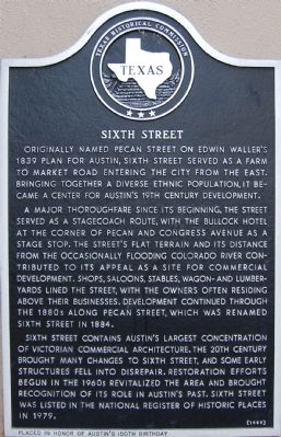
Sixth Street
Originally named Pecan Street on Edwin Wallerís 1839 plan for Austin, Sixth Street served as a farm to market road entering the city from the east. Bringing together a diverse ethnic population, it became a center for Austinís 19th century development.
A major thoroughfare since its beginning, the street served as a stagecoach route, with the Bullock Hotel at the corner of Pecan and Congress Avenue as a stage stop. The streetís flat terrain and its distance from the occasionally flooding Colorado River contributed to its appeal as a site for commercial development. Shops, saloons, stables, wagon and lumberyards lined the street, with the owners often residing above their businesses. Development continued through the 1880s along Pecan Street, which was renamed Sixth Street in 1884.
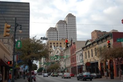
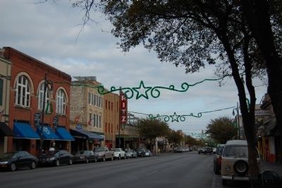
Sixth Street contains Austinís largest concentration of Victorian commercial architecture. The 20th century brought many changes to Sixth Street, and some early structures fell into disrepair. Restoration efforts begun in the 1960s revitalized the area and brought recognition of its role in Austinís past. Sixth Street was listed in the National Register of Historic Places in 1979.
Erected 1989 by Texas Historical Commission. (Marker Number 15449.)
Topics. This historical marker is listed in this topic list: Roads & Vehicles. A significant historical year for this entry is 1839.
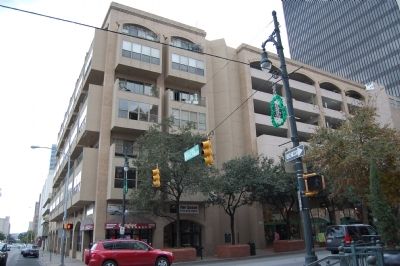
Location. 30° 16.063′ N, 97° 44.499′ W. Marker is in Austin, Texas, in Travis County. It is in Downtown Austin. Marker is on 6th Street west of Brazos Street when traveling east. Touch for map. Marker is at or near this postal address: 115 E 6th Street, Austin TX 78701, United States of America. Touch for directions.
Other nearby markers. At least 8 other markers are within walking distance of this marker. Site of John Bremond & Company (a few steps from this marker); Driskill Hotel (within shouting distance of this marker); Littlefield Building (within shouting distance of this marker); Hotel Provident and Heierman Building (about 300 feet away, measured in a direct line); Scarbrough Building (about 400 feet away); Angelina Eberly Statue (about 500 feet away); Stephen F. Austin Hotel (about 500 feet away); Platt-Simpson Building (about 600 feet away). Touch for a list and map of all markers in Austin.
Credits. This page was last revised on February 1, 2023. It was originally submitted on January 17, 2010, by Keith Peterson of Cedar Park, Texas. This page has been viewed 860 times since then and 50 times this year. Photos: 1, 2, 3, 4. submitted on January 17, 2010, by Keith Peterson of Cedar Park, Texas. • Bill Pfingsten was the editor who published this page.


