Upper Sandusky in Wyandot County, Ohio — The American Midwest (Great Lakes)
Wyandott Indian Mission
First Methodist Mission in America
| — | United Methodist Church Registered Historic Landmark | — |
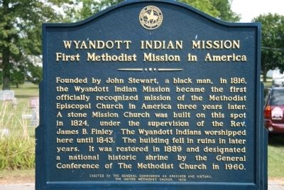
Photographed by Dale K. Benington, August 6, 2008
1. Wyandott Indian Mission Marker
Erected 1974 by The General Commission on Archives and History, The United Methodist Church.
Topics and series. This historical marker is listed in these topic lists: Indigenous Peoples and Communities • Religion & Religious Structures. In addition, it is included in the United Methodist Church Historic Sites series list. A significant historical year for this entry is 1816.
Location. 40° 50.136′ N, 83° 16.722′ W. Marker is in Upper Sandusky, Ohio, in Wyandot County. It is at the intersection of East Church Street and North 4th Street, on the left when traveling east on East Church Street. To view this historic marker,
this page online

Regionally, this marker is in the Till Plains. It is also in the American Midwest and in the Corn Belt. Globally, it is in North America, the Western Hemisphere, the Western World, and the Anglosphere. Historically, it finds itself in what was once the Viceroyalty of New France, the Haudenosaunee (Iroquois) Confederacy, the territory of the Mississippian Culture, and the Northwest Territory.
Other nearby markers. At least 8 other markers are within walking distance of this marker: The Wyandot Removal Trail / Upper Sandusky (July 11, 1843)
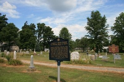
Photographed by Dale K. Benington, August 6, 2008
2. Wyandott Indian Mission Marker
View of historical marker in the foreground with Ohio Historical Marker for the "Departing Wyandot Indians" in the right background and the Missionary Church in the distant left background.
Another marker is no longer nearby. Departure of the Wyandot Indians (was within shouting distance of this marker but has been permanently removed).
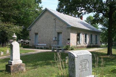
Photographed by Dale K. Benington, August 6, 2008
3. Wyandott Indian Mission
View of the Wyandott Indian Mission.
Credits. This page was last revised on August 19, 2023. It was originally submitted on January 17, 2010, by Dale K. Benington of Toledo, Ohio. This page has been viewed 1,619 times since then and 45 times this year. Photos: 1, 2, 3. submitted on January 17, 2010, by Dale K. Benington of Toledo, Ohio.
