Ripa in Roma in Città metropolitana di Roma Capitale, Latium, Rome, Italy — Central Italy (Tyrrhenian Coast)
Area Sacra di S. Omobono
⎯⎯⎯
S. Omobono Sanctuary
Photographed by James Hulse, March 5, 2024
1. Area Sacra di S. Omobono / S. Omobono Sanctuary Marker

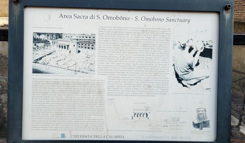
L'area sacra di S. Omobono si trova nei pressi dell'antico porto fluviale sul Tevere, che sin dalle epoche più antiche favoriva i commerci della città di Roma. Un complesso di edifici di culto fu individuato in questa zona fin dagli anni Trenta del secolo scorso, quando l'area fu salvaguardata dalle attività edilizie per merito dell'archeologo A.M. Colini. Nei successivi cinquanta anni, una serie di scavi portò in luce i resti di almeno quattro distinte fasi principali di costruzione e ricostruzione di due grandi templi affiancati e dedicati a Fortuna e Mater Matuta, databili fra il VI secolo a. C. ed il II secolo d.C. Nel periodo più antico, è attestato un solo tempio di dimensioni minori (oggi non visibile), ma che ha restituito spettacolari terrecotte architettoniche che ne adornavano il tetto. Fra queste, il gruppo di Ercole e Minerva ora visibile nei Musei Capitolini faceva riferimento ad un culto, quello di Ercole, ben rappresentato in quest'area e particolarmente caro ai mercanti di tutto il Mediterraneo in età arcaica. Agli inizi della Repubblica (V-IV secolo a. C.), l'area sacra fu completamente
this page online
Molti problemi interpretativi e cronologici non sono mai stati risolti definitivamente dagli scavi precedenti, che hanno raggiunto i livelli più profondi solo su superfici molto ristrette. L'area, inoltre, presenta cospicui problemi di conservazione, soprattutto per quanto riguarda i tufi, particolarmente soggetti a degrado
Photographed by James Hulse, March 5, 2024
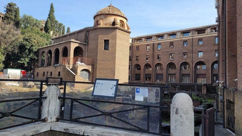
2. The view of the S. Omobono Sanctuary archaeological site and Marker
Didascalie
(Foto #1) Gli scavi di Colini degli Anni Trenta del secolo scorso
(Foto #2) Sezione ricostruttiva con le diverse fasi
(Foto #3) Campagna di scavo 2010
(Foto #4) Statua in terracotta di età arcaica
The ancient sanctuary at S. Omobono overlooked the river harbor on the Tiber, through which Rome traded overseas since its beginnings. In the 1930s, when the area was spared from development through the action of the archaeologist A. M. Colini, a cultic compound was brought to light and repeatedly explored over the following 50 years. The results show two major temples placed side-by-side and dedicated to the goddesses Fortuna and Mater Matuta. Between the 6th century BCE and the 2nd century CE, the temples were built and rebuilt four times. In the earliest phase, remains of only one
Photographed by James Hulse, March 5, 2024
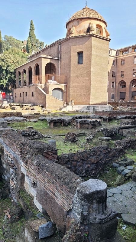
3. The View of the archaeological area with the S. Omobono Church in the background
The excavations carried out so far have left open a number of problems of interpretation and chronology, in part because the deeper levels have only been reached in very small trenches. There are also serious conservation issues, especially in connection with the parts in tufo, which are extremely vulnerable to weathering. Since 2009, a new program of research, excavation, restoration and presentation to the public of this unique monument has been undertaken by the Heritage Office of the City of Rome, with the collaboration of the University of Calabria and the University of Michigan.
Captions
(Photo #1) View of Colini's excavations to the 1930s
(Photo #2) Cross-section showing the main phases
(Photo #3) The 2010 excavation season
(Photo #4) Archaic terracotta statue
Erected by Universita'
Photographed by James Hulse, March 5, 2024
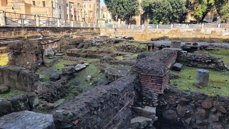
4. A view at the archaeological site
Topics. This historical marker is listed in these topic lists: Anthropology & Archaeology • Religion & Religious Structures. A significant historical year for this entry is 396 BCE.
Location. 41° 53.422′ N, 12° 28.857′ E. Marker is in Roma, Lazio (Latium, Rome), in Città metropolitana di Roma Capitale. It is in Ripa. It is on Via Luigi Petroselli just south of Vicus Jugarius, on the right when traveling north. The marker is located along the southwest corner of the archaeological site at the fence. Touch for map. Marker is at or near this postal address: Via Luigi Petroselli 45, Roma, Lazio 00186, Italy. Touch for directions.

Regionally, it is in Europe, the European Union, the Schengen Area, a coastal Mediterranean country, and the Western World. Historically, it finds itself in what was once the Roman Empire.
Other nearby markers. At least 8 other markers are within walking distance of this marker: Vacanze Romane / Roman Holiday (about 210 meters away, measured in a direct line); Teatro di Marcello / Marcellus Theater (about 210 meters away); Area del teatro di Marcello / Area of the Theater of Marcellus (about 210 meters away); Chiesa di San Giorgio al Velabro / Church of Saint George at the Velabrum (about 210 meters away); Ripa (about 210 meters away); Tempio di Apollo Sesiano Tempio di Bellona / Temple of Apollo Sesiano Temple of Bellona (approx. 0.2 kilometers away); Bernardino Bolasco (approx. 0.2 kilometers away); In ricordo dei neonati / In Memory of the Infants (approx. 0.3 kilometers away). Touch for a list and map of all markers in Roma.
Also see . . . Sant'Omobono Area. Wikipedia
The Sant'Omobono Area is an archaeological site in Rome next to the church of Sant'Omobono, at the junction of via L. Petroselli and the Vico Jugario at the foot of the Campidoglio. It was discovered in 1937 and contains much important evidence for archaic and republican Rome. It contains altars and the sites of the temple of Fortuna and the temple of Mater Matuta. An earlier archaic-period temple underlies these two, dating itself to the early 6th century BCE, making it the oldest known temple remains in Rome.(Submitted on February 1, 2025, by James Hulse of Medina, Texas.)
Credits. This page was last revised on February 1, 2025. It was originally submitted on January 30, 2025, by James Hulse of Medina, Texas. This page has been viewed 173 times since then and 25 times this year. Photos: 1, 2, 3, 4. submitted on February 1, 2025, by James Hulse of Medina, Texas.
