Langemark in West-Vlaanderen, Flanders, Belgium — Northwestern Europe
Duitse Militaire Begraafplaats
German Military Cemetery
Photographed by Steve Stoessel, November 12, 2024
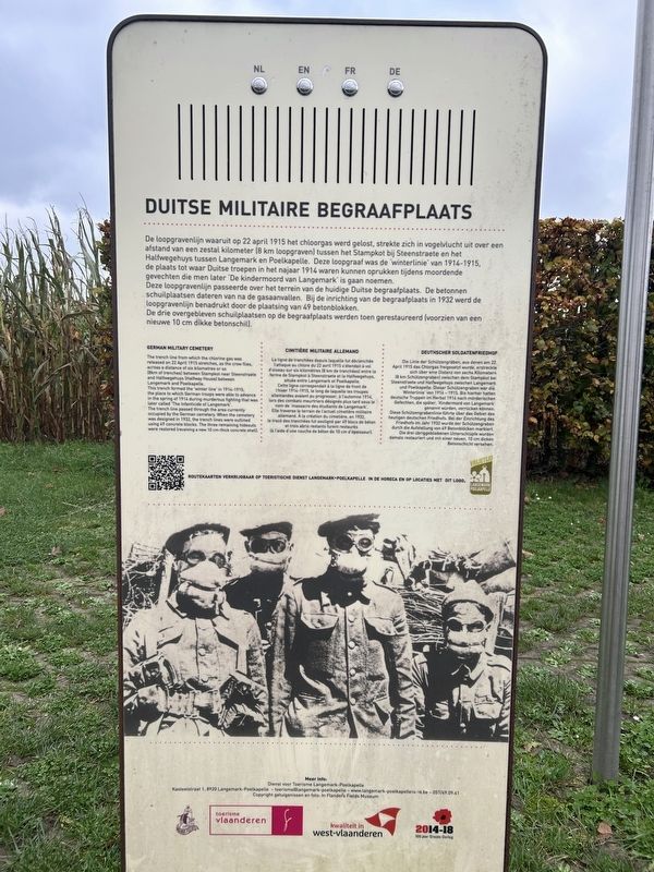
1. Duitse Militaire Begraafplaats Marker

Duitse Militaire Begraafplaats
De loopgravenlijn waaruit op 22 april 1915 het chloorgas werd gelost, strekte zich in vogelvlucht uit over een afstand van een zestal kilometer (8 km loopgraven) tussen het Stampkot bij Steenstraete en het Halfwegehuys tussen Langemark en Poelkapelle. Deze loopgraaf was de winterlinie van 1914-1915, de plaats tot waar Duitse tropen in het najaar 1914 waren kunnen oprukken tijdens moordende gevechten die men later 'De kindermoord van Langemark' is gaan noemen.
Deze loopgravenlijn passeerde over het terrein van de huidige Duitse begraafplaats. De betonnen schuilplaatsen dateren van na de gasaanvallen. Bij de inrichting van de begraafplaats in 1932 werd de loopgravenlijn benadrukt door de plaatsing van 49 betonblokken.
De drie overgebleven schuilplaatsen op de begraafplaats werden toen gerestaureerd (voorzien van een nieuwe 10 cm dikke betonschil).
The trench line from which the chlorine gas was released on 22 April 1915 stretches, as the crow flies, across a distance of six kilometres or so (8km of trenches) between Stampkot near Steenstraete and Halfwegehuys
this page online
La ligne de tranchées depuis laquelle fut déclenchée l'attaque au chlore du 22 avril 1915 s'étendait à vol d'oiseau sur six kilomètres (8 km de tranchées) entre la ferme de Stampkot à Steenstraete et la Halfwegehuys, située entre Langemark et Poelkapelle. Cette ligne correspondait à la ligne de front de C'hiver 1914-1915, le long de laquelle les troupes allemandes avaient pu progresser, à l'automne 1914, lors des combats meurtriers désignés plus tard sous le nom de massacre des étudiants de Langemark Elle traverse le terrain de l'actuel cimetière militaire allemand. À la création du
Photographed by Steve Stoessel, November 12, 2024
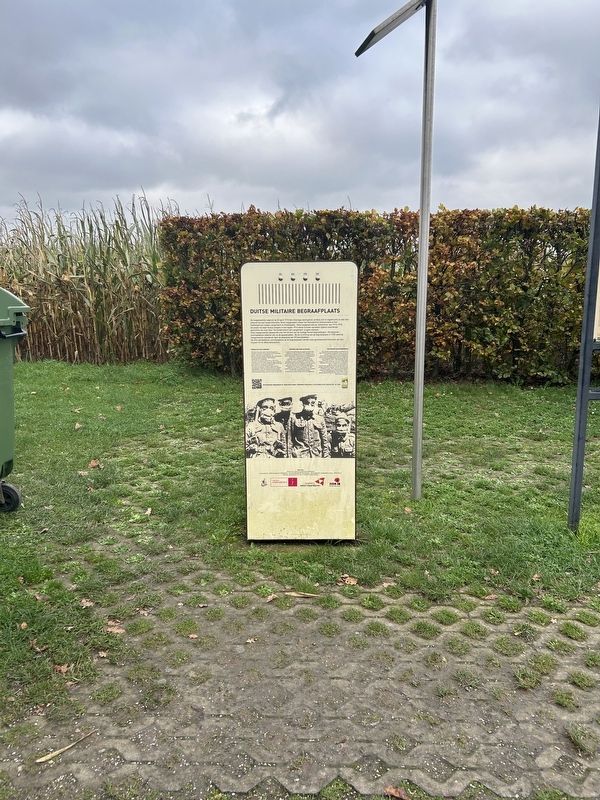
2. Duitse Militaire Begraafplaats Marker
Die Linie der Schützengräben, aus denen am 22 April 1915 das Chlorgas freigesetzt wurde, erstreckte sich über eine Distanz von sechs Kilometern (8 km Schützengraben) zwischen dem Stampkot bei Steenstraete und Halfwegehuys zwischen Langemark und Poelkapelle. Dieser Schützengraben war die. Winterlinie von 1914 - 1915. Bis hierher hatten deutsche Truppen im Herbst 1914 nach mörderischen Gefechten, die später, "Kindermord von Langemark' genannt wurden, vorrücken können. Diese Schützengrabenlinie führte über das Gebiet des heutigen deutschen Friedhofs. Bei der Einrichtung des Friedhofs im Jahr 1932 wurde der Schützengraben durch die Aufstellung von 49 Betonblöcken markiert. Die drei übriggebliebenen Unterschlüpfe wurden damals restauriert und mit einer neuen, 10 cm dicken Betonschicht versehen.
Topics. This historical marker is listed in these topic lists: Cemeteries & Burial Sites • War, World I. A significant historical date for this entry is April 22, 1915.
Location. 50° 55.298′ N, 2° 55′ E. Marker is near Langemark, Vlaanderen (Flanders), in West-Vlaanderen. It can be reached from Klerkenstraat south of Beekstraat. Touch for map. Marker is at or near this postal address: Klerkenstraat 8920, Langemark, Vlaanderen 8920, Belgium. Touch for directions.

Regionally, it is in Europe, the European Union, Atlantic Europe, the Benelux Low Countries, the Schengen Area, Western Europe, and the Western World. Historically, it finds itself in what was once the Roman Empire and specifically also the Holy Roman Empire.
Other nearby markers. At least 8 other markers are within 3 kilometers of this marker, measured as the crow flies: Langemark German Cemetery (here, next to this marker); Peacemonument (within shouting distance of this marker); Langemark (within shouting distance of this marker); Langemark German Military Cemetery (about 150 meters away, measured in a direct line); Guynemer (approx. 2.8 kilometers away); a different marker also named Guynemer (approx. 2.9 kilometers away); Tank Memorial Ypres Salient (approx. 2.9 kilometers away); Tank Memorial (approx. 2.9 kilometers away). Touch for a list and map of all markers in Langemark.
Also see . . .
1. Second Battle of Ypres (Wikipedia). (Submitted on February 1, 2025, by Steve Stoessel of Niskayuna, New York.)
2. First Battle of Ypres (Wikipedia). (Submitted on February 1, 2025, by Steve Stoessel of Niskayuna, New York.)
3. Massacre of the Innocents (History Net). (Submitted on February 1, 2025, by Steve Stoessel of Niskayuna, New York.)
4. The Great War Project. (Submitted on February 1, 2025, by Steve Stoessel of Niskayuna, New York.)
Credits. This page was last revised on February 2, 2025. It was originally submitted on February 1, 2025, by Steve Stoessel of Niskayuna, New York. This page has been viewed 135 times since then and 14 times this year. Photos: 1, 2. submitted on February 1, 2025, by Steve Stoessel of Niskayuna, New York.
