
Alva in Woods County, Oklahoma — The American South (West South Central)
Statehood Day
| — | Alva Mural Society | — |
Photographed by Cosmos Mariner, September 8, 2024
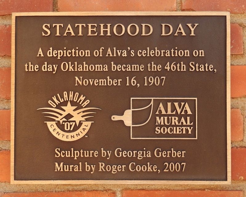
1. Statehood Day Marker
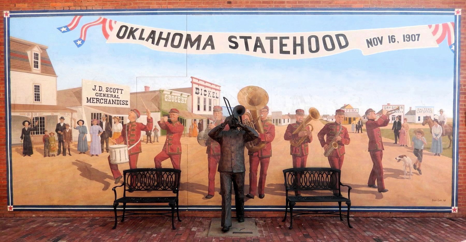
A depiction of Alva’s celebration on the day Oklahoma became the 46th State, November 16, 1907
Mural by Roger Cooke, 2007
Erected 2007 by Alva Mural Society. (Marker Number 18.)
Topics. This historical marker is listed in this topic list: Notable Events. A significant historical date for this entry is November 16, 1907.
Location. 36° 48.273′ N, 98° 39.804′ W. Marker is in Alva, Oklahoma, in Woods County. It is on 4th Street just south of Flynn Street, on the left when traveling south. The marker and mural are located on the north facade of the building at this location, near the northwest corner. Touch for map. Marker is at or near this postal address: 402 4th Street, Alva OK 73717, United States of America. Touch for directions.

Regionally, this marker is in the American South, specifically on the prairies, and on the Southern Plains. Globally, it is in North America, the Western Hemisphere, the Western World, and the Anglosphere. Historically, it finds itself in what was once the territory of the Mississippian Culture, the Louisiana Purchase, and Cherokee Outlet.
Other nearby markers. At least
this page online
Also see . . . History of Oklahoma (Wikipedia).
Excerpt: Areas of Oklahoma east of its panhandle were acquired in the Louisiana Purchase of 1803, while the Panhandle was not acquired until the U.S. land acquisitions following the Mexican–American War (1846–1848).(Submitted on February 2, 2025, by Cosmos Mariner of Cape Canaveral, Florida.)
Most of Oklahoma was set aside as Indian Territory, with the general borders of the Indian Territory being formed in 1834 from the Indian Intercourse Act. It was opened for general settlement in 1889. From 1890 to 1907 Oklahoma split into two territories known as Oklahoma Territory in the west and Indian Territory in the east. Oklahoma becamethe 46th state to enter the union on November 16, 1907.Photographed by Cosmos Mariner, September 8, 20242. Statehood Day / Oklahoma Centennial PlazaThe marker and mural are inside the small Centennial Plaza behind this decorative wrought iron fence. The marker is mounted on the right side of the mural.
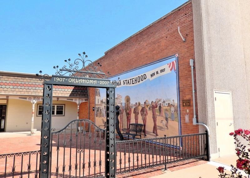
Photographed by Cosmos Mariner, September 8, 2024
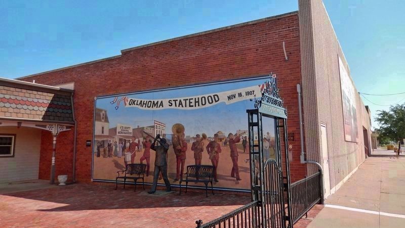
3. Statehood Day Marker & Mural
Looking south along 4th Street (on the right). The marker and mural are located on the north facade of the building adjacent to the Statehood Day / Centennial Plaza.
Photographed by Cosmos Mariner, September 8, 2024
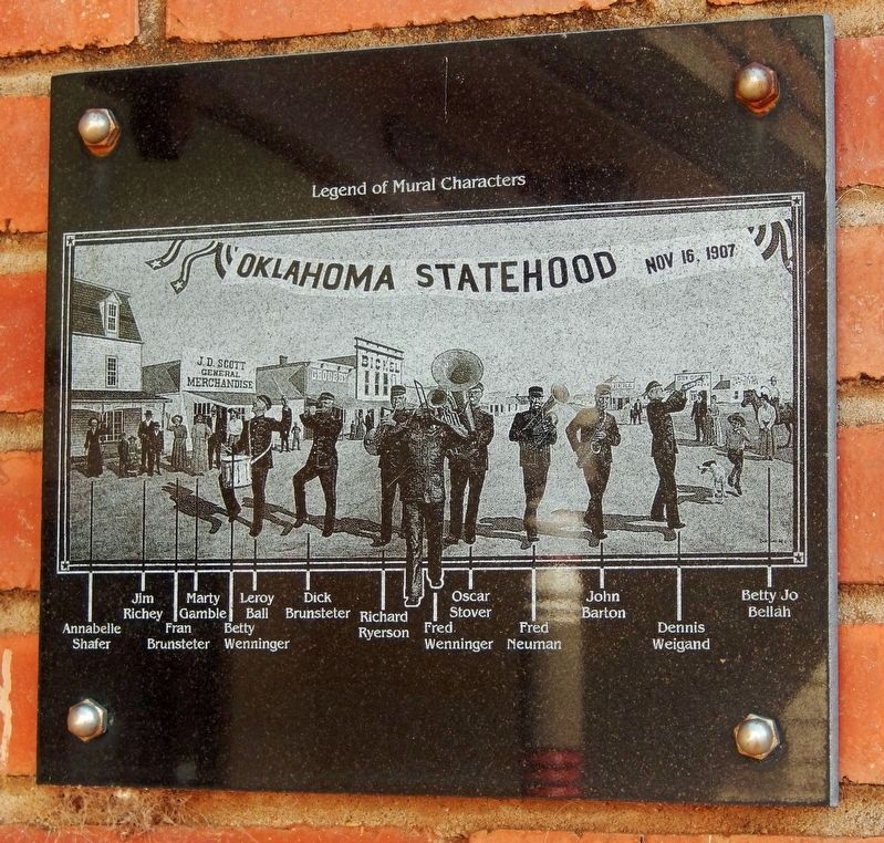
4. Statehood Day Mural Legend
Photographed by Cosmos Mariner, September 8, 2024
5. Statehood Day Mural and The Bandleader Sculpture
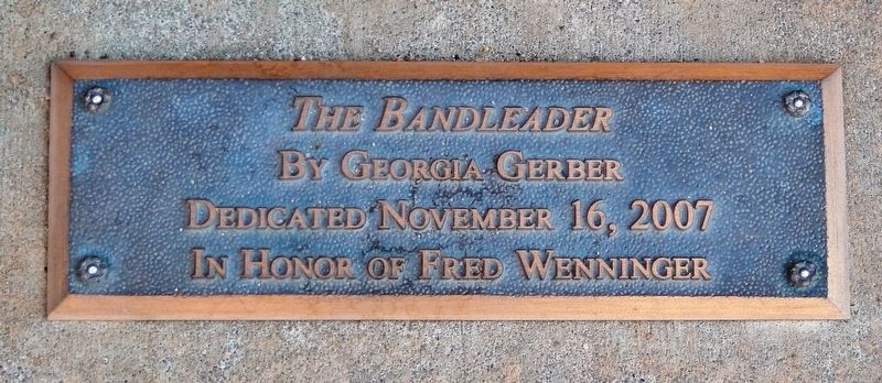
The mural was painted by Roger Cooke in 2007. In front of the mural is a bronze statue of a trombone player leading the band. This statue is in honor of Fred Wenninger, one of the founding members of the mural society.
Photographed by Cosmos Mariner, September 8, 2024
6. The Bandleader Sculpture
Dedicated November 16, 2007
In Honor of Fred Wenninger
Credits. This page was last revised on February 2, 2025. It was originally submitted on February 1, 2025, by Cosmos Mariner of Cape Canaveral, Florida. This page has been viewed 123 times since then and 6 times this year. Photos: 1, 2, 3, 4, 5, 6. submitted on February 2, 2025, by Cosmos Mariner of Cape Canaveral, Florida.
