Central Office District in Richmond, Virginia — The American South (Mid-Atlantic)
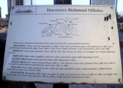
Downtown Richmond Millsites
HOLLYWOOD: A flour mill was operating by 1800. Canal water powered a paper mill beginning in 1887, and a 2,100 kilowatt hydroelectric plant from 1940 to 1972. River water powered a City hydroelectric plant until 1986.
TREDEGAR: Canal water powered a flour mill by 1801, the Armory by 1802, and Tredegar Iron Works beginning in 1837.
BASIN RACE: Basin water supplied a mill race which powered a paper mill beginning in 1834.
GALLEGO MILLS: Basin water powered flour mills beginning in 1834.
HAXALL MILLS: River water powered Ross’s Mill by 1788. Haxall Canal water powered flour mills from 1809 to 1894, and an 8,800 kilowatt hydroelectric plant from 1901 to 1968.
BELLE ISLE: River water powered an iron works by 1848, and filled a basin which powered a 3,000 kilowatt hydroelectric plant from 1914 to 1965.
MANCHESTER: Manchester Mill Canal was open by 1804, and powered a series of mills: in 1895, two paper mills, acorn mill, and a flour mill; and from 1925 to 1965 a 1,000 kilowatt hydroelectric plant.
Topics. This historical marker is listed in these topic lists: Industry & Commerce • Waterways & Vessels. A significant historical year for this entry is 1800.
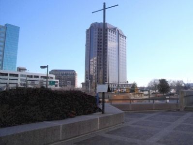
Location. 37° 32.235′ N, 77° 26.332′ W. Marker is in Richmond, Virginia. It is in the Central Office District. Marker can be reached from the intersection of South 8th Street and East Canal Street. This marker is located along the Dominion Building plaza. Touch for map. Marker is at or near this postal address: 701 East Cary Street, Richmond VA 23219, United States of America. Touch for directions.
Other nearby markers. At least 8 other markers are within walking distance of this marker. Basin Race (here, next to this marker); Kanawha Plaza (within shouting distance of this marker); Canal Walk (within shouting distance of this marker); Evacuation of Richmond (within shouting distance of this marker); Evacuation Fire (within shouting distance of this marker); The First National Bank Building (about 700 feet away, measured in a direct line); Great Turning Basin (about 800 feet away); a different marker also named Great Turning Basin (approx. 0.2 miles away). Touch for a list and map of all markers in Richmond.
More about this marker. On top is a map showing the site of Richmond mills.
Also see . . . James River and Kanawha Canal Historic District. National Register of Historic Places (Submitted on January 18, 2010.)
Credits. This page was last revised on February 1, 2023. It was originally submitted on January 18, 2010, by Bernard Fisher of Richmond, Virginia. This page has been viewed 943 times since then and 24 times this year. Photos: 1, 2. submitted on January 18, 2010, by Bernard Fisher of Richmond, Virginia.

