Proyecto Escola in Puerto Vallarta, Jalisco, Mexico — The Pacific Coast (and Central Highlands)
Baliza de Enfilación
Leading Beacon
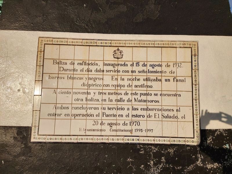
Photographed by Douglass Halvorsen, January 14, 2025
1. Baliza de Enfilación Marker

Leading beacon, inaugurated on August 15, 1932. During the day it provided service with its black and white bars. At night it used a dioptric lantern equipped with an acetylene light. One hundred and ninety-three meters from this point is another beacon on Matamoros Street. Both concluded their service to sea vessels when the port in the El Salado estuary came into operation on August 20, 1970.
Erected by Honorable Ayuntamiento Constitucional 1995-1997.
Topics and series. This historical marker is listed in these topic lists: Industry & Commerce • Waterways & Vessels. In addition, it is included in the Lighthouses series list. A significant historical date for this entry is August 15, 1932.
Location. 20° 36.609′ N,
this page online

Regionally, this marker is in Western Mexico, in the Bajío, on the Pacific Coast, and in the Sierra Madre. Globally, it is in North America, on the Ring of Fire, on the Pacific Rim, and in the Western Hemisphere. Historically, it finds itself in what was once New Spain, a Spanish colony, and the Aztec Empire.
Other nearby markers. At least 8 other markers are within walking distance of this marker: Jesús Langarica (within shouting distance of this marker); El Servicio de Correos (about 120 meters away, measured in a direct line); Teatro Saucedo (about 150 meters away); Escuela “20 de Noviembre” (about 180 meters away); Interconexión Eléctrica de Puerto Vallarta (about 180 meters away); Acta de Inauguración (about 180 meters away); San Pascual Bailón (approx. 0.3 kilometers away); Francisca Rodríguez (approx. 0.4 kilometers away). Touch for a list and map of all markers in Puerto
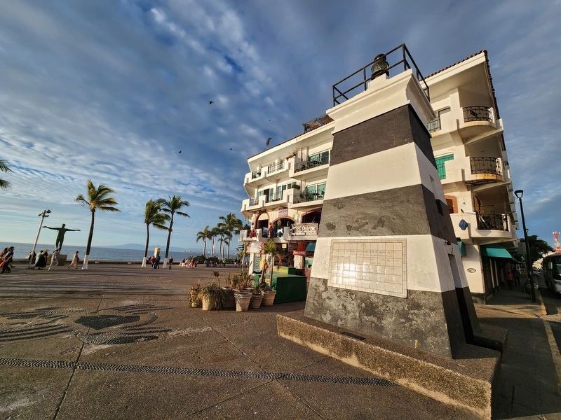
Photographed by Douglass Halvorsen, January 14, 2025
2. Baliza de Enfilación Marker
Related marker. Click here for another marker that is related to this marker.
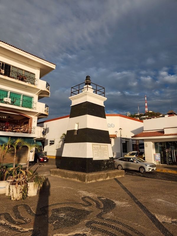
Photographed by Douglass Halvorsen, January 14, 2025
3. Baliza de Enfilación Marker
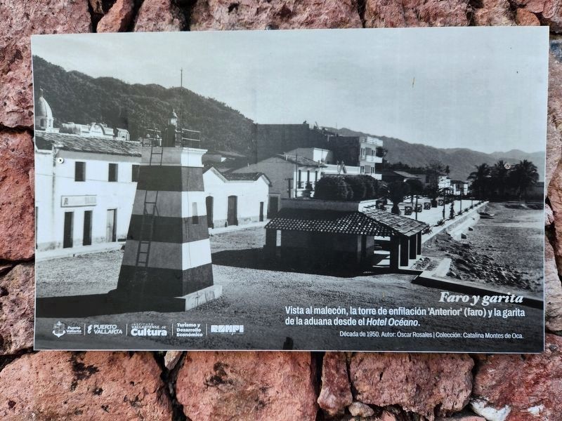
Photographed by Douglass Halvorsen, January 17, 2025
4. Faro y garita (Lighthouse and sentry box)
Vista al malecón, la torre de enfilación 'Anterior' (faro) y la garita de la aduana desde el Hotel Oceano. Decada de 1950 English: View of the Malecon, the 'Anterior' (lighthouse) and the customs house from the Hotel Oceano. 1950s
This image is located on a photo wall at the location of the 'Posterior' lighthouse up the hill from here.
This image is located on a photo wall at the location of the 'Posterior' lighthouse up the hill from here.
Photographed by Douglass Halvorsen, January 17, 2025
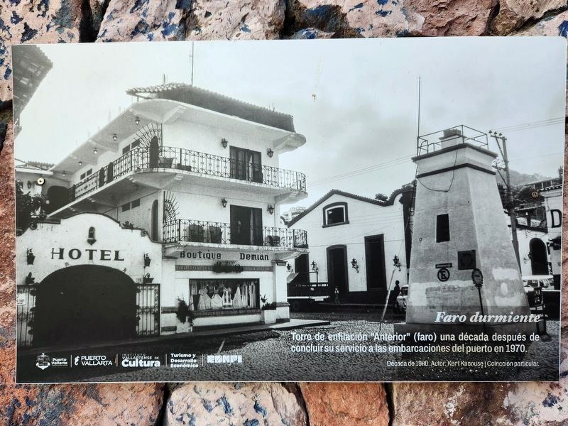
5. Faro durmiente (Sleeping lighthouse)
Torre de enfilación "Anterior" (faro) una década después de concluir su servicio a las embarcaciones del puerto en 1970. Decade de 1980. English: "Anterior” (lighthouse) tower a decade after it concluded its service to the port's vessels in 1970. Decade of 1980.
This image resides on a photo wall located at the former 'Posterior' lighthouse up the hill from here.
This image resides on a photo wall located at the former 'Posterior' lighthouse up the hill from here.
Credits. This page was last revised on February 5, 2025. It was originally submitted on February 3, 2025, by Douglass Halvorsen of Klamath Falls, Oregon. This page has been viewed 114 times since then and 13 times this year. Last updated on February 4, 2025, by Douglass Halvorsen of Klamath Falls, Oregon. Photos: 1, 2, 3. submitted on February 3, 2025, by Douglass Halvorsen of Klamath Falls, Oregon. 4, 5. submitted on February 4, 2025, by Douglass Halvorsen of Klamath Falls, Oregon. • J. Makali Bruton was the editor who published this page.
