Ripa in Roma in Città metropolitana di Roma Capitale, Latium, Rome, Italy — Central Italy (Tyrrhenian Coast)
L'Età Moderna
⎯⎯⎯
The Modern Age
Photographed by James Hulse, February 27, 2024
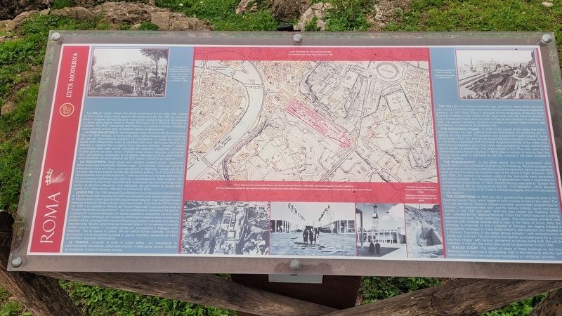
1. L'Età Moderna / The Modern Age Marker

La Valle. L'area rimase fino all'età moderna al di fuori della città adibita ad orti e campi irrigui, come appare nelle piante storiche. Nel 1587 per ordine di Sisto V vengono riportati alla luce i due grandi obelischi egizi che si trovavano al centro della pista e posti in Piazza del Popolo ed in P.zza S. Giovanni in Laterano. Dal 1645, alle pendici dell' Aventino, si impiantò il Cimitero Israelitico, alcuni cipressi ancora oggi ne indicano l'antica localizzazione.
La Fase Industriale. La Compagnia Anglo-Romana dell'Illuminazione a Gaz nel 1854 realizzò, al centro della valle, il primo impianto per la produzione del gas per l'illuminazione pubblica. La collocazione fu scelta per motivi di salute della cittadinanza e per la presenza del corso dell'Acqua Mariana. La fabbrica si espanse fino a coprire circa due terzi dell'area mentre il settore sudorientale della valle veniva occupato da capannoni, magazzini ed opifici di vario genere. La zona verso il Tevere venne invece utilizzata, a partire dal 1870, dal pastificio Pantanella, la cui attività, interrotta da alcuni gravi incendi, venne trasferita nei
this page online
La Riscoperta. Negli stessi anni vennero spostati anche i gasometri nella nuova area industriale cittadina lungo via Ostiense. Iniziarono quindi le sistemazioni viarie ed i lavori e per sgombrare le fabbriche, i casali e gli orti e riportare alla luce il settore meridionale dell'antico edificio. Tra il 1928 ed il 1936 venne scavato, ed in parte restaurato, il settore centrale ed orientale dell'emiciclo ma la presenza dell'acqua non permise il completamento delle indagini. Nel 1934 Antonio Munoz compi l'operazione di "isolamento" del monumento aprendo anche via del Circo Massimo, cosi realizzata per permettere la visuale della cupola di S. Pietro senza intaccare le strutture del Circo.
Le Mostre. Dal 1936 l'area del Circo Massimo fu concessa dal Governatorato al Partito Nazionale Fascista che iniziò ad utilizzarla come spazio espositivo con la "Mostra delle Colonie Estive e dell'assistenza all'infanzia". I vari padiglioni erano associati anche ad attività culturali, sportive e sociali. Tra la fine del 1937 e l'inizio del 1938 vi fu ospitata la "Mostra del Tessile Nazionale"
Photographed by James Hulse, February 27, 2024
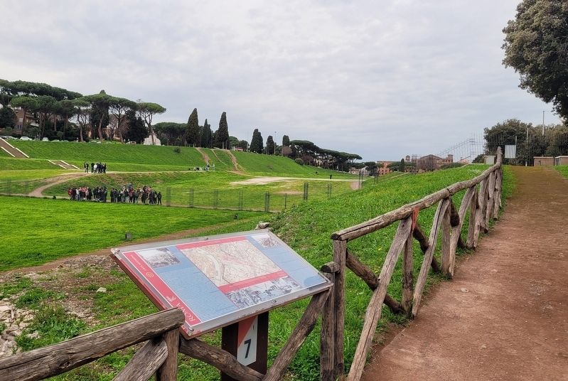
2. The view of the Modern Age Marker with the Circus Maximus in the background
Le Tracce. L'impatto di molti di questi edifici sul monumento fu particolarmente devastante, settori dell'emiciclo e della spina furono obliterati da fondazioni e muri in cemento armato.
Didascalie
(Foto #1) Veduta del Circo Massimo dall'Aventino (L. Rossini 1824 circa)
(Foto #2) L'area 'industriale' del Circo Massimo nel 1924.
(Foto #3) Il Circo Massimo nel periodo della Mostre del Partito nazionale Fascista (1936-1939). (Archivio Fotografico Sovrint Capitolina).
(Foto #4) Struffure in cemento armato riscoperte nell'area dell'emiciclo (1982).
(Foto #5) Le fabbriche nella valle alla fine dell'800
The Valley.
Photographed by James Hulse, February 27, 2024
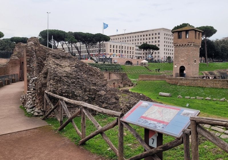
3. The Modern Age Marker and the tower
The Industrial Phase. In 1854, in the centre of the valley, the Anglo-Roman Society for Gas Lighting built the first factory for producing gas for lighting the city's streets. The location was selected for health reasons, being on the edge of the city, and for the Acqua Mariana aqueduct running through it. The factory expanded until it covered roughly two-thirds of the entire area, while the southeastern part of the valley was occupied by sheds, warehouses and a variety of workshops. The area closest to the Tibur was used by the Pantanella pasta factory starting in 1870; after a number of serious fires, this factory would move to premises on the Via Casilina in the early decades of the 20th century.
The Rediscovery. In the same period, the city's gasometers were transferred to a new industrial zone along Via Ostiense. Work thus began on the roads around the Circus Maximus, while the factories, farms and gardens were removed to bring the southern part of the circus to light. Between 1928 and 1936, the central and eastern parts of the hemicycle were excavated and partly restored, but the presence of groundwater made it impossible to complete the excavations. In 1934, Antonio Munoz was able to "isolate" the archaeological site by inaugurating Via del Circo Massimo, which allowed for a view of the dome of St. Peter's without damaging any of the structures in the stadium.
The Exhibitions. In 1936, the city's governorship leased the area to the National Fascist Party, which began to hold a series of fairs in the valley. The first was devoted to "Summer Camps and other government programmes for children"; the pavilions were also used for various cultural, sports and social events. In late 1937 and early 1938 the area hosted the "National Textile Fair", followed by the "National Workers' Clubs Fair" which featured a bathing establishment and three swimming pools. The monumental entrance was adorned with colossal statues and a view of the Stele of Axum. After the embargo in response to Italy's invasion of Ethiopia, the regime initiated a propaganda campaign to make Italian industry self-sufficient; this resulted in a "Autarkic Exposition of the Italian Mining Industry", with reconstructions of mines and quarries. The success of this last fair prompted plans for a "Circus Maximus Village", with various permanent structures being built, but with the outbreak of the war, the entire idea would be abandoned in April 1940.
Traces Today. The impact of many of these buildings on the Circus Maximus was particularly devastating. Part of the hemicycle and the 'spina' were obliterated by new walls and foundations in reinforced concrete.
Captions
(Photo #1) A view of the Circus Maximus from the Aventine Hill (L. Rossini, c. 1824)
(Photo #2) The 'industrial' zone' in the Circus Maximus in 1924.
(Photo #3) The Circus Maximus during the fairs held by the National Fascist Party (1936-1833) (Photo Archives of the Superintendency of Cultural Heritage for the City of Rome).
(Photo #4) Reinforced concrete structures excavated in the hemicycle area (1982).
(Photo #5) Factories in the valley in the late 1800s
Erected by Rome.
Topics. This historical marker is listed in this topic list: Anthropology & Archaeology. A significant historical year for this entry is 1587.
Location. 41° 53.105′ N, 12° 29.309′ E. Marker is in Roma, Lazio (Latium, Rome), in Città metropolitana di Roma Capitale. It is in Ripa. It is at the intersection of Viale Aventino and Via del Circo Massimo on Viale Aventino. The marker is located on the south end of the Circus Maximus Archaeological Site. Touch for map. Marker is in this post office area: Roma, Lazio 00186, Italy. Touch for directions.

Regionally, it is in Europe, the European Union, the Schengen Area, a coastal Mediterranean country, and the Western World. Historically, it finds itself in what was once the Roman Empire.
Other nearby markers. At least 8 other markers are within walking distance of this marker: Il Fornice XII / Vaulted Chamber XII (a few steps from this marker); Circo Massimo (a few steps from this marker); Le Latrine / The Latrines (a few steps from this marker); Il Mulino e le Macine / The Mill and the Millstones (within shouting distance of this marker); Frammenti Dell'Arco di Tito / Fragments From the Arch of Titus (within shouting distance of this marker); La Torre della Moletta / The Moletta Tower (within shouting distance of this marker); L'Emiciclo / The Hemicycle (within shouting distance of this marker); L'Arco di Tito / The Arch of Titus (within shouting distance of this marker). Touch for a list and map of all markers in Roma.
More about this marker. There is a small entry fee to visit the Circus Maximus Archaeological Site.
Also see . . . Circus Maximus. Wikipedia
The Circus Maximus (Latin for "largest circus"; Italian: Circo Massimo) is an ancient Roman chariot-racing stadium and mass entertainment venue in Rome, Italy. In the valley between the Aventine and Palatine hills, it was the first and largest stadium in ancient Rome and its later Empire. It measured 621 m (2,037 ft) in length and 118 m (387 ft) in width and could accommodate over 150,000 spectators. In its fully developed form, it became the model for circuses throughout the Roman Empire.(Submitted on February 5, 2025, by James Hulse of Medina, Texas.)
Credits. This page was last revised on February 6, 2025. It was originally submitted on February 5, 2025, by James Hulse of Medina, Texas. This page has been viewed 92 times since then and 4 times this year. Photos: 1, 2, 3. submitted on February 6, 2025, by James Hulse of Medina, Texas.
