Near Damloup in Meuse, Alsace, Lorraine, Champagne-Ardenne, France — Western Europe
De sa construction à la bataille de Verdun
Pourquoi le fort de Vaux
Photographed by Steve Stoessel, November 18, 2024
1. De sa construction à la bataille de Verdun Marker

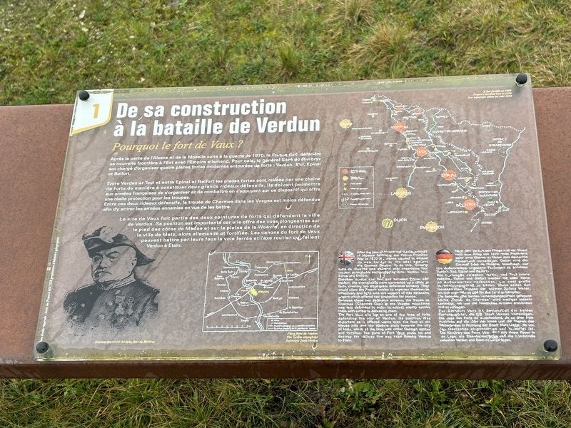
Entre Verdun et Toul et entre Epinal et Belfort les places fortes sont reliées par une chaîne de forts de manière à constituer deux grands rideaux défensifs. Ils doivent permettre aux armées françaises de s'organiser et de combattre en s'appuyant sur ce dispositif qui offre une réelle protection pour les troupes.
Entre ces deux rideaux défensifs, la trouée de Charmes dans les Vosges est moins défendue afin d'y attirer les armées ennemies en vue de les battre.
Le site de Vaux fait partie des deux ceintures de forts qui défendent la ville de Verdun. Sa position est importante car elle offre des vues plongeantes sur le pied des côtes de Meuse et sur la plaine de la Woëvre, en direction de la ville de Metz, alors allemande et fortifiée. Les canons du fort de Vaux peuvent battre par leurs feux la voie ferrée et l'axe routier qui
this page online
Between Verdun and Toul and between Epinal and Belfort, the strongholds were connected by a chain of forts, creating a large scale defensive screen. They would allow the French armies to organize themselves effectively and fight with the support of this defensive system which offered real protection for troops.
Between these two defensive screens, the Trouée de Charmes (Charmes Gap) in the Vosges mountains was less defended in order to attract enemy armies there with a view to defeating them.
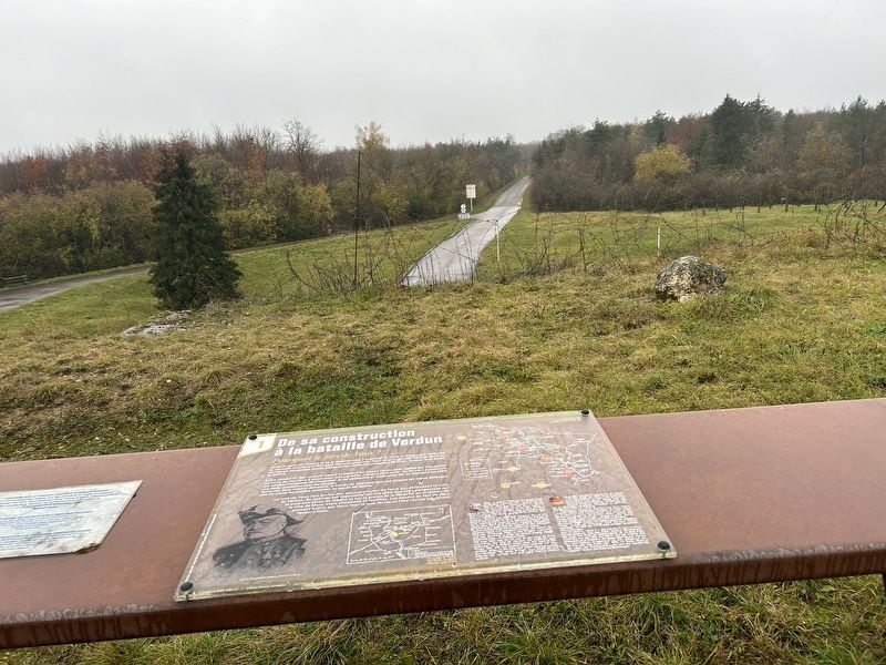
The Fort Vaux ate lay on one of the lines of forts defending the city of Verdun. Its position was important as it offered views onto the foot of the Meuse hills and the Woëvre plain towards the city of Metz, which at the time was under German control and fortified. The guns of Fort Vaux could hit and
Photographed by Steve Stoessel, November 18, 2024
2. De sa construction à la bataille de Verdun Marker
[German text too obscured to be transcribed] (Marker Number 1.)
Topics. This historical marker is listed in these topic lists: Forts and Castles • War, World I • Wars, Non-US. A significant historical year for this entry is 1870.
Location. 49° 12.014′ N, 5° 28.212′ E. Marker is near Damloup, Grand Est (Alsace, Lorraine, Champagne-Ardenne), in Meuse. It can be reached from Grand Est Route 913a 2 kilometers north of Route 913. Touch for map. Marker is in this post office area: Damloup, Grand Est 55400, France. Touch for directions.

Regionally, it is in the North Atlantic Region, Europe, the European Union, Atlantic Europe, the Schengen Area, Western Europe, a coastal Mediterranean country, and the Western World. Historically, it finds itself in what was once a French colony, the Roman Empire, and specifically the Holy Roman Empire.
Other nearby markers. At least 8 other markers are within walking distance of this marker: Dans la bataille de Verdun (here, next to this marker); a different marker also named Dans la bataille de Verdun (here, next to this
Photographed by Steve Stoessel, November 18, 2024
3. De sa construction à la bataille de Verdun Marker
Credits. This page was last revised on February 18, 2025. It was originally submitted on February 6, 2025, by Steve Stoessel of Niskayuna, New York. This page has been viewed 108 times since then and 10 times this year. Photos: 1, 2, 3. submitted on February 6, 2025, by Steve Stoessel of Niskayuna, New York.
