
Niskayuna in Schenectady County, New York — The American Northeast (Mid-Atlantic)
Erie Canal, Lock 7
Discover Schenectady County
Photographed by Steve Stoessel, February 7, 2025
1. Erie Canal, Lock 7 Marker
National Historic Landmark
2016
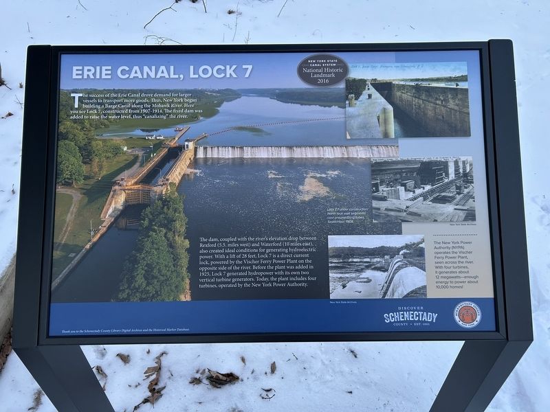
The success of the Erie Canal drove demand for larger vessels to transport more goods. Thus, New York began building a Barge Canal along the Mohawk River. Here you see Lock 7, constructed from 1907-1914. The fixed dam was added to raise the water level, thus "canalizing" the river.
The dam, coupled with the river's elevation drop between Rexford (5.5. miles west) and Waterford (10 miles east), also created ideal conditions for generating hydroelectric power. With a lift of 28 feet, Lock 7 is a direct current lock, powered by the Vischer Ferry Power Plant on the opposite side of the river. Before the plant was added in 1925, Lock 7 generated hydropower with its own two vertical turbine generators. Today, the plant includes four turbines, operated by the New York Power Authority.
The New York Power Authority (NYPA) operates the Vischer Ferry Power Plant, seen across the river. With four turbines, it generates about 12 megawatts - enough energy to power about 10,000 homes! [Photo Caption]
Lock E7 under construction. North lock wall segments cast
this page online
Erected 2024 by Schenectady County.
Topics. This historical marker is listed in this topic list: Waterways & Vessels. A significant historical month for this entry is September 1908.
Location. 42° 48.141′ N, 73° 50.927′ W. Marker is in Niskayuna, New York, in Schenectady County. It is at the intersection of Hudson-Mohawk Bike Trail and Lock 7 Parking Area, on the right when traveling north on Hudson-Mohawk Bike Trail. Marker is on the bike trail. Touch for map. Marker is in this post office area: Schenectady NY 12309, United States of America. Touch for directions.

Regionally, this marker is in Upstate New York, in the Capital District, and in the Albany Metropolitan Area. It is also in the American Northeast and in the Mid-Atlantic. Globally, it is in North America, the Western Hemisphere, the Western World, and the Anglosphere. Historically, it finds itself in what was once New Netherland and also one of the original Thirteen Colonies.
Other nearby markers. At least 8 other markers are within one mile of this marker, measured as the crow flies: Margaret Lordi & Eleanor Brown (a few steps
Photographed by Steve Stoessel, February 7, 2025
2. Erie Canal, Lock 7 Marker
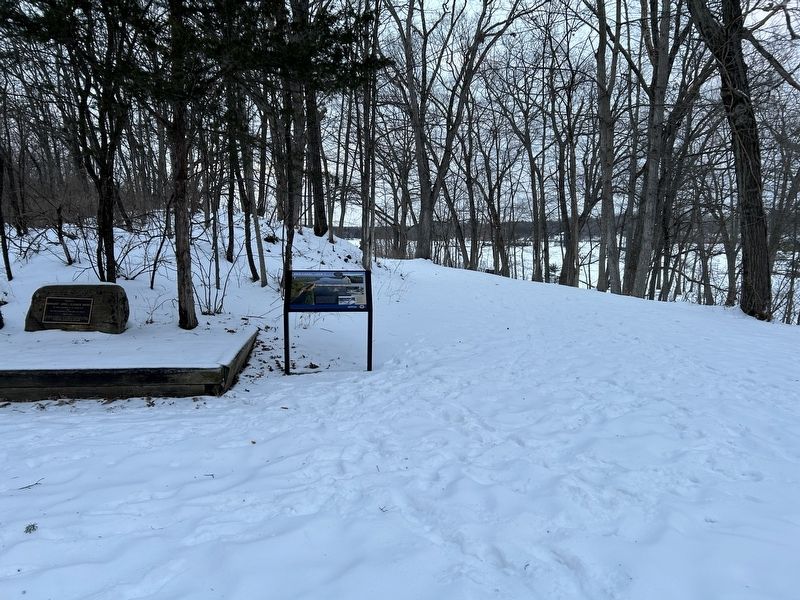
The dam and lock are in the background. This picture is taken from the bike path.
Credits. This page was last revised on February 7, 2025. It was originally submitted on February 7, 2025, by Steve Stoessel of Niskayuna, New York. This page has been viewed 520 times since then and 107 times this year. Photos: 1, 2. submitted on February 7, 2025, by Steve Stoessel of Niskayuna, New York.
