Woodstock Valley in Eastford in Northeastern Region, Connecticut — The American Northeast (New England)
Kenyonville, Connecticut
June 2, 2021
1. Kenyonville, Connecticut Marker
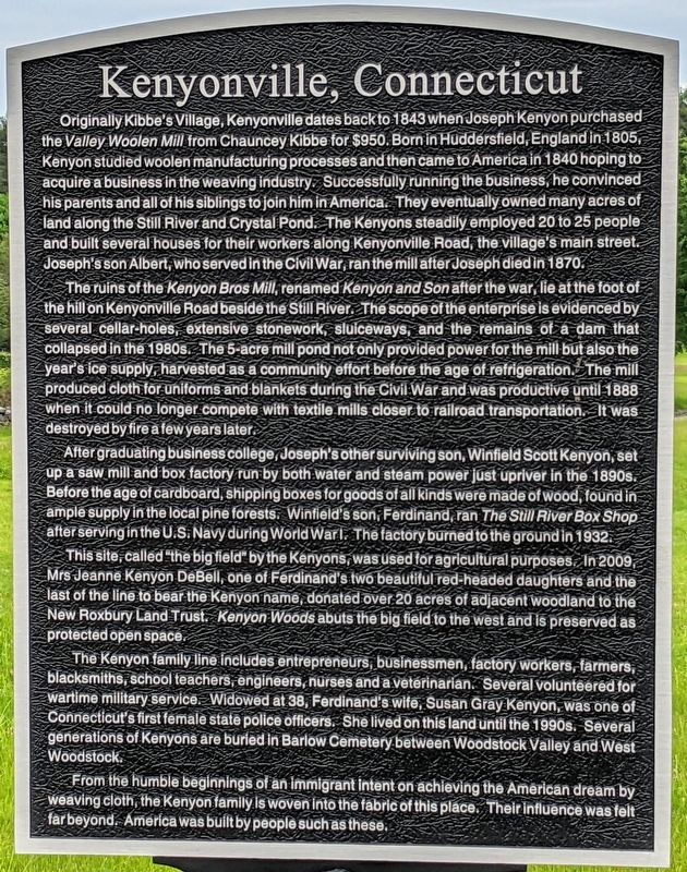
Originally Kibbe's Village, Kenyonville dates back to 1843 when Joseph Kenyon purchased the Valley Woolen Mill from Chauncey Kibbe for $950. Born in Huddersfield, England in 1805, Kenyon studied woolen manufacturing processes and then came to America in 1840 hoping to acquire a business in the weaving industry. Successfully running the business, he convinced his parents and all of his siblings to join him in America. They eventually owned many acres of land along the Still River and Crystal Pond. The Kenyons steadily employed 20 to 25 people and built several houses for their workers along Kenyonville Road, the village's main street. Joseph's son Albert, who served in the Civil War, ran the mill after Joseph died in 1870.
The ruins of the Kenyon Bros Mill, renamed Kenyon and Son after the war, lie at the foot of the hill on Kenyonville Road beside the Still River. The scope of the enterprise is evidenced by several cellar-holes, extensive stonework, sluiceways, and the remains of a dam that collapsed in the 1980s. The 5-acre mill pond not only provided power for the mill but also the year's ice supply, harvested as a
this page online
After graduating business college, Joseph's other surviving son, Winfield Scott Kenyon, set up a saw mill and box factory run by both water and steam power just upriver in the 1890s. Before the age of cardboard, shipping boxes for goods of all kinds were made of wood, found in ample supply in the local pine forests. Winfield's sons, Amos Winfield ("Winnie") and Ferdinand, who served in the U.S. Navy during World War I, ran the Still River Box Shop. The factory burned to the ground in 1932.
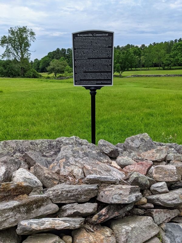
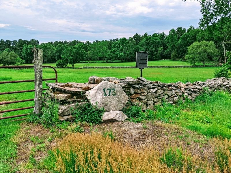
This site, called "the big field" by the Kenyons, was used for agricultural purposes. In 2009, Mrs. Jeanne Kenyon DeBell, one of Ferdinand's two beautiful red-headed daughters and the last of the line to bear the Kenyon name, donated over 20 acres of adjacent woodland to the New Roxbury Land Trust. Kenyon Woods abuts the big field to the west and is preserved as protected
June 2, 2021
2. Kenyonville, Connecticut Marker
The Kenyon family line includes entrepreneurs, businessmen, factory workers, farmers, blacksmiths, school teachers, artists, engineers, nurses and a veterinarian. Several volunteered for wartime military service. Widowed at 38, Ferdinand's wife, Susan Gray Kenyon, was one of Connecticut's first female state police officers. She lived on this land until the 1990s. Several generations of Kenyons are buried in Barlow Cemetery between Woodstock Valley and West Woodstock.
From the humble beginnings of an immigrant intent on achieving the American dream by weaving cloth, the Kenyon family is woven into the fabric of this place. Their influence was felt far beyond. America was built by people such as these.
Erected 2021.
Topics. This historical marker is listed in this topic list: Agriculture. A significant historical year for this entry is 1843.
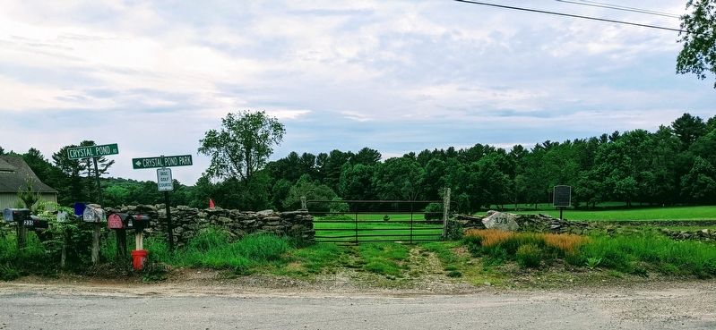
Location. 41° 55.556′ N, 72° 5.562′ W. Marker is in Eastford in Northeastern Region, Connecticut. It is in Woodstock Valley. It is at the intersection of Crystal Pond Road and Crystal Pond Road when traveling west on Crystal Pond Road. Touch for map. Marker is at or near this
June 2, 2021
3. Kenyonville, Connecticut Marker

Regionally, this marker is in the Quiet Corner. It is also in the American Northeast and in New England. Globally, it is in North America, the Western Hemisphere, the Western World, and the Anglosphere. Historically, it finds itself in what was once Windham County and also one of the original Thirteen Colonies.
Other nearby markers. At least 8 other markers are within 6 miles of this marker, measured as the crow flies: John Perry (approx. 1.7 miles away); Eastford (approx. 1.8 miles away); Eastford Veterans Memorial (approx. 1.8 miles away); Red-White School (approx. 3.9 miles away); Ashford (approx. 4 miles away); Constitution Oak (approx. 4 miles away); Nathaniel Lyon Birthplace (approx. 5½ miles away); Site of the first Meetinghouse in Union (approx. 5½ miles away). Touch for a list and map of all markers in Eastford.
June 2, 2021
4. Kenyonville, Connecticut Marker
Credits. This page was last revised on May 19, 2026. It was originally submitted on June 3, 2021. This page has been viewed 1,333 times since then and 85 times this year. Last updated on February 8, 2025. Photos: 1, 2, 3, 4. submitted on June 3, 2021. • J. Makali Bruton was the editor who published this page.
