
Daniel Island in Charleston in Berkeley County, South Carolina — The American South (South Atlantic)
Etiwan Island

Photographed by Thomas Moore, February 9, 2025
1. Etiwan Island Marker
(front)
Prior to European settlement this Island was inhabited by the Etiwan Indians. Archaeological excavations in nearby areas show a Native American presence on the island dating back thousands of years. The earliest written record of the Ettwan is a 1609 report from a Spanish voyage that entered the Bar of Cayaqua (Kiawah), later the site of Charleston harbor. When the English founded colonial Carolina in 1670, this island was known as Etiwan Island.
(reverse)
In addition to this island, the Etiwan had settlements along the upper Cooper River (then called Etiwan River) and the Charleston peninsula. A colonial census taken in 1715 reported an Etiwan population of 240. As English colonists settled this island, Etiwan residents were pushed out to outlying areas, and this was later known as Daniel Island after Robert Daniell. Among the Etiwans’ descendants are the state-recognized Wassmasaw Tribe of Varnertown Indians.
Erected 2025 by Berkeley North Historical & Cultural Association. (Marker Number 08-84.)
Topics and series. This historical marker is listed in these topic lists: Exploration •
this page online
Location. 32° 51.844′ N, 79° 54.108′ W. Marker is in Charleston, South Carolina, in Berkeley County. It is on Daniel Island. It is on Seven Farms Drive near Indian Park Drive, on the right when traveling north. Located at the entrance of Governor's Park at Seven Farms Drive. Touch for map. Marker is in this post office area: Charleston SC 29492, United States of America. Touch for directions.

Regionally, this marker is in the Lowcountry and in Santee Cooper Country. It is also in the American South, specifically in the Deep South, and on the Eastern Seaboard. Globally, it is in the North Atlantic Region, North America, the Western Hemisphere, the Western World, and the Anglosphere. Historically, it finds itself in what was once the territory of the Mississippian Culture, one of the original Thirteen Colonies, one of the Confederate States of America, and the Antebellum South.
Other nearby markers. At least 8 other markers are within walking distance of this
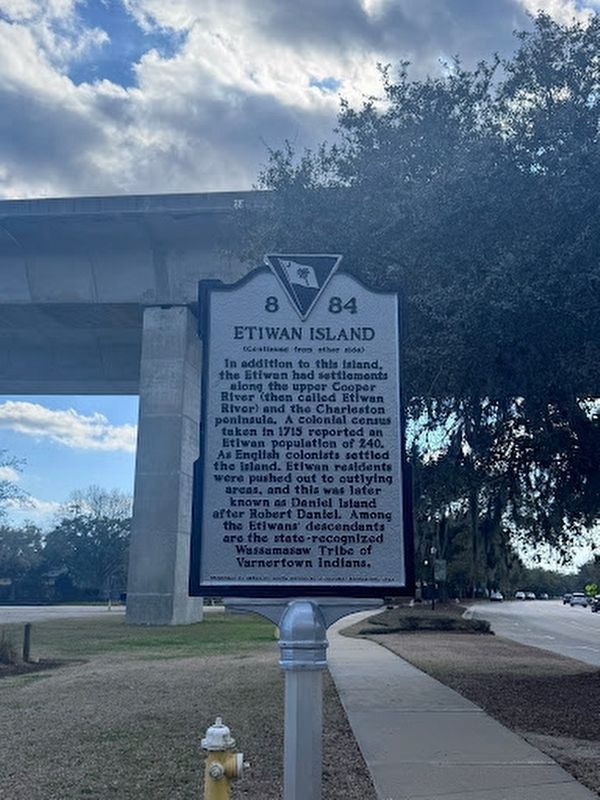
Photographed by Thomas Moore, February 9, 2025
2. Etiwan Island Marker Reverse
Photographed by Suzanne Detar, February 1, 2025
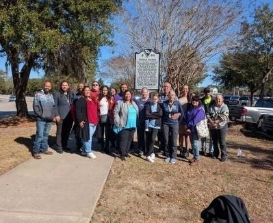
3. Marker being unveiled
Members of the Wassamasaw Tribe of the Varnertown Indians gather around a new historical marker that details the history of their Etiwan Tribe ancestors
Credits. This page was last revised on February 9, 2025. It was originally submitted on February 9, 2025, by Thomas Moore of Charleston, South Carolina. This page has been viewed 335 times since then and 52 times this year. Photos: 1, 2, 3. submitted on February 9, 2025, by Thomas Moore of Charleston, South Carolina. • J. J. Prats was the editor who published this page.
Editor’s want-list for this marker. Closeup photos of both sides • Can you help?
