Mount Pleasant in Charleston County, South Carolina — The American South (South Atlantic)
Fort Palmetto
Oyster Point
Photographed by Thomas Moore, February 8, 2025
1. Fort Palmetto Marker
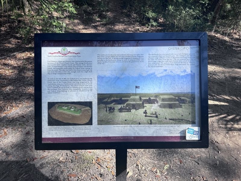
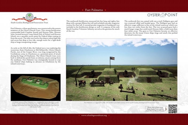
Fort Palmetto, a three-gun battery, was constructed at the eastern terminus of the Christ Church Lines. This strong fortification commanded both Copahee Sound and Dewees Inlet. Dewees Inlet, located between Long Island (Isle of Palms) and Dewees Island, was a possible access point for Federal ships coming in from the ocean. The inlet was twelve feet deep at mean high tide and seven feet deep at low tide, enough water for a light-draft ship or barge transporting troops.
As early as the fall of 1861, the Federal navy was exploring the waterways from Charleston to McClellanville. Christ Church Parish, east of the Cooper River, was long recognized by the Confederate army in Charleston as a potential point of attack during the Siege of Charleston. The Christ Church Lines were built to defend the parish from an infantry attack coming from the northeast. Fort Palmetto was strategically located to stop any Federal ships looking to advance on Charleston by the inland waterways.
The earthwork fortification measured 160 feet long and eighty feet deep with a parapet fifteen feet tall and included a powder magazine twenty-five
this page online
The earthwork fort was armed with one 9-inch Dahlgren gun and two 32-pound rifled and banded guns. The Dahlgren gun had an effective range sufficient to fire on the inland waterway which was less than two miles from the fort. The two 32-pound guns had much longer range that could reach Dewees Inlet, a little more than four miles away. The guns at Fort Palmetto became an effective deterrent, for the many Union ships, large and small, that probed the inland waterways.
(captions)
A LiDAR survey of Fort Palmetto was completed in 2014 to develop a model of the condition of the extantt fortification. Though the fort has suffered some damage and erosion over time, the three gun positions and the magazines arestill clearly visible.
Fort Palmetto as it appeared in 1863. The model is provided courtesy of the South Carolina Battleground Preservation Trust.
Erected by South Carolina Battleground Preservation Trust.
Topics. This
2. Fort Palmetto Marker
South Carolina Battleground Preservation Trust
Location. 32° 49.409′ N, 79° 47.873′ W. Marker is in Mount Pleasant, South Carolina, in Charleston County. It can be reached from the intersection of North Palmetto Fort Drive and McManus Road, on the right when traveling north. The marker is located 1,000 yards east of the Fort Palmetto Park parking lot. Touch for map. Marker is at or near this postal address: 2213 N Palmetto Fort Dr, Mount Pleasant SC 29466, United States of America. Touch for directions.

Regionally, this marker is in the Lowcountry. It is also in the American South, specifically in the Deep South, and on the Eastern Seaboard. Globally, it is in the North Atlantic Region, North America, the Western Hemisphere, the Western World, and the Anglosphere. Historically, it finds itself in what was once the territory of the Mississippian Culture, one of the original Thirteen Colonies, one of the Confederate States of America, and the Antebellum South.
Other nearby markers. At least 8 other markers are within 2 miles of this marker, measured as the crow flies: Defending the Inland Waterways (about 400 feet away, measured in a direct line); The Christ Church Lines (about 500 feet away); Christ Church Parish Line (approx. 0.4 miles away); Early Site History (approx. 0.4 miles away); Seaside (approx. 1.1 miles away); Christ Church (approx. 1.7 miles away); Confederate Lines (approx. 1.7 miles away); a different marker also named Christ Church (approx. 1.7 miles away). Touch for a list and map of all markers in Mount Pleasant.
Another marker is no longer nearby. Cook's Old Field Cemetery / Copahee Plantation and Hamlin Beach (was approx. 1.2 miles away but has been confirmed missing).
Also see . . . South Carolina Battleground Preservation Trust. (Submitted on February 11, 2025.)
Credits. This page was last revised on July 20, 2025. It was originally submitted on February 9, 2025, by Thomas Moore of Charleston, South Carolina. This page has been viewed 358 times since then and 53 times this year. Photos: 1. submitted on February 9, 2025, by Thomas Moore of Charleston, South Carolina. 2. submitted on February 11, 2025. • Bernard Fisher was the editor who published this page.
