Congdon Park in Duluth in Saint Louis County, Minnesota — The American Midwest (Upper Plains)
Stone Bridge & Trails
| — | Glensheen Historic Estate | — |

Photographed by Cosmos Mariner, June 24, 2024
1. Stone Bridge & Trails Marker
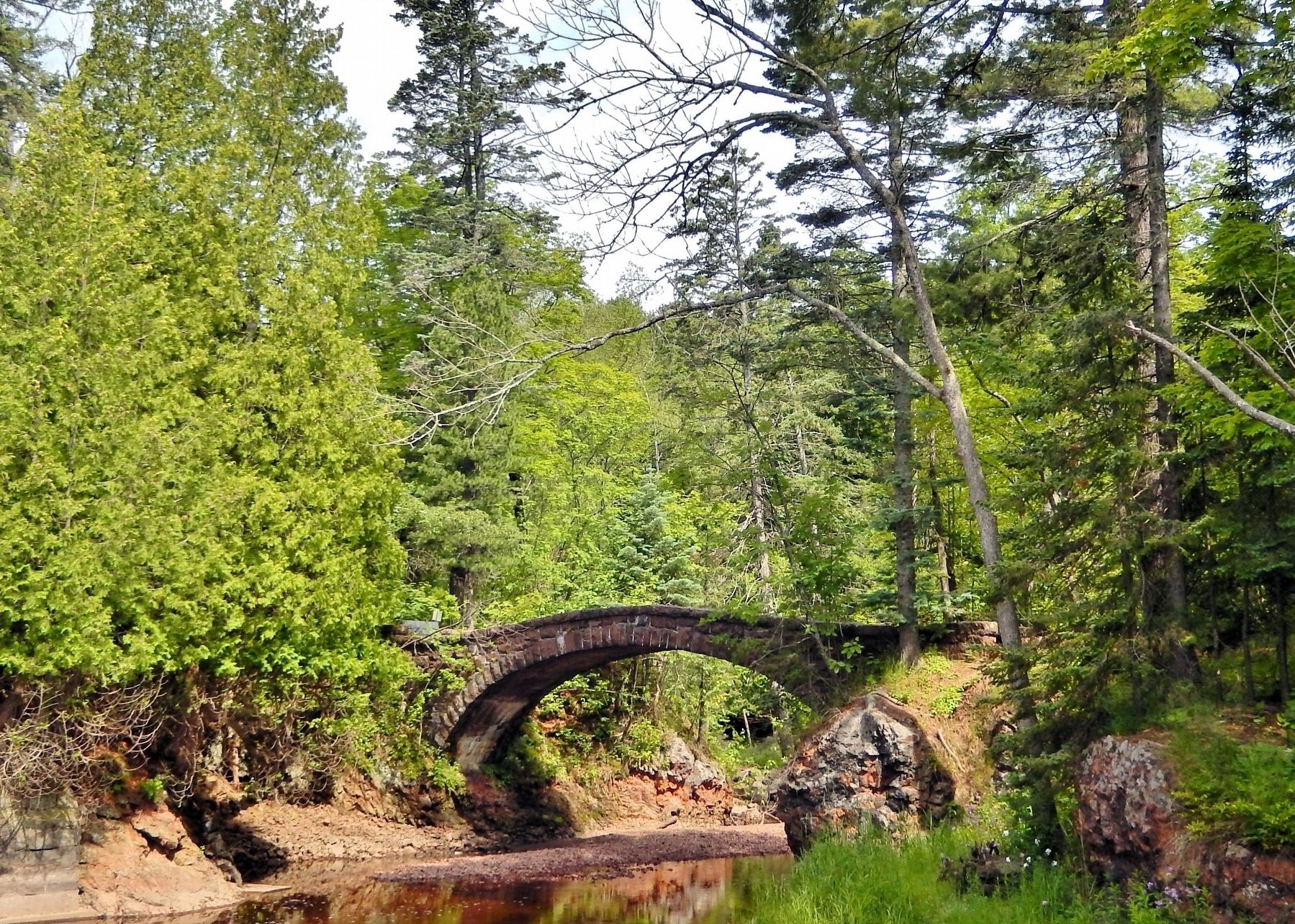
The Stone Arch Bridge over Tischer Creek was designed by famed landscape architect Charles Leavitt, Jr. His associates, Anthony Morell and Arthur Nichols, came to Duluth to oversee construction, and the pair were later hired by the city of Duluth. This is why one can find similarly styled bridges in nearby Lester Park and on Seven Bridges Road.
This point is also the beginning of West Trail. It once connected into the present-day trail system of Congdon Park. Chester Congdon donated the picturesque 34 acres and its hanging waterfalls and red rock gorges to the city in 1908.
Chester Congdon met with President Theodore Roosevelt. Known for his vocal championing of land conservation and the National Park System, the president himself may have influenced Congdon to create his namesake park for the public to enjoy.
Erected by Glensheen Historic Estate. (Marker Number 7.)
Topics and series. This historical marker is listed in these topic lists: Architecture • Bridges & Viaducts • Charity & Public Work • Parks & Recreational Areas. In addition, it is included in the Former U.S. Presidents: #26 Theodore Roosevelt,
this page online
Location. 46° 48.877′ N, 92° 3.101′ W. Marker is in Duluth, Minnesota, in Saint Louis County. It is in Congdon Park. It can be reached from London Road (Voyageur Highway) (State Highway 61) 0.2 miles north of South 32nd Avenue East, on the right when traveling north. The marker is located along the Glensheen Estate interpretive trail, overlooking Tischer Creek. Walking access is from the Glensheen Estate parking lot on the northeast side of the property. Touch for map. Marker is at or near this postal address: 3300 London Road, Duluth MN 55804, United States of America. Touch for directions.

Regionally, this marker is in the Arrowhead Region and in the Iron Range. It is also in the American Midwest and in the Corn Belt. Globally, it is in North America, in the Great North Woods, on the Great Lakes, in the Western Hemisphere, in the Western World, and in the Anglosphere. Historically, it finds itself in what was once the Viceroyalty of New France, Rupert’s Land, the territory of the Mississippian Culture, and

Photographed by Cosmos Mariner, June 24, 2024
2. Stone Bridge & Trails Marker
Looking south from the interpretive trail; the marker overlooks the mouth of Tischer Creek. The trail crosses the stone arch bridge about 30 meters uphill from the marker (to the right).
Other nearby markers. At least 8 other markers are within walking distance of this marker: Tischer Creek (within shouting distance of this marker); Lake Superior (within shouting distance of this marker); The Boathouse (within shouting distance of this marker); Glensheen Restoration (within shouting distance of this marker); The Landscape (within shouting distance of this marker); Glensheen (within shouting distance of this marker); Servant's Courtyard (within shouting distance of this marker); West Gate (about 300 feet away, measured in a direct line). Touch for a list and map of all markers in Duluth.
Another marker is no longer nearby. Boat House and Pier (was within shouting distance of this marker but has been permanently removed).
Regarding Stone Bridge & Trails. Contributing structure, Chester and Clara Congdon Estate — Glensheen, National Register of Historic Places № 91001057.
From the National Register Nomination prepared by Michael Koop, 8/1990:
Tischer Creek Bridge, 1907. This graceful stone arch footbridge is 55' long, 7.5' wide, and 14.5' from the keystone to the water. It crossesthe creek just west of the house and links the path systems on the east and west banks of Tischer Creek.Photographed by Cosmos Mariner, June 24, 20243. Stone Bridge TrailThe trail leading downhill from the marker to the lake shore.

Related markers. Click here for a list of markers that are related to this marker. Glensheen — The Historic Congdon Estate

Photographed by Cosmos Mariner, June 24, 2024
4. Tischer Creek Bridge Approach
The trail crosses Tischer Creek Bridge.

Photographed by Cosmos Mariner, June 24, 2024
5. Tischer Creek Bridge (north/upstream elevation)
Photographed by Cosmos Mariner, June 24, 2024
6. Tischer Creek & Stone Arch Bridge
Credits. This page was last revised on February 20, 2025. It was originally submitted on February 14, 2025, by Cosmos Mariner of Cape Canaveral, Florida. This page has been viewed 194 times since then and 53 times this year. Photos: 1, 2, 3, 4, 5, 6. submitted on February 19, 2025, by Cosmos Mariner of Cape Canaveral, Florida.
