Mount Pleasant in Charleston County, South Carolina — The American South (South Atlantic)
Christ Church Parish Line

Photographed by Thomas Moore, February 8, 2025
1. Christ Church Parish Line Marker
Entrenchments
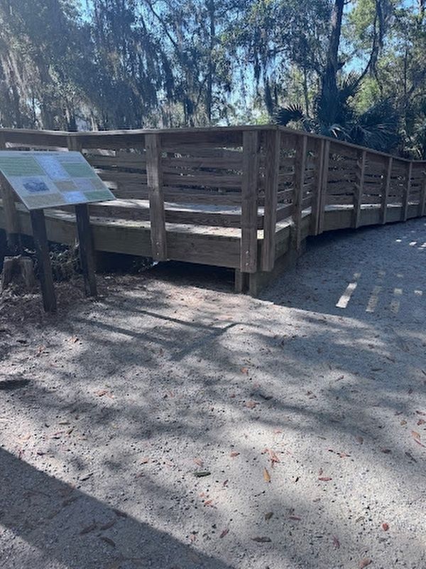
This boardwalk crosses a Civil War trench, the Christ Church Parish Line. The entrenchment was constructed from November 1861 to January 1862, a period that coincides with General Robert E. Lee's oversights of Confederate coastal defenses. As one of 72 field fortifications, the entrenchment was part of a grand-scale project begun in September 1860 to defend Charleston Harbor.
Confederates constructed shore-side batteries and forts first. Then they added a series of entrenched lines to guard against overland advance on the city. Engineers from the South Carolina Regulars and Confederate Army supervised the construction, but enslaved people were forced to undertake most of the labor. Lieutenant Francis S. Blake, a South Carolina Regular engineer, is credited for directing the construction of this entrenchment.
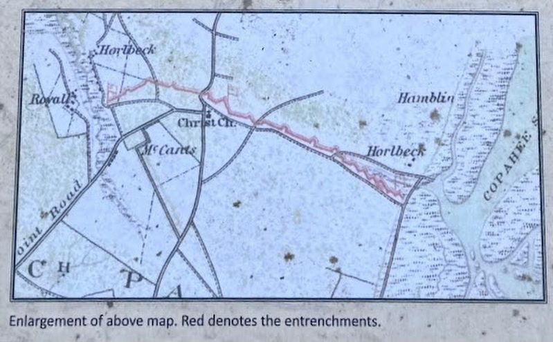
The effort by the undocumented enslaved people was significant. Workers hand-dug the three-mile trench, placing excavated fill on its south side to create a berm. When finished, the line ran east from Butler's Creek, across Georgetown Road (now Highway 17), then southeast to Copahee Sound.
“The land defenses around the city...are in a good state of progress...The works have been mostly constructed by [enslaved] labor furnished by the planters.”
this page online
The Art of Fortification
The American Civil War marked a transition from a militia to a professional army and with it an increased emphasis on military engineering. Dennis Hart Mahan was instrumental in this evolution of the “Engineers’ Art,” knowledge he acquired through his studies in Europe of advanced engineering and contemporary military theory. Mahan taught this knowledge to students at the United States Military Academy (West Point) from 1830 until 1871.
Mahan Sketch of Trench Construction
Mahan noted that all entrenchments are composed of two primary elements. This included a berm to stop enemy missiles and inspire confidence in relatively untrained militia troops, and a ditch to provide material for the berm and to function as an obstacle to an advancing enemy.
The Christ Church Parish Line and its anchor shore-side batteries were never threatened during the war and Charleston was successfully defended. However, the city and its harbor were ultimately abandoned to Union forces in February 1865.
Topics. This historical marker is listed in these topic lists: Forts and Castles
Photographed by Thomas Moore, February 8, 2025
2. Marker with Boardwalk
This boardwalk crosses the Christ Church Parish Line.
Location. 32° 49.695′ N, 79° 48.024′ W. Marker is in Mount Pleasant, South Carolina, in Charleston County. It can be reached from the intersection of North Palmetto Fort Drive and McManus Road, on the right when traveling north. The marker is located 300 yards east of the Fort Palmetto Park parking lot. Touch for map. Marker is at or near this postal address: 2213 N Palmetto Fort Dr, Mount Pleasant SC 29466, United States of America. Touch for directions.

Regionally, this marker is in the Lowcountry. It is also in the American South, specifically in the Deep South, and on the Eastern Seaboard. Globally, it is in the North Atlantic Region, North America, the Western Hemisphere, the Western World, and the Anglosphere. Historically, it finds itself in what was once the territory of the Mississippian Culture, one of the original Thirteen Colonies, one of the Confederate States of America, and the Antebellum South.
Other nearby markers. At least 8 other markers are within 2 miles of this marker, measured as the crow flies: Early Site History (within shouting

February 8, 2025
3. Civil War
The War in South Carolina, Battery on Sullivan's Island
Another marker is no longer nearby. Cook's Old Field Cemetery / Copahee Plantation and Hamlin Beach (was approx. 0.9 miles away but has been confirmed missing).
Also see . . . South Carolina Battleground Preservation Trust. (Submitted on February 21, 2025.)

February 8, 2025
4. Charleston and Its Defenses
February 8, 2025
5. Enlarged Map
Red denotes the entrenchments

6. Note B, Mahan's Book
A figure from Mahan's 1860 book, A Treatise on Field Fortification.
Credits. This page was last revised on February 21, 2025. It was originally submitted on February 14, 2025, by Thomas Moore of Charleston, South Carolina. This page has been viewed 225 times since then and 53 times this year. Photos: 1, 2, 3, 4, 5, 6. submitted on February 14, 2025, by Thomas Moore of Charleston, South Carolina. • Bernard Fisher was the editor who published this page.
