South Lake Union in Seattle in King County, Washington — The American West (Northwest)
Paths — The Union of Pathways

Photographed by Douglass Halvorsen, August 22, 2024
1. The Union of Pathways Marker
Land
In the 1850s, Lake Union seemed very remote from Seattle, but settlers soon built a wagon road over an Indian trail to link the lake with the little waterfront town. Later development followed electric streetcar lines along both the eastern and western shores of Lake Union, bringing merrymakers to Jensen’s Grove and homemakers to Fremont and Wallingford.
Caption
(Photo #1) In 1890, the electric streetcar line extended from Seattle to south Lake Union, a destination proudly advertised by this trolley. A horsedrawn car had served the area since 1885.
(Photo #2) This postcard shows a passenger train on the Seattle, Lakeshore and Eastern Railroad trestle at the north end of the lake, in about 1890.
Side 2:
Air
Seattle’s air transportation industry was born on Lake Union when William Boeing first built seaplanes in his boathouse and successfully gained the contract to fly United States airmail to Victoria.
Today, seaplanes take off from the busy lake, flying low over the boat traffic as they carry passengers to the Kitsap Peninsula, British Columbia and the San Juan Islands.
Captions
(Photo #1) On March 3, 1919, pilot Eddie Hubbard (left) and William Boeing (right) flew the first U.S. international airmail route in this Boeing Model C. Their flight began in Vancouver, British Columbia and ended in Lake Union.
(Photo #2) In 1929, the Lake Union Air Terminal was located on the lake’s western shore, housing seaplanes for passenger flights.
Side
this page online
Water
Historically, Lake Union drained westward in a creek and then out to saltwater through a marsh; it was bounded to the east by the canoe portage across Montlake. The lake was at the crossroads of water pathways.
Settler John Ross deepened the westward outflow and Harvey Pike labored to dig a log chute through Montlake. In 1917, the Lake Washington Ship Canal opened the lakes to Shilshole Bay, lowering Lake Washington by nine feet. This dramatic change drained wetlands on Lake Washington, eliminating many Native cultural sites, and also left the mouth of the Black River high above the lake’s water level, drying that vital transportation route.
Caption
(Photo) Before the Lake Washington Ship Canal was completed, enterprising lumbermen dug a canal through Montlake. This 1908 photo shows logs heading from Lake Washington to Portage Bay, on Lake Union.
Side 4:
“I remember when Lake Washington Fell, when they opened the ship canal. That was quite a day for the white people at least. The waters just went down, down, until our landing and canoes stood dry, and there was no black river at all.” —Joseph Moses
Caption
(Photo) When the Montlake Cut was complete, the temporary dam holding back the lake was breached, and bystanders fled from the rushing water.
Topics.

Photographed by Douglass Halvorsen, August 22, 2024
2. The Union of Pathways Marker - Side 1
Location. 47° 37.558′ N, 122° 20.26′ W. Marker is in Seattle, Washington, in King County. It is in South Lake Union. It is on Terry Avenue North. Touch for map. Marker is at or near this postal address: 860 Terry Ave N, Seattle WA 98109, United States of America. Touch for directions.

Regionally, this marker is in Washington’s Puget Sound Region. It is also on the American Pacific Coast, in the Pacific Northwest, and in the Lewis & Clark Corridor. Globally, it is in North America, in the Cascade Range, in the Inside Passage, on the Ring of Fire, in the Pacific Rim, in the Western Hemisphere, in the Western World, and in the Anglosphere.
Other nearby markers. At least 8 other markers are within walking distance of this marker: Native — This Indian Lake (a few steps from this marker); Play — Having Fun on the Lake (within shouting distance of this marker); Lake — A Lake at the Heart of the City (within shouting distance

Photographed by Douglass Halvorsen, August 22, 2024
3. The Union of Pathways Marker - Side 2

Photographed by Douglass Halvorsen, August 22, 2024
4. The Union of Pathways Marker - Side 3

Photographed by Douglass Halvorsen, August 22, 2024
5. The Union of Pathways Marker - Side 4
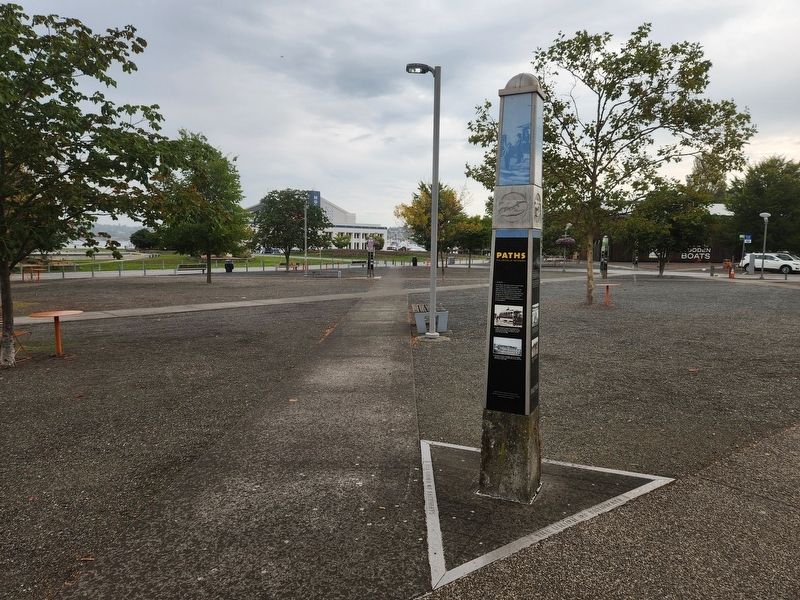
Photographed by Douglass Halvorsen, August 22, 2024
6. The Union of Pathways Marker
Credits. This page was last revised on February 18, 2025. It was originally submitted on February 16, 2025, by Douglass Halvorsen of Klamath Falls, Oregon. This page has been viewed 115 times since then and 12 times this year. Photos: 1, 2, 3, 4, 5, 6. submitted on February 16, 2025, by Douglass Halvorsen of Klamath Falls, Oregon. • James Hulse was the editor who published this page.
