Near Zonnebeke in West-Vlaanderen, Flanders, Belgium — Northwestern Europe
Polygons Ruiterpad
Photographed by Steve Stoessel, November 12, 2024
1. Polygons Ruiterpad Marker

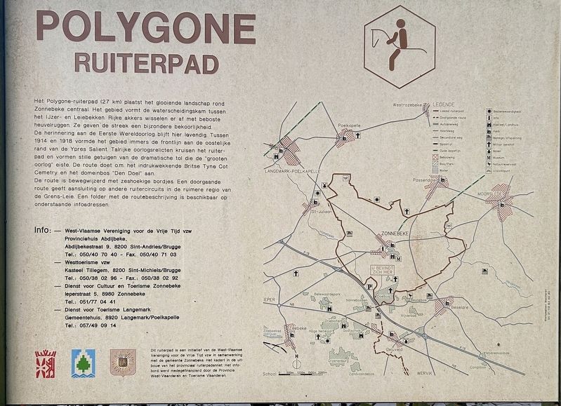
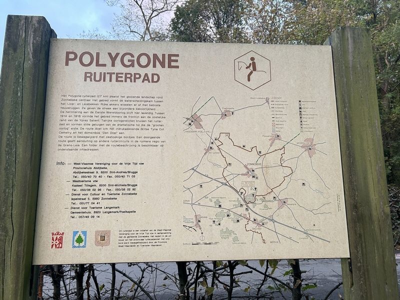
Polygone Ruiterpad
Het Polygone-ruiterpad (27 km) plaatst het glooiende landschap rond Zonnebeke centraal. Het gebied vormt de waterscheidingskam tussen het IJzer- en Leiebekken. Rijke akkers wisselen er af met beboste heuvelruggen. Ze geven de streek een bijzondere bekoorlijkheid.
De herinnering aan de Eerste Wereldoorlog blijft hier levendig. Tussen 1914 en 1918 vormde het gebied immers de frontlijn aan de oostelijke rand van de Ypres Salient. Talrijke oorlogsrelicten kruisen het ruiterpad en vormen stille getuigen van de dramatische tol die de "grooten oorlog" eiste. De route doet o.m. het indrukwekkende Britse Tyne Cot Cemetry en het domeinbos "Den Doel" aan.
De route is bewegwijzerd met zeshoekige bordjes. Een doorgaande route geeft aansluiting op andere ruitercircuits in de ruimere regio van de Grens-Leie. Een folder met de routebeschrijving is beschikbaar op onderstaande infoadressen.
Dit ruiterpad is een initiatief van de West-Vlaamse Vereniging voor de Vrije Tijd vzw in samenwerking met de gemeente Zonnebeke. Het kadert in de uitbouw van het provinciaal ruiterpadennet. Het info-bord werd medegefinancierd
this page online
Info:
- West-Vlaamse Vereniging voor de Vrije Tijd vzw, Provinciehuis Abdijbeke, Abdijbekestraat 9, 8200 Sint-Andries/Brugge Tel.: 050/40 70 40 - Fax. 050/40 71 03
- Westtoerisme vzw, Kasteel Tillegem, 8200 Sint-Michiels/Brugge Tel.: 050/38 02 96 - Fax.: 050/38 02 92
- Dienst voor Cultuur en Toerisme Zonnebeke leperstraat 5, 8980 Zonnebeke Tel.: 051/77 04 41
- Dienst voor Toerisme Langemark Gemeentehuis, 8920 Langemark/Poelkapelle Tel.: 057/49 09
Polygone Riding Path
The Polygone Riding Path (27 km) focuses on the rolling landscape around Zonnebeke. The area forms the watershed between the Yser and Leie basins. Rich fields alternate with wooded ridges. They give the region a special charm.
The memory of the First World War remains alive here. Between 1914 and 1918, the area formed the front line on the eastern edge of the Ypres Salient. Numerous war relics cross the riding path and are silent witnesses to the dramatic toll that the "Great War" took. The route takes in the impressive British Tyne Cot Cemetery and the "Den Doel" estate forest, among
Photographed by Steve Stoessel, November 12, 2024
2. Polygons Ruiterpad Marker
The route is signposted with hexagonal signs. A continuous route connects to other riding circuits in the wider region of the Grens-Leie. A brochure with the route description is available at the information addresses below.
This bridle path is an initiative of the West Flemish Association for Leisure Time vzw in collaboration with the municipality of Zonnebeke. It is part of the development of the provincial bridle path network. The information board was co-financed by the Province of West Flanders and Tourism Flanders.
Topics. This historical marker is listed in these topic lists: Parks & Recreational Areas • War, World I. A significant historical year for this entry is 1914.
Location. 50° 51.231′ N, 2° 58.704′ E. Marker is near Zonnebeke, Vlaanderen (Flanders), in West-Vlaanderen. It is at the intersection of Lotegatstraat and Lange Dreve, on the right when traveling south on Lotegatstraat. Touch for map. Marker is at or near this postal address: Lange Dreve 16, Zonnebeke, Vlaanderen 8980, Belgium. Touch for directions.

Regionally, it is in Europe, the European Union, Atlantic Europe, the Benelux Low Countries, the Schengen Area, Western Europe, and the Western World. Historically, it finds itself in what was once the Roman Empire and specifically also the Holy Roman Empire.
Other nearby markers. At least 8 other markers are within walking distance of this marker: Black Watch Corner (approx. 0.6 kilometers away); a different marker also named Black Watch Corner (approx. 0.7 kilometers away); a different marker also named Black Watch Corner (approx. 0.7 kilometers away); New Zealand Bunkers (approx. 0.7 kilometers away); Scott Post (approx. 0.7 kilometers away); Buttes New British Cemetery (approx. 0.9 kilometers away); Polygon Wood (approx. 0.9 kilometers away); Fifth Australian Division Monument (approx. one kilometer away). Touch for a list and map of all markers in Zonnebeke.
Credits. This page was last revised on December 23, 2025. It was originally submitted on February 21, 2025, by Steve Stoessel of Niskayuna, New York. This page has been viewed 108 times since then and 12 times this year. Photos: 1, 2. submitted on February 21, 2025, by Steve Stoessel of Niskayuna, New York.
